Property Record
5930 W Broadway Ave, Minneapolis, MN 55428
This Property Is For Sale
NEARBY LISTINGS FOR SALE OR LEASE
Property Detail
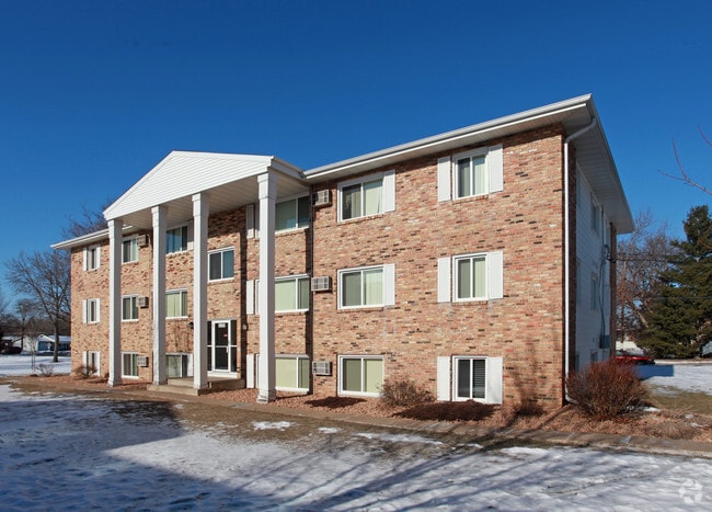
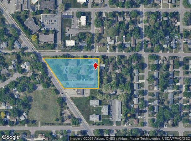
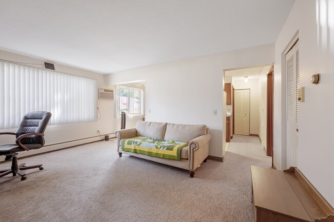
5930 W Broadway Ave
Minneapolis-St. Paul-Bloomington, MN-WI
Crystal Park Apartments
05-118-21-24-0002
LOT 001 BLOCK 001 T CRYSTAL PARK APARTMENTS W324X491X264X306
Apartment
Hennepin
X
Minnesota
27053C0211F
1
2024
2.43 AC
2024
Lions Park
020801
Minneapolis/St Paul
DEMOGRAPHICS near 5930 W Broadway Ave
1 Mile
3 Mile
5 Mile
2024 Total Population
15,134
100,256
259,020
2029 Population
14,906
98,225
254,056
Pop Growth 2024-2029
(1.51%)
(2.03%)
(1.92%)
Average Age
39
39
39
2024 Total Households
6,028
38,155
97,864
HH Growth 2024-2029
(1.74%)
(2.20%)
(2.07%)
Median Household Inc
$59,168
$68,610
$76,527
Avg Household Size
2.40
2.50
2.50
2024 Avg HH Vehicles
2.00
2.00
2.00
Median Home Value
$234,601
$255,514
$274,174
Median Year Built
1968
1968
1971
Nearby Places
- Restaurants
- Banks
- Shops
- Fitness
- Groceries
PUBLIC TRANSPORTATION
COMMUTER RAIL
Fridley Station (Northstar Corridor - Northstar Commuter Rail)
DRIVE
WALK
Distance
Fridley Station (Northstar Corridor - Northstar Commuter Rail)
12 min
7.0 mi
Target Field Station (Northstar Corridor - Northstar Commuter Rail)
DRIVE
WALK
Distance
Target Field Station (Northstar Corridor - Northstar Commuter Rail)
17 min
8.0 mi
AIRPORT
Minneapolis-St Paul International/Wold-Chamberlain
DRIVE
WALK
Distance
Minneapolis-St Paul International/Wold-Chamberlain
34 min
23.0 mi
Freight Ports
Port Milwaukee
DRIVE
WALK
Distance
Port Milwaukee
388 min
350.4 mi
Nearby Properties
Address
Land Use
TOTAL SIZE
Lot Size
Zoning
Address
Land Use
TOTAL SIZE
Lot Size
Zoning
17.26 AC
Address
Land Use
TOTAL SIZE
Lot Size
Zoning
36.46 AC
Address
Land Use
TOTAL SIZE
Lot Size
Zoning
26.57 AC
Address
Land Use
TOTAL SIZE
Lot Size
Zoning
Address
Land Use
TOTAL SIZE
Lot Size
Zoning
26.73 AC
Address
Land Use
TOTAL SIZE
Lot Size
Zoning
409,456 SF
12.40 AC
Address
Land Use
TOTAL SIZE
Lot Size
Zoning
22.67 AC
Address
Land Use
TOTAL SIZE
Lot Size
Zoning
12.38 AC
Address
Land Use
TOTAL SIZE
Lot Size
Zoning
351,351 SF
17.98 AC
Address
Land Use
TOTAL SIZE
Lot Size
Zoning
20.48 AC
Address
Land Use
TOTAL SIZE
Lot Size
Zoning
19.10 AC
Address
Land Use
TOTAL SIZE
Lot Size
Zoning
Address
Land Use
TOTAL SIZE
Lot Size
Zoning
255,324 SF
15.22 AC
Address
Land Use
TOTAL SIZE
Lot Size
Zoning
106,897 SF
4.37 AC
Address
Land Use
TOTAL SIZE
Lot Size
Zoning
Address
Land Use
TOTAL SIZE
Lot Size
Zoning
26.26 AC
Address
Land Use
TOTAL SIZE
Lot Size
Zoning
Address
Land Use
TOTAL SIZE
Lot Size
Zoning
4.34 AC
Address
Land Use
TOTAL SIZE
Lot Size
Zoning
Address
Land Use
TOTAL SIZE
Lot Size
Zoning
Address
Land Use
TOTAL SIZE
Lot Size
Zoning
15.94 AC
Address
Land Use
TOTAL SIZE
Lot Size
Zoning
21.10 AC
Address
Land Use
TOTAL SIZE
Lot Size
Zoning
13.07 AC
Address
Land Use
TOTAL SIZE
Lot Size
Zoning
35,762 SF
4.48 AC
Address
Land Use
TOTAL SIZE
Lot Size
Zoning
18.26 AC
Address
Land Use
TOTAL SIZE
Lot Size
Zoning
9.89 AC
Address
Land Use
TOTAL SIZE
Lot Size
Zoning
14.87 AC
Address
Land Use
TOTAL SIZE
Lot Size
Zoning
Address
Land Use
TOTAL SIZE
Lot Size
Zoning
13.50 AC
Address
Land Use
TOTAL SIZE
Lot Size
Zoning
37.78 AC
The World's #1 Commercial Real Estate Marketplace
Connect with us
© 2025 CoStar Group
The information above has been obtained from sources believed reliable. While we do not doubt its accuracy we have not verified it and make no guarantee, warranty or representation about it. It is your responsibility to independently confirm its accuracy and completeness. Any projections, opinions, assumptions, or estimates used are for example only and do not represent the current or future performance of the property. The value of this transaction to you depends on tax and other factors which should be evaluated by your tax, financial, and legal advisors. You and your advisors should conduct a careful, independent investigation of the property to determine to your satisfaction the suitability of the property for your needs.