Property Record
5930 Middle Fiskville Rd, Austin, TX 78752


NEARBY LISTINGS FOR SALE OR LEASE
Property Detail
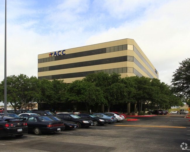
5930 Middle Fiskville Rd
Austin-Round Rock, TX
Austin Mall
228171
LOT 1 AUSTIN MALL
Officebuilding
Travis
X
Texas
48453C0455J
1
0
4.70 AC
2025
Central
001503
Austin
108,340 SF
DEMOGRAPHICS near 5930 Middle Fiskville Rd
1 Mile
3 Mile
5 Mile
2024 Total Population
19,777
169,617
372,045
2029 Population
21,890
184,848
405,151
Pop Growth 2024-2029
+ 10.68%
+ 8.98%
+ 8.90%
Average Age
36
36
36
2024 Total Households
9,657
75,599
161,087
HH Growth 2024-2029
+ 11.32%
+ 9.85%
+ 9.90%
Median Household Inc
$66,065
$66,949
$72,142
Avg Household Size
2.00
2.10
2.10
2024 Avg HH Vehicles
1.00
2.00
2.00
Median Home Value
$482,723
$573,361
$584,767
Median Year Built
1981
1980
1985
Nearby Places
Map Layers
Map Styles
 Street
 Aerial
- Restaurants
- Banks
- Shops
- Fitness
- Groceries
PUBLIC TRANSPORTATION
TRANSIT/SUBWAY
Highland Station (550-Metro Rail Red Line - Capital Metro)
DRIVE
WALK
Distance
Highland Station (550-Metro Rail Red Line - Capital Metro)
1 min
12 min
0.6 mi
COMMUTER RAIL
Austin (Texas Eagle - Amtrak)
DRIVE
WALK
Distance
Austin (Texas Eagle - Amtrak)
11 min
6.1 mi
AIRPORT
Austin-Bergstrom International
DRIVE
WALK
Distance
Austin-Bergstrom International
26 min
13.6 mi
Freight Ports
Calhoun Port
DRIVE
WALK
Distance
Calhoun Port
191 min
157.1 mi
Nearby Properties
Address
Land Use
TOTAL SIZE
Lot Size
Zoning
Address
Land Use
TOTAL SIZE
Lot Size
Zoning
28.39 AC
Address
Land Use
TOTAL SIZE
Lot Size
Zoning
28.62 AC
Address
Land Use
TOTAL SIZE
Lot Size
Zoning
30.96 AC
Address
Land Use
TOTAL SIZE
Lot Size
Zoning
18.52 AC
Address
Land Use
TOTAL SIZE
Lot Size
Zoning
74.69 AC
Address
Land Use
TOTAL SIZE
Lot Size
Zoning
548,399 SF
23.82 AC
Address
Land Use
TOTAL SIZE
Lot Size
Zoning
623,000 SF
11.78 AC
Address
Land Use
TOTAL SIZE
Lot Size
Zoning
21 AC
Address
Land Use
TOTAL SIZE
Lot Size
Zoning
614,532 SF
66.07 AC
Address
Land Use
TOTAL SIZE
Lot Size
Zoning
973,370 SF
11.26 AC
Address
Land Use
TOTAL SIZE
Lot Size
Zoning
1,234 SF
96.75 AC
Address
Land Use
TOTAL SIZE
Lot Size
Zoning
95.86 AC
Address
Land Use
TOTAL SIZE
Lot Size
Zoning
14.55 AC
Address
Land Use
TOTAL SIZE
Lot Size
Zoning
73.48 AC
Address
Land Use
TOTAL SIZE
Lot Size
Zoning
510,500 SF
9.26 AC
Address
Land Use
TOTAL SIZE
Lot Size
Zoning
401,418 SF
4.77 AC
Address
Land Use
TOTAL SIZE
Lot Size
Zoning
Address
Land Use
TOTAL SIZE
Lot Size
Zoning
19,284 SF
178.26 AC
Address
Land Use
TOTAL SIZE
Lot Size
Zoning
241,998 SF
2.42 AC
Address
Land Use
TOTAL SIZE
Lot Size
Zoning
238,650 SF
1.18 AC
Address
Land Use
TOTAL SIZE
Lot Size
Zoning
480,823 SF
18.46 AC
Address
Land Use
TOTAL SIZE
Lot Size
Zoning
322,150 SF
3.83 AC
Address
Land Use
TOTAL SIZE
Lot Size
Zoning
432,032 SF
6.70 AC
Address
Land Use
TOTAL SIZE
Lot Size
Zoning
609,823 SF
3.33 AC
Address
Land Use
TOTAL SIZE
Lot Size
Zoning
372,075 SF
4.97 AC
Address
Land Use
TOTAL SIZE
Lot Size
Zoning
265,000 SF
1.57 AC
Address
Land Use
TOTAL SIZE
Lot Size
Zoning
346,319 SF
6.53 AC
Address
Land Use
TOTAL SIZE
Lot Size
Zoning
297,356 SF
4.32 AC
Address
Land Use
TOTAL SIZE
Lot Size
Zoning
283,800 SF
4.05 AC
The World's #1 Commercial Real Estate Marketplace
Connect with us
© 2025 CoStar Group
The information above has been obtained from sources believed reliable. While we do not doubt its accuracy we have not verified it and make no guarantee, warranty or representation about it. It is your responsibility to independently confirm its accuracy and completeness. Any projections, opinions, assumptions, or estimates used are for example only and do not represent the current or future performance of the property. The value of this transaction to you depends on tax and other factors which should be evaluated by your tax, financial, and legal advisors. You and your advisors should conduct a careful, independent investigation of the property to determine to your satisfaction the suitability of the property for your needs.