Property Record
5933 S Salina St, Nedrow, NY 13120
NEARBY LISTINGS FOR SALE OR LEASE
Property Detail
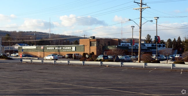
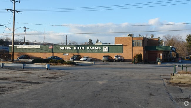
5933 S Salina St
314200-041-000-0001-027-002-0000
FL 147
Supermarket
Onondaga
X
New York
36067C0332F
28.000
2025
1.12 AC
2024
W Outer Onondaga County
006101
Syracuse
34,763 SF
Syracuse, NY
DEMOGRAPHICS near 5933 S Salina St
1 Mile
3 Mile
5 Mile
2024 Total Population
4,921
43,007
125,992
2029 Population
4,803
42,295
123,645
Pop Growth 2024-2029
(2.40%)
(1.66%)
(1.86%)
Average Age
43
40
38
2024 Total Households
2,067
16,203
49,634
HH Growth 2024-2029
(2.61%)
(1.86%)
(1.89%)
Median Household Inc
$63,837
$46,238
$46,846
Avg Household Size
2.30
2.30
2.20
2024 Avg HH Vehicles
2.00
1.00
1.00
Median Home Value
$106,260
$132,909
$162,945
Median Year Built
1952
1957
1955
Nearby Places
Map Layers
Map Styles
 Street
 Aerial
- Restaurants
- Banks
- Shops
- Fitness
- Groceries
PUBLIC TRANSPORTATION
COMMUTER RAIL
DRIVE
WALK
Distance
15 min
7.3 mi
DRIVE
WALK
Distance
15 min
7.3 mi
AIRPORT
Syracuse Hancock International
DRIVE
WALK
Distance
Syracuse Hancock International
22 min
12.0 mi
Ithaca Tompkins International
DRIVE
WALK
Distance
Ithaca Tompkins International
70 min
47.0 mi
Nearby Properties
Address
Land Use
TOTAL SIZE
Lot Size
Zoning
Address
Land Use
TOTAL SIZE
Lot Size
Zoning
12.08 AC
Address
Land Use
TOTAL SIZE
Lot Size
Zoning
412,577 SF
39.43 AC
08 - GOVER
Address
Land Use
TOTAL SIZE
Lot Size
Zoning
348,998 SF
65.59 AC
25
Address
Land Use
TOTAL SIZE
Lot Size
Zoning
6,400 SF
86.36 AC
06 - INDUS
Address
Land Use
TOTAL SIZE
Lot Size
Zoning
50,472 SF
4.89 AC
10
Address
Land Use
TOTAL SIZE
Lot Size
Zoning
7,392 SF
35.06 AC
06 - INDUS
Address
Land Use
TOTAL SIZE
Lot Size
Zoning
233,580 SF
10.73 AC
06 - INDUS
Address
Land Use
TOTAL SIZE
Lot Size
Zoning
6,400 SF
0.26 AC
06 - INDUS
Address
Land Use
TOTAL SIZE
Lot Size
Zoning
290,000 SF
11.44 AC
25
Address
Land Use
TOTAL SIZE
Lot Size
Zoning
248,704 SF
0.17 AC
01 - NOT Z
Address
Land Use
TOTAL SIZE
Lot Size
Zoning
176,250 SF
5.86 AC
25
Address
Land Use
TOTAL SIZE
Lot Size
Zoning
11,928 SF
12.30 AC
06 - INDUS
Address
Land Use
TOTAL SIZE
Lot Size
Zoning
93,020 SF
5.97 AC
06 - INDUS
Address
Land Use
TOTAL SIZE
Lot Size
Zoning
121,158 SF
0.74 AC
01 - NOT Z
Address
Land Use
TOTAL SIZE
Lot Size
Zoning
5,643 SF
0.38 AC
06 - INDUS
Address
Land Use
TOTAL SIZE
Lot Size
Zoning
108,000 SF
3.15 AC
01 - NOT Z
Address
Land Use
TOTAL SIZE
Lot Size
Zoning
209,598 SF
8.07 AC
06 - INDUS
Address
Land Use
TOTAL SIZE
Lot Size
Zoning
209,598 SF
4.22 AC
06 - INDUS
Address
Land Use
TOTAL SIZE
Lot Size
Zoning
209,598 SF
8.62 AC
06 - INDUS
Address
Land Use
TOTAL SIZE
Lot Size
Zoning
51,456 SF
6.42 AC
10
Address
Land Use
TOTAL SIZE
Lot Size
Zoning
44.68 AC
02 - SINGL
Address
Land Use
TOTAL SIZE
Lot Size
Zoning
49,315 SF
16.05 AC
07 - MIXED
Address
Land Use
TOTAL SIZE
Lot Size
Zoning
167,680 SF
6.20 AC
06 - INDUS
Address
Land Use
TOTAL SIZE
Lot Size
Zoning
108,386 SF
1.50 AC
01 - NOT Z
Address
Land Use
TOTAL SIZE
Lot Size
Zoning
11,952 SF
2.62 AC
07 - MIXED
Address
Land Use
TOTAL SIZE
Lot Size
Zoning
4,760 SF
1.24 AC
01 - NOT Z
Address
Land Use
TOTAL SIZE
Lot Size
Zoning
10,644 SF
0.58 AC
01 - NOT Z
Address
Land Use
TOTAL SIZE
Lot Size
Zoning
72,964 SF
4.26 AC
Address
Land Use
TOTAL SIZE
Lot Size
Zoning
37,000 SF
12.02 AC
07 - MIXED
Address
Land Use
TOTAL SIZE
Lot Size
Zoning
99,038 SF
2.92 AC
01 - NOT Z
The World's #1 Commercial Real Estate Marketplace
Connect with us
© 2026 CoStar Group
The information above has been obtained from sources believed reliable. While we do not doubt its accuracy we have not verified it and make no guarantee, warranty or representation about it. It is your responsibility to independently confirm its accuracy and completeness. Any projections, opinions, assumptions, or estimates used are for example only and do not represent the current or future performance of the property. The value of this transaction to you depends on tax and other factors which should be evaluated by your tax, financial, and legal advisors. You and your advisors should conduct a careful, independent investigation of the property to determine to your satisfaction the suitability of the property for your needs.