Property Record
5939 17Th Ave W, Bradenton, FL 34209

NEARBY LISTINGS FOR SALE OR LEASE
Property Detail
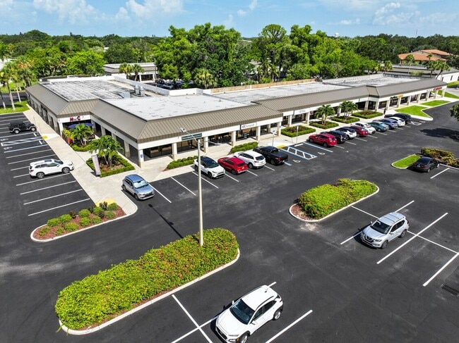
5939 17Th Ave W
North Port-Bradenton-Sarasota, FL
Blake Park Condominium
39384-5700-3
UNITS 1 THRU 72 BLDG J BLAKE PARK CONDO PHASE II PI#39384.5700/3
Officecondo
Manatee
X
Florida
12081C0301F
1
2024
0.83 AC
2025
Manatee
000407
Tampa/St Petersburg
9,216 SF
DEMOGRAPHICS near 5939 17Th Ave W
1 mile
3 mile
5 mile
2024 Total Population
10,371
76,456
168,148
2029 Population
12,062
89,117
197,524
Pop Growth 2024-2029
+ 16.31%
+ 16.56%
+ 17.47%
Average Age
55
48
47
2024 Total Households
4,963
34,070
73,707
HH Growth 2024-2029
+ 15.51%
+ 15.85%
+ 16.83%
Median Household Inc
$63,610
$60,292
$51,647
Avg Household Size
1.90
2.10
2.20
2024 Avg HH Vehicles
2.00
2.00
2.00
Median Home Value
$271,335
$258,821
$226,770
Median Year Built
1981
1978
1978
Nearby Places
Map Layers
Map Styles
 Street
 Aerial
Transit
 Traffic
 Biking
Places
Listings with unknown addresses are not visible on the map
- Restaurants
- Banks
- Shops
- Fitness
- Groceries
PUBLIC TRANSPORTATION
AIRPORT
Sarasota/Bradenton International
Drive
Walk
Distance
Sarasota/Bradenton International
22 min
10.0 mi
St Pete-Clearwater International
Drive
Walk
Distance
St Pete-Clearwater International
54 min
41.2 mi
Freight Ports
Port Manatee
Drive
Walk
Distance
Port Manatee
1 min
11.1 mi
Nearby Properties
Address
Land Use
TOTAL SIZE
Lot Size
Zoning
Address
Land Use
TOTAL SIZE
Lot Size
Zoning
508,298 SF
18.71 AC
P
Address
Land Use
TOTAL SIZE
Lot Size
Zoning
437,460 SF
46.14 AC
PD-R
Address
Land Use
TOTAL SIZE
Lot Size
Zoning
356,808 SF
24.25 AC
RMF-9 MULT
Address
Land Use
TOTAL SIZE
Lot Size
Zoning
456,263 SF
28.02 AC
BR_R-3
Address
Land Use
TOTAL SIZE
Lot Size
Zoning
314,018 SF
28.20 AC
BR_R-3
Address
Land Use
TOTAL SIZE
Lot Size
Zoning
297,456 SF
17.24 AC
GC,RMF-9
Address
Land Use
TOTAL SIZE
Lot Size
Zoning
279,545 SF
19.41 AC
BR_R-1
Address
Land Use
TOTAL SIZE
Lot Size
Zoning
395,543 SF
29.18 AC
BR_R-3
Address
Land Use
TOTAL SIZE
Lot Size
Zoning
247,280 SF
17.72 AC
PD-R
Address
Land Use
TOTAL SIZE
Lot Size
Zoning
235,443 SF
14.75 AC
RMF-9 MULT
Address
Land Use
TOTAL SIZE
Lot Size
Zoning
214,906 SF
20.71 AC
BR_R-1
Address
Land Use
TOTAL SIZE
Lot Size
Zoning
223,974 SF
17.41 AC
BR_R-2
Address
Land Use
TOTAL SIZE
Lot Size
Zoning
335,019 SF
32.58 AC
BR_R-3
Address
Land Use
TOTAL SIZE
Lot Size
Zoning
247,592 SF
13.39 AC
GC,RMF-6
Address
Land Use
TOTAL SIZE
Lot Size
Zoning
198,036 SF
8.32 AC
GC GENERA
Address
Land Use
TOTAL SIZE
Lot Size
Zoning
163,868 SF
12.60 AC
BR_R-3
Address
Land Use
TOTAL SIZE
Lot Size
Zoning
162,027 SF
14.21 AC
BR_R-2
Address
Land Use
TOTAL SIZE
Lot Size
Zoning
331,144 SF
40.48 AC
PD-PI
Address
Land Use
TOTAL SIZE
Lot Size
Zoning
583,480 SF
16.52 AC
BR_R-3
Address
Land Use
TOTAL SIZE
Lot Size
Zoning
166,810 SF
3.16 AC
BR_T4-O
Address
Land Use
TOTAL SIZE
Lot Size
Zoning
106,355 SF
120.66 AC
BR_PDP
Address
Land Use
TOTAL SIZE
Lot Size
Zoning
196,346 SF
33.03 AC
BR_R-1
Address
Land Use
TOTAL SIZE
Lot Size
Zoning
148,992 SF
9.81 AC
RMF-9,GC
Address
Land Use
TOTAL SIZE
Lot Size
Zoning
183,257 SF
4.19 AC
PD-R
Address
Land Use
TOTAL SIZE
Lot Size
Zoning
118,425 SF
320.26 AC
Address
Land Use
TOTAL SIZE
Lot Size
Zoning
360,846 SF
1.13 AC
BR_T5
Address
Land Use
TOTAL SIZE
Lot Size
Zoning
285,307 SF
5.17 AC
BR_T4-O
Address
Land Use
TOTAL SIZE
Lot Size
Zoning
171,396 SF
15.03 AC
GC GENERA
Address
Land Use
TOTAL SIZE
Lot Size
Zoning
211,632 SF
24.68 AC
BR_SCC
Address
Land Use
TOTAL SIZE
Lot Size
Zoning
228,067 SF
4.39 AC
BR_T4-O
The World's #1 Commercial Real Estate Marketplace
Connect with us
© 2026 CoStar Group
The information above has been obtained from sources believed reliable. While we do not doubt its accuracy we have not verified it and make no guarantee, warranty or representation about it. It is your responsibility to independently confirm its accuracy and completeness. Any projections, opinions, assumptions, or estimates used are for example only and do not represent the current or future performance of the property. The value of this transaction to you depends on tax and other factors which should be evaluated by your tax, financial, and legal advisors. You and your advisors should conduct a careful, independent investigation of the property to determine to your satisfaction the suitability of the property for your needs.