Property Record
5940 Matthews St, Goleta, CA 93117
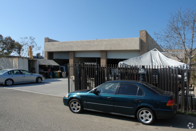

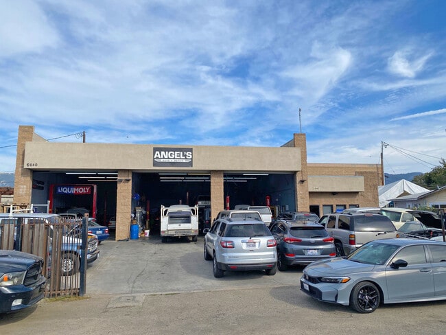
This Property Is For Sale
Property Detail
5940 Matthews St
Santa Maria-Santa Barbara, CA
FAIRFIELD TR LOTS 15 / LOT 16 BLK B
071-152-008
Santa Barbara
Vehiclerentalsvehiclesales
California
AE The base floodplain where base flood elevations are provided. AE Zones are now used on new format FIRMs instead of A1-A30 Zones.
15-16
2024
0.19 AC
2025
Santa Barbara Airport
003001
Santa Barbara/Sta Maria/Goleta
801 SF
NEARBY LISTINGS FOR SALE OR LEASE
DEMOGRAPHICS near 5940 Matthews St
1 mile
3 mile
5 mile
2025 Total Population
6,425
60,189
90,637
2030 Population
6,349
60,114
90,553
Pop Growth 2025-2030
(1.18%)
(0.12%)
(0.09%)
Average Age
40
37
39
2025 Total Households
2,430
20,186
31,982
HH Growth 2025-2030
(1.03%)
+ 0.02%
(0.01%)
Median Household Inc
$78,230
$95,664
$102,605
Avg Household Size
2.50
2.70
2.60
2025 Avg HH Vehicles
2.00
2.00
2.00
Median Home Value
$898,963
$1,087,419
$1,075,972
Median Year Built
1970
1973
1973
Nearby Places
Map Layers
Map Styles
 Street
 Aerial
Transit
 Traffic
 Biking
Places
Listings with unknown addresses are not visible on the map
- Restaurants
- Banks
- Shops
- Fitness
- Groceries
PUBLIC TRANSPORTATION
COMMUTER RAIL
Drive
Walk
Distance
4 min
1.5 mi
Drive
Walk
Distance
13 min
9.5 mi
AIRPORT
Santa Barbara Municipal
Drive
Walk
Distance
Santa Barbara Municipal
2 min
0.7 mi
Freight Ports
The Port of Hueneme
Drive
Walk
Distance
The Port of Hueneme
64 min
48.8 mi
Nearby Properties
Address
Land Use
TOTAL SIZE
Lot Size
Zoning
Address
Land Use
TOTAL SIZE
Lot Size
Zoning
13,528 SF
9.35 AC
Address
Land Use
TOTAL SIZE
Lot Size
Zoning
20.78 AC
8R1
Address
Land Use
TOTAL SIZE
Lot Size
Zoning
2.50 AC
SRH20
Address
Land Use
TOTAL SIZE
Lot Size
Zoning
5.30 AC
Address
Land Use
TOTAL SIZE
Lot Size
Zoning
1.90 AC
Address
Land Use
TOTAL SIZE
Lot Size
Zoning
13.08 AC
Address
Land Use
TOTAL SIZE
Lot Size
Zoning
8.82 AC
Address
Land Use
TOTAL SIZE
Lot Size
Zoning
4.25 AC
Address
Land Use
TOTAL SIZE
Lot Size
Zoning
Address
Land Use
TOTAL SIZE
Lot Size
Zoning
2.42 AC
SRH20
Address
Land Use
TOTAL SIZE
Lot Size
Zoning
2.18 AC
Address
Land Use
TOTAL SIZE
Lot Size
Zoning
102,570 SF
14.03 AC
Address
Land Use
TOTAL SIZE
Lot Size
Zoning
3.05 AC
Address
Land Use
TOTAL SIZE
Lot Size
Zoning
37,584 SF
2 AC
SRH20
Address
Land Use
TOTAL SIZE
Lot Size
Zoning
3.81 AC
Address
Land Use
TOTAL SIZE
Lot Size
Zoning
85,052 SF
2.97 AC
SRH20
Address
Land Use
TOTAL SIZE
Lot Size
Zoning
7.18 AC
Address
Land Use
TOTAL SIZE
Lot Size
Zoning
7.99 AC
Address
Land Use
TOTAL SIZE
Lot Size
Zoning
0.87 AC
SRH20
Address
Land Use
TOTAL SIZE
Lot Size
Zoning
109,624 SF
9.11 AC
SC
Address
Land Use
TOTAL SIZE
Lot Size
Zoning
13.74 AC
Address
Land Use
TOTAL SIZE
Lot Size
Zoning
34,688 SF
2.17 AC
Address
Land Use
TOTAL SIZE
Lot Size
Zoning
6.90 AC
Address
Land Use
TOTAL SIZE
Lot Size
Zoning
0.38 AC
C2
Address
Land Use
TOTAL SIZE
Lot Size
Zoning
5.38 AC
Address
Land Use
TOTAL SIZE
Lot Size
Zoning
1.82 AC
Address
Land Use
TOTAL SIZE
Lot Size
Zoning
10.19 AC
Address
Land Use
TOTAL SIZE
Lot Size
Zoning
5.34 AC
Address
Land Use
TOTAL SIZE
Lot Size
Zoning
68,163 SF
4.04 AC
Address
Land Use
TOTAL SIZE
Lot Size
Zoning
18.65 AC
The World's #1 Commercial Real Estate Marketplace
Connect with us
© 2026 CoStar Group
The information above has been obtained from sources believed reliable. While we do not doubt its accuracy we have not verified it and make no guarantee, warranty or representation about it. It is your responsibility to independently confirm its accuracy and completeness. Any projections, opinions, assumptions, or estimates used are for example only and do not represent the current or future performance of the property. The value of this transaction to you depends on tax and other factors which should be evaluated by your tax, financial, and legal advisors. You and your advisors should conduct a careful, independent investigation of the property to determine to your satisfaction the suitability of the property for your needs.