Property Record
5942 Us Route 60, Ashland, KY 41102


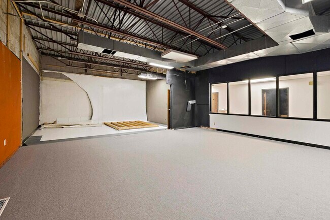
This Property Is For Sale
NEARBY LISTINGS FOR SALE OR LEASE
Property Detail
5942 Us Route 60
Huntington-Ashland, WV-KY-OH
Us Route 60
024-06-00-027.04
.71 ACRE +- 232.76X133.84X190X147.45X20.
Financialbuilding
Boyd
X
Kentucky
21019C0062D
0.71 AC
2025
Outlying Boyd County
2025
Huntington/Ashland
031003
DEMOGRAPHICS near 5942 Us Route 60
1 mile
3 mile
5 mile
2024 Total Population
1,373
19,867
43,540
2029 Population
1,368
19,649
43,010
Pop Growth 2024-2029
(0.36%)
(1.10%)
(1.22%)
Average Age
42
43
42
2024 Total Households
547
8,086
17,930
HH Growth 2024-2029
(0.73%)
(1.10%)
(1.17%)
Median Household Inc
$74,021
$56,740
$53,998
Avg Household Size
2.30
2.40
2.30
2024 Avg HH Vehicles
2.00
2.00
2.00
Median Home Value
$151,351
$133,353
$129,395
Median Year Built
1978
1972
1969
Nearby Places
Map Layers
Map Styles
 Street
 Aerial
Transit
 Traffic
 Biking
Places
Listings with unknown addresses are not visible on the map
- Restaurants
- Banks
- Shops
- Fitness
- Groceries
PUBLIC TRANSPORTATION
COMMUTER RAIL
Drive
Walk
Distance
8 min
4.3 mi
AIRPORT
Tri-State/Milton J Ferguson Field
Drive
Walk
Distance
Tri-State/Milton J Ferguson Field
27 min
14.4 mi
Nearby Properties
Address
Land Use
TOTAL SIZE
Lot Size
Zoning
Address
Land Use
TOTAL SIZE
Lot Size
Zoning
0.52 AC
Address
Land Use
TOTAL SIZE
Lot Size
Zoning
2,318 SF
190 AC
Address
Land Use
TOTAL SIZE
Lot Size
Zoning
87.12 AC
COMMERCIAL
Address
Land Use
TOTAL SIZE
Lot Size
Zoning
91,786 SF
2.93 AC
Address
Land Use
TOTAL SIZE
Lot Size
Zoning
11 AC
COMMERCIAL
Address
Land Use
TOTAL SIZE
Lot Size
Zoning
22 AC
OTHER
Address
Land Use
TOTAL SIZE
Lot Size
Zoning
22,592 SF
43.50 AC
OTHER
Address
Land Use
TOTAL SIZE
Lot Size
Zoning
33,980 SF
2.03 AC
COMMERCIAL
Address
Land Use
TOTAL SIZE
Lot Size
Zoning
Address
Land Use
TOTAL SIZE
Lot Size
Zoning
4 AC
Z01
Address
Land Use
TOTAL SIZE
Lot Size
Zoning
7.76 AC
Z03
Address
Land Use
TOTAL SIZE
Lot Size
Zoning
36,866 SF
4.70 AC
OTHER
Address
Land Use
TOTAL SIZE
Lot Size
Zoning
9,576 SF
12.29 AC
COMMERCIAL
Address
Land Use
TOTAL SIZE
Lot Size
Zoning
Address
Land Use
TOTAL SIZE
Lot Size
Zoning
20,018 SF
0.36 AC
OTHER
Address
Land Use
TOTAL SIZE
Lot Size
Zoning
22,236 SF
3.96 AC
RESIDENTIA
Address
Land Use
TOTAL SIZE
Lot Size
Zoning
1.04 AC
COMMERCIAL
Address
Land Use
TOTAL SIZE
Lot Size
Zoning
6.72 AC
Address
Land Use
TOTAL SIZE
Lot Size
Zoning
0.57 AC
RESIDENTIA
Address
Land Use
TOTAL SIZE
Lot Size
Zoning
6,840 SF
24 AC
COMMERCIAL
Address
Land Use
TOTAL SIZE
Lot Size
Zoning
1.02 AC
COMMERCIAL
Address
Land Use
TOTAL SIZE
Lot Size
Zoning
9.03 AC
Z02
Address
Land Use
TOTAL SIZE
Lot Size
Zoning
Address
Land Use
TOTAL SIZE
Lot Size
Zoning
Address
Land Use
TOTAL SIZE
Lot Size
Zoning
2.44 AC
COMMERCIAL
Address
Land Use
TOTAL SIZE
Lot Size
Zoning
1.09 AC
COMMERCIAL
Address
Land Use
TOTAL SIZE
Lot Size
Zoning
6 AC
COMMERCIAL
Address
Land Use
TOTAL SIZE
Lot Size
Zoning
3,520 SF
0.19 AC
COMMERCIAL
Address
Land Use
TOTAL SIZE
Lot Size
Zoning
1.11 AC
COMMERCIAL
Address
Land Use
TOTAL SIZE
Lot Size
Zoning
19,488 SF
0.28 AC
COMMERCIAL
The World's #1 Commercial Real Estate Marketplace
Connect with us
© 2026 CoStar Group
The information above has been obtained from sources believed reliable. While we do not doubt its accuracy we have not verified it and make no guarantee, warranty or representation about it. It is your responsibility to independently confirm its accuracy and completeness. Any projections, opinions, assumptions, or estimates used are for example only and do not represent the current or future performance of the property. The value of this transaction to you depends on tax and other factors which should be evaluated by your tax, financial, and legal advisors. You and your advisors should conduct a careful, independent investigation of the property to determine to your satisfaction the suitability of the property for your needs.