Property Record
5945 Palm Dr, Carmichael, CA 95608


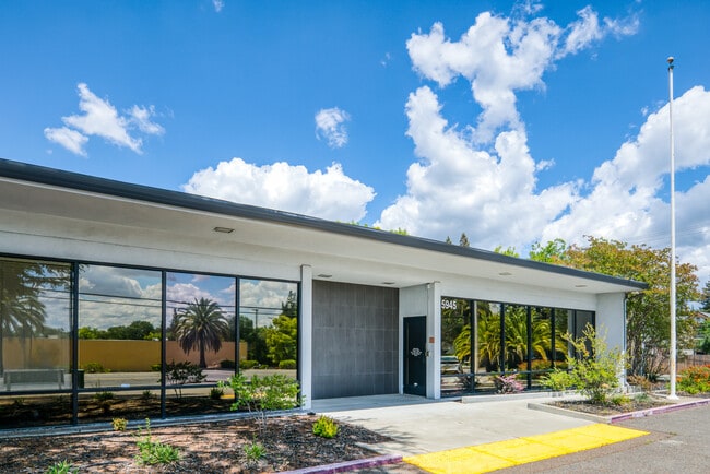

Property Detail
5945 Palm Dr
273-0131-023
POR LOT 173 CARMICHAEL COLONY BEG AT SE COR SD LOT 173 WH IS C/L OF A COUNTY RD TH N ALG E LINESD LOT 173 A DIST OF 360 TH W 185 TH S 360 TO APT IN S LINE SD LOT 173 TH E 185 TO POB EXC R/W REC ON951020-472. CONTG 1.20 N AC M/L.
Officebuilding
Sacramento
SPA
California
B and X Area of moderate flood hazard, usually the area between the limits of the 100-year and 500-year floods.
173
2024
1.20 AC
2025
NE Sacramento
007802
Sacramento
12,413 SF
Sacramento-Roseville-Folsom, CA
NEARBY LISTINGS FOR SALE OR LEASE
DEMOGRAPHICS near 5945 Palm Dr
1 mile
3 mile
5 mile
2025 Total Population
16,340
132,977
352,860
2030 Population
16,544
134,059
356,380
Pop Growth 2025-2030
+ 1.25%
+ 0.81%
+ 1.00%
Average Age
42
42
40
2025 Total Households
6,526
51,992
137,681
HH Growth 2025-2030
+ 1.35%
+ 0.83%
+ 1.00%
Median Household Inc
$80,285
$89,007
$82,276
Avg Household Size
2.40
2.50
2.50
2025 Avg HH Vehicles
2.00
2.00
2.00
Median Home Value
$678,069
$549,360
$493,659
Median Year Built
1974
1970
1972
Nearby Places
Map Layers
Map Styles
 Street
 Aerial
Transit
 Traffic
 Biking
Places
Listings with unknown addresses are not visible on the map
- Restaurants
- Banks
- Shops
- Fitness
- Groceries
PUBLIC TRANSPORTATION
AIRPORT
Sacramento International
Drive
Walk
Distance
Sacramento International
31 min
20.3 mi
SALE & LEASE HISTORY
LISTING DATE
SALE/LEASE

Nov 16, 2021
For Sale
Nov 05, 2019
For Sale
Jun 26, 2025
For Sale
Jan 31, 2022
For Sale
Dec 22, 2020
For Lease
Nearby Properties
Address
Land Use
TOTAL SIZE
Lot Size
Zoning
Address
Land Use
TOTAL SIZE
Lot Size
Zoning
512,630 SF
37.68 AC
SPA (NPA)
Address
Land Use
TOTAL SIZE
Lot Size
Zoning
223,046 SF
10.99 AC
RD 20
Address
Land Use
TOTAL SIZE
Lot Size
Zoning
145,334 SF
8.84 AC
RD-20
Address
Land Use
TOTAL SIZE
Lot Size
Zoning
278,877 SF
13.17 AC
RD-30
Address
Land Use
TOTAL SIZE
Lot Size
Zoning
75,700 SF
4.02 AC
RD-40
Address
Land Use
TOTAL SIZE
Lot Size
Zoning
221,337 SF
12.19 AC
RD 25
Address
Land Use
TOTAL SIZE
Lot Size
Zoning
156,032 SF
9.31 AC
OPMU
Address
Land Use
TOTAL SIZE
Lot Size
Zoning
169,618 SF
10.44 AC
RD-4
Address
Land Use
TOTAL SIZE
Lot Size
Zoning
198,413 SF
9.24 AC
RD 30
Address
Land Use
TOTAL SIZE
Lot Size
Zoning
140,102 SF
3.30 AC
RD-20
Address
Land Use
TOTAL SIZE
Lot Size
Zoning
89,098 SF
4.93 AC
RD-40
Address
Land Use
TOTAL SIZE
Lot Size
Zoning
43,183 SF
12.35 AC
H F
Address
Land Use
TOTAL SIZE
Lot Size
Zoning
72,119 SF
2.38 AC
BP (NPA)
Address
Land Use
TOTAL SIZE
Lot Size
Zoning
1,484 SF
4.94 AC
RD-20
Address
Land Use
TOTAL SIZE
Lot Size
Zoning
218,823 SF
10.77 AC
HDR
Address
Land Use
TOTAL SIZE
Lot Size
Zoning
115,593 SF
6.31 AC
OPMU
Address
Land Use
TOTAL SIZE
Lot Size
Zoning
90,972 SF
2.36 AC
RD-40
Address
Land Use
TOTAL SIZE
Lot Size
Zoning
184,249 SF
10.72 AC
OIMU (FBSP
Address
Land Use
TOTAL SIZE
Lot Size
Zoning
135,053 SF
6.66 AC
LC SC RD-4
Address
Land Use
TOTAL SIZE
Lot Size
Zoning
137,939 SF
5.25 AC
CMU (FBSP)
Address
Land Use
TOTAL SIZE
Lot Size
Zoning
110,533 SF
4.17 AC
RD-5 RD-40
Address
Land Use
TOTAL SIZE
Lot Size
Zoning
64,250 SF
2.38 AC
OPMU
Address
Land Use
TOTAL SIZE
Lot Size
Zoning
124,604 SF
8.50 AC
OPMU
Address
Land Use
TOTAL SIZE
Lot Size
Zoning
166,300 SF
8.04 AC
RD-40 RD-2
Address
Land Use
TOTAL SIZE
Lot Size
Zoning
100,234 SF
5.93 AC
RD 30
Address
Land Use
TOTAL SIZE
Lot Size
Zoning
103,414 SF
5.01 AC
RD-30
Address
Land Use
TOTAL SIZE
Lot Size
Zoning
81,280 SF
13.51 AC
OIMU (FBSP
Address
Land Use
TOTAL SIZE
Lot Size
Zoning
132,890 SF
5.68 AC
OIMU (FBSP
Address
Land Use
TOTAL SIZE
Lot Size
Zoning
122,175 SF
10.10 AC
CMU (FBSP)
Address
Land Use
TOTAL SIZE
Lot Size
Zoning
120,568 SF
5.64 AC
RD-30
The World's #1 Commercial Real Estate Marketplace
Connect with us
© 2026 CoStar Group
The information above has been obtained from sources believed reliable. While we do not doubt its accuracy we have not verified it and make no guarantee, warranty or representation about it. It is your responsibility to independently confirm its accuracy and completeness. Any projections, opinions, assumptions, or estimates used are for example only and do not represent the current or future performance of the property. The value of this transaction to you depends on tax and other factors which should be evaluated by your tax, financial, and legal advisors. You and your advisors should conduct a careful, independent investigation of the property to determine to your satisfaction the suitability of the property for your needs.