Property Record
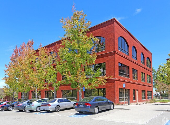
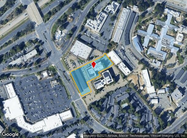
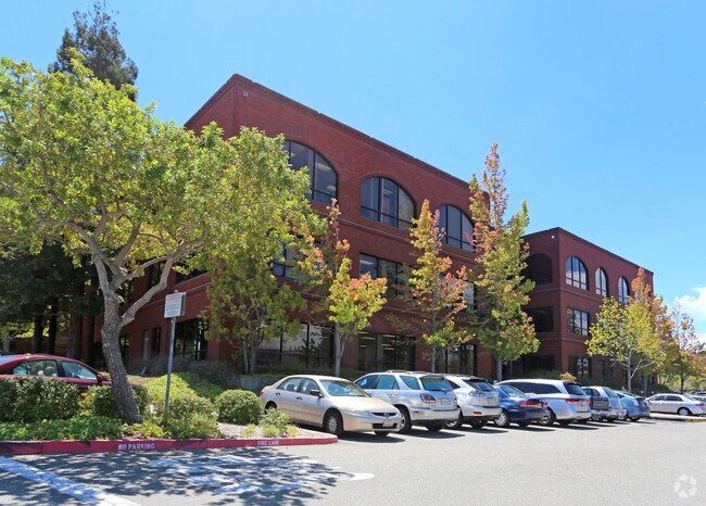
595 Center Ave, Martinez, CA 94553
NEARBY LISTINGS FOR SALE OR LEASE
Property Detail
595 Center Ave
162-493-013-5
PCL MAP 117 PG 36 PCL B
Federalproperty
Contra Costa
X
California
06013C0280G
1.58 AC
2025
Martinez/Pacheco/Hercules
2025
East Bay/Oakland
321101
Oakland-Fremont-Berkeley, CA
42,544 SF
DEMOGRAPHICS near 595 Center Ave
1 mile
3 mile
5 mile
2024 Total Population
12,268
57,548
131,497
2029 Population
12,190
57,061
130,384
Pop Growth 2024-2029
(0.64%)
(0.85%)
(0.85%)
Average Age
42
43
41
2024 Total Households
4,873
22,663
50,659
HH Growth 2024-2029
(0.68%)
(0.86%)
(0.83%)
Median Household Inc
$128,953
$118,181
$107,763
Avg Household Size
2.50
2.50
2.50
2024 Avg HH Vehicles
2.00
2.00
2.00
Median Home Value
$767,476
$763,482
$766,491
Median Year Built
1975
1975
1972
Nearby Places
Map Layers
Map Styles
 Street
 Aerial
Transit
 Traffic
 Biking
Places
Listings with unknown addresses are not visible on the map
- Restaurants
- Banks
- Shops
- Fitness
- Groceries
PUBLIC TRANSPORTATION
COMMUTER RAIL
Martinez (California Zephyr - Capitol Corridor Joint Powers Authority, Capitol Corridor - Capitol Corridor Joint Powers Authority, Coast Starlight - Capitol Corridor Joint Powers Authority, San Joaquins - Capitol Corridor Joint Powers Authority)
Drive
Walk
Distance
Martinez (California Zephyr - Capitol Corridor Joint Powers Authority, Capitol Corridor - Capitol Corridor Joint Powers Authority, Coast Starlight - Capitol Corridor Joint Powers Authority, San Joaquins - Capitol Corridor Joint Powers Authority)
6 min
2.5 mi
AIRPORT
Metro Oakland International
Drive
Walk
Distance
Metro Oakland International
44 min
33.0 mi
San Francisco International
Drive
Walk
Distance
San Francisco International
60 min
44.6 mi
Freight Ports
Port of Richmond
Drive
Walk
Distance
Port of Richmond
33 min
22.7 mi
Nearby Properties
Address
Land Use
TOTAL SIZE
Lot Size
Zoning
Address
Land Use
TOTAL SIZE
Lot Size
Zoning
228,197 SF
294.92 AC
HI
Address
Land Use
TOTAL SIZE
Lot Size
Zoning
28,948 SF
63.56 AC
HI
Address
Land Use
TOTAL SIZE
Lot Size
Zoning
9,000 SF
137.45 AC
Address
Land Use
TOTAL SIZE
Lot Size
Zoning
25,089 SF
57.67 AC
HI
Address
Land Use
TOTAL SIZE
Lot Size
Zoning
12.82 AC
Address
Land Use
TOTAL SIZE
Lot Size
Zoning
187,998 SF
135.96 AC
Address
Land Use
TOTAL SIZE
Lot Size
Zoning
66,196 SF
40.92 AC
HI
Address
Land Use
TOTAL SIZE
Lot Size
Zoning
54,870 SF
34.53 AC
HI
Address
Land Use
TOTAL SIZE
Lot Size
Zoning
234,624 SF
6.63 AC
Address
Land Use
TOTAL SIZE
Lot Size
Zoning
70,000 SF
25.77 AC
Address
Land Use
TOTAL SIZE
Lot Size
Zoning
112,000 SF
18.40 AC
Address
Land Use
TOTAL SIZE
Lot Size
Zoning
9,840 SF
5.85 AC
Address
Land Use
TOTAL SIZE
Lot Size
Zoning
15.34 AC
Address
Land Use
TOTAL SIZE
Lot Size
Zoning
66.32 AC
Address
Land Use
TOTAL SIZE
Lot Size
Zoning
68.97 AC
Address
Land Use
TOTAL SIZE
Lot Size
Zoning
7.08 AC
Address
Land Use
TOTAL SIZE
Lot Size
Zoning
49,519 SF
2.04 AC
Address
Land Use
TOTAL SIZE
Lot Size
Zoning
3.07 AC
Address
Land Use
TOTAL SIZE
Lot Size
Zoning
71,000 SF
1.23 AC
Address
Land Use
TOTAL SIZE
Lot Size
Zoning
196.06 AC
HI
Address
Land Use
TOTAL SIZE
Lot Size
Zoning
3,612 SF
4.74 AC
Address
Land Use
TOTAL SIZE
Lot Size
Zoning
22.30 AC
Address
Land Use
TOTAL SIZE
Lot Size
Zoning
51,500 SF
5.92 AC
Address
Land Use
TOTAL SIZE
Lot Size
Zoning
93,942 SF
6.29 AC
Address
Land Use
TOTAL SIZE
Lot Size
Zoning
13.74 AC
HI
Address
Land Use
TOTAL SIZE
Lot Size
Zoning
2,318 SF
4.13 AC
CM
Address
Land Use
TOTAL SIZE
Lot Size
Zoning
32,928 SF
7.56 AC
Address
Land Use
TOTAL SIZE
Lot Size
Zoning
126,248 SF
3.34 AC
Address
Land Use
TOTAL SIZE
Lot Size
Zoning
12,656 SF
5.34 AC
Address
Land Use
TOTAL SIZE
Lot Size
Zoning
54,874 SF
0.57 AC
The World's #1 Commercial Real Estate Marketplace
Connect with us
© 2026 CoStar Group
The information above has been obtained from sources believed reliable. While we do not doubt its accuracy we have not verified it and make no guarantee, warranty or representation about it. It is your responsibility to independently confirm its accuracy and completeness. Any projections, opinions, assumptions, or estimates used are for example only and do not represent the current or future performance of the property. The value of this transaction to you depends on tax and other factors which should be evaluated by your tax, financial, and legal advisors. You and your advisors should conduct a careful, independent investigation of the property to determine to your satisfaction the suitability of the property for your needs.