Property Record
595 Windsor Ave, Windsor, CT 06095
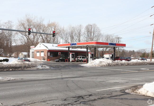


Property Detail
595 Windsor Ave
WIND-000068-000420-000049C
Capitol
Commercialbuilding
Connecticut
AE The base floodplain where base flood elevations are provided. AE Zones are now used on new format FIRMs instead of A1-A30 Zones.
49c
2024
1.86 AC
2025
Windsor
473700
Hartford
2,454 SF
Hartford-West Hartford-East Hartford, CT
NEARBY LISTINGS FOR SALE OR LEASE
DEMOGRAPHICS near 595 Windsor Ave
1 mile
3 mile
5 mile
2025 Total Population
7,319
48,401
170,859
2030 Population
7,381
49,182
174,561
Pop Growth 2025-2030
+ 0.85%
+ 1.61%
+ 2.17%
Average Age
41
40
39
2025 Total Households
2,693
17,920
69,150
HH Growth 2025-2030
+ 0.74%
+ 1.58%
+ 2.33%
Median Household Inc
$107,365
$73,208
$62,749
Avg Household Size
2.60
2.50
2.30
2025 Avg HH Vehicles
2.00
2.00
1.00
Median Home Value
$256,239
$253,640
$278,929
Median Year Built
1952
1957
1961
Nearby Places
Map Layers
Map Styles
 Street
 Aerial
Transit
 Traffic
 Biking
Places
Listings with unknown addresses are not visible on the map
- Restaurants
- Banks
- Shops
- Fitness
- Groceries
PUBLIC TRANSPORTATION
COMMUTER RAIL
Windsor (Hartford Line - CONN DOT)
Drive
Walk
Distance
Windsor (Hartford Line - CONN DOT)
6 min
2.7 mi
Hartford (Hartford Line - CONN DOT)
Drive
Walk
Distance
Hartford (Hartford Line - CONN DOT)
8 min
4.2 mi
AIRPORT
Bradley International
Drive
Walk
Distance
Bradley International
27 min
13.7 mi
Freight Ports
Port of New Haven
Drive
Walk
Distance
Port of New Haven
58 min
43.0 mi
Nearby Properties
Address
Land Use
TOTAL SIZE
Lot Size
Zoning
Address
Land Use
TOTAL SIZE
Lot Size
Zoning
13,680 SF
240.83 AC
Address
Land Use
TOTAL SIZE
Lot Size
Zoning
584 AC
OS
Address
Land Use
TOTAL SIZE
Lot Size
Zoning
68.36 AC
Address
Land Use
TOTAL SIZE
Lot Size
Zoning
7.45 AC
CAMP
Address
Land Use
TOTAL SIZE
Lot Size
Zoning
10.74 AC
ID-1
Address
Land Use
TOTAL SIZE
Lot Size
Zoning
82,938 SF
62.53 AC
I-1
Address
Land Use
TOTAL SIZE
Lot Size
Zoning
23.99 AC
ID-1
Address
Land Use
TOTAL SIZE
Lot Size
Zoning
6.50 AC
Address
Land Use
TOTAL SIZE
Lot Size
Zoning
421,152 SF
45.95 AC
CD
Address
Land Use
TOTAL SIZE
Lot Size
Zoning
356,062 SF
23.10 AC
ID-2
Address
Land Use
TOTAL SIZE
Lot Size
Zoning
35.05 AC
FP
Address
Land Use
TOTAL SIZE
Lot Size
Zoning
66.09 AC
CX-2
Address
Land Use
TOTAL SIZE
Lot Size
Zoning
122,329 SF
4.49 AC
MX-2
Address
Land Use
TOTAL SIZE
Lot Size
Zoning
109,206 SF
4.27 AC
MX-2
Address
Land Use
TOTAL SIZE
Lot Size
Zoning
177,630 SF
32.64 AC
Address
Land Use
TOTAL SIZE
Lot Size
Zoning
247,428 SF
35.46 AC
Address
Land Use
TOTAL SIZE
Lot Size
Zoning
209,744 SF
25.67 AC
CD
Address
Land Use
TOTAL SIZE
Lot Size
Zoning
259,600 SF
25.58 AC
CD
Address
Land Use
TOTAL SIZE
Lot Size
Zoning
122.44 AC
OS
Address
Land Use
TOTAL SIZE
Lot Size
Zoning
182,628 SF
15.94 AC
CD
Address
Land Use
TOTAL SIZE
Lot Size
Zoning
20.78 AC
CAMP
Address
Land Use
TOTAL SIZE
Lot Size
Zoning
14.90 AC
R-15
Address
Land Use
TOTAL SIZE
Lot Size
Zoning
416,640 SF
30 AC
I
Address
Land Use
TOTAL SIZE
Lot Size
Zoning
62,592 SF
31.12 AC
R-15
Address
Land Use
TOTAL SIZE
Lot Size
Zoning
424,627 SF
26 AC
ID-1
Address
Land Use
TOTAL SIZE
Lot Size
Zoning
768 SF
15.72 AC
Address
Land Use
TOTAL SIZE
Lot Size
Zoning
76,947 SF
5.70 AC
MX-2
Address
Land Use
TOTAL SIZE
Lot Size
Zoning
107,272 SF
31.67 AC
Address
Land Use
TOTAL SIZE
Lot Size
Zoning
270,025 SF
23 AC
CAMP
Address
Land Use
TOTAL SIZE
Lot Size
Zoning
97,048 SF
5.29 AC
MX-2
The World's #1 Commercial Real Estate Marketplace
Connect with us
© 2026 CoStar Group
The information above has been obtained from sources believed reliable. While we do not doubt its accuracy we have not verified it and make no guarantee, warranty or representation about it. It is your responsibility to independently confirm its accuracy and completeness. Any projections, opinions, assumptions, or estimates used are for example only and do not represent the current or future performance of the property. The value of this transaction to you depends on tax and other factors which should be evaluated by your tax, financial, and legal advisors. You and your advisors should conduct a careful, independent investigation of the property to determine to your satisfaction the suitability of the property for your needs.