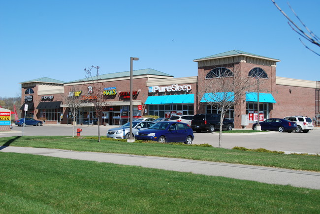
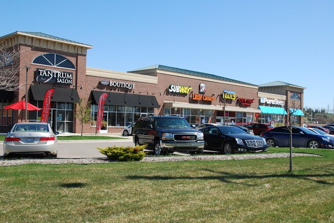
Property Record
5951 Highland Rd, White Lake, MI 48383

NEARBY LISTINGS FOR SALE OR LEASE
Property Detail
5951 Highland Rd
12-20-126-005
T3N, R8E, SEC 20 PART OF NW 1/4 BEG AT PT DIST N 89-02-35 W 660 FT FROM CEN OF SEC, TH N 89-02-35 W 443.70 FT TH N 86-31-24 W
Regionalshoppingcenterormallwithanchorstore
Oakland
X
Michigan
26125C0318F
2.10 AC
2024
St Clair & Lapeer Counties
2025
Detroit
130100
Detroit-Warren-Dearborn, MI
24,027 SF
DEMOGRAPHICS near 5951 Highland Rd
1 Mile
3 Mile
5 Mile
2024 Total Population
2,538
18,974
63,749
2029 Population
2,535
18,817
63,359
Pop Growth 2024-2029
(0.12%)
(0.83%)
(0.61%)
Average Age
38
42
43
2024 Total Households
1,022
7,288
24,475
HH Growth 2024-2029
(0.20%)
(0.81%)
(0.61%)
Median Household Inc
$69,912
$94,560
$97,679
Avg Household Size
2.50
2.60
2.60
2024 Avg HH Vehicles
2.00
2.00
2.00
Median Home Value
$82,786
$314,068
$322,617
Median Year Built
1983
1982
1983
Nearby Places
Map Layers
Map Styles
 Street
 Aerial
- Restaurants
- Banks
- Shops
- Fitness
- Groceries
PUBLIC TRANSPORTATION
AIRPORT
Bishop International
DRIVE
WALK
Distance
Bishop International
53 min
37.0 mi
Freight Ports
Port of Toledo
DRIVE
WALK
Distance
Port of Toledo
105 min
82.7 mi
SALE & LEASE HISTORY
LISTING DATE
SALE/LEASE

Sep 25, 2016
For Lease
Mar 09, 2018
For Lease
Jun 26, 2019
For Lease
Nearby Properties
Address
Land Use
TOTAL SIZE
Lot Size
Zoning
Address
Land Use
TOTAL SIZE
Lot Size
Zoning
4,260 SF
101.34 AC
MM
Address
Land Use
TOTAL SIZE
Lot Size
Zoning
207,282 SF
55.01 AC
BI
Address
Land Use
TOTAL SIZE
Lot Size
Zoning
119,755 SF
14.03 AC
Address
Land Use
TOTAL SIZE
Lot Size
Zoning
71,627 SF
13 AC
BV
Address
Land Use
TOTAL SIZE
Lot Size
Zoning
42,467 SF
13.70 AC
Address
Land Use
TOTAL SIZE
Lot Size
Zoning
46,500 SF
5.86 AC
BI
Address
Land Use
TOTAL SIZE
Lot Size
Zoning
34,854 SF
5.28 AC
AI
Address
Land Use
TOTAL SIZE
Lot Size
Zoning
65,345 SF
5.69 AC
GB
Address
Land Use
TOTAL SIZE
Lot Size
Zoning
88,540 SF
9.07 AC
PB
Address
Land Use
TOTAL SIZE
Lot Size
Zoning
103,525 SF
8.33 AC
PB
Address
Land Use
TOTAL SIZE
Lot Size
Zoning
45,644 SF
7.74 AC
BI
Address
Land Use
TOTAL SIZE
Lot Size
Zoning
38,846 SF
6.78 AC
BI
Address
Land Use
TOTAL SIZE
Lot Size
Zoning
24,370 SF
4.86 AC
BI
Address
Land Use
TOTAL SIZE
Lot Size
Zoning
23,300 SF
3.99 AC
BI
Address
Land Use
TOTAL SIZE
Lot Size
Zoning
58,677 SF
16.70 AC
II
Address
Land Use
TOTAL SIZE
Lot Size
Zoning
25,432 SF
4.53 AC
AI
Address
Land Use
TOTAL SIZE
Lot Size
Zoning
29,295 SF
15.15 AC
AI
Address
Land Use
TOTAL SIZE
Lot Size
Zoning
12,463 SF
4.73 AC
Address
Land Use
TOTAL SIZE
Lot Size
Zoning
15.74 AC
MM
Address
Land Use
TOTAL SIZE
Lot Size
Zoning
19,097 SF
6.04 AC
GB
Address
Land Use
TOTAL SIZE
Lot Size
Zoning
11,400 SF
1.44 AC
Address
Land Use
TOTAL SIZE
Lot Size
Zoning
12,000 SF
1.43 AC
BI
Address
Land Use
TOTAL SIZE
Lot Size
Zoning
13,000 SF
19.01 AC
II
Address
Land Use
TOTAL SIZE
Lot Size
Zoning
12,601 SF
2.54 AC
BI
Address
Land Use
TOTAL SIZE
Lot Size
Zoning
29,143 SF
9.62 AC
BI
Address
Land Use
TOTAL SIZE
Lot Size
Zoning
5,878 SF
4.20 AC
LB
Address
Land Use
TOTAL SIZE
Lot Size
Zoning
10,859 SF
2.70 AC
GB
Address
Land Use
TOTAL SIZE
Lot Size
Zoning
18,769 SF
2.29 AC
BI
Address
Land Use
TOTAL SIZE
Lot Size
Zoning
14,350 SF
2.87 AC
LM
The World's #1 Commercial Real Estate Marketplace
Connect with us
© 2025 CoStar Group
The information above has been obtained from sources believed reliable. While we do not doubt its accuracy we have not verified it and make no guarantee, warranty or representation about it. It is your responsibility to independently confirm its accuracy and completeness. Any projections, opinions, assumptions, or estimates used are for example only and do not represent the current or future performance of the property. The value of this transaction to you depends on tax and other factors which should be evaluated by your tax, financial, and legal advisors. You and your advisors should conduct a careful, independent investigation of the property to determine to your satisfaction the suitability of the property for your needs.