Property Record
5951 Mojave St, Pahrump, NV 89061
NEARBY LISTINGS FOR SALE OR LEASE
-
-
View all Pahrump listings for sale on LoopNet.com
Property Detail
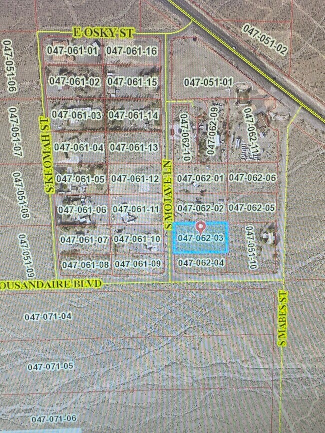
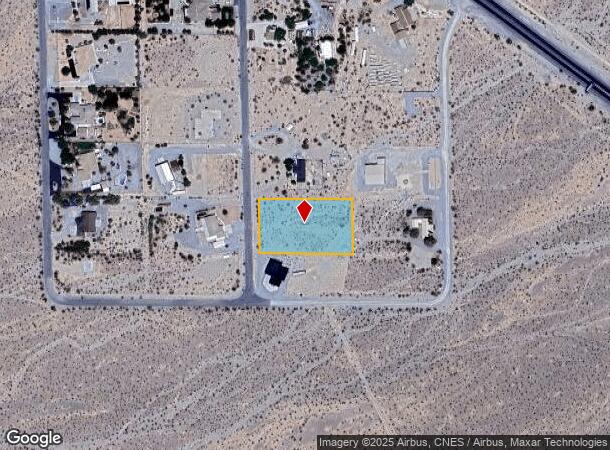
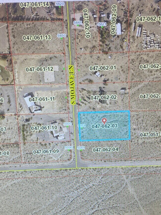
5951 Mojave St
Pahrump, NV
Rogers Est
47-062-03
T21S R54E S11 PT SE SE PLAT BK 34 PG 12 B.1 L.3 ROGERS EST
Residentialacreage
Nye
A
Nevada
32023C8865F
3
2024
1 AC
2025
Outlying S Clark County
960410
Las Vegas
DEMOGRAPHICS near 5951 Mojave St
1 Mile
3 Mile
5 Mile
2024 Total Population
35
3,352
10,778
2029 Population
42
4,034
12,838
Pop Growth 2024-2029
+ 20.00%
+ 20.35%
+ 19.11%
Average Age
56
55
51
2024 Total Households
16
1,568
4,671
HH Growth 2024-2029
+ 18.75%
+ 20.34%
+ 19.25%
Median Household Inc
$106,250
$73,115
$67,208
Avg Household Size
2.20
2.10
2.20
2024 Avg HH Vehicles
2.00
2.00
2.00
Median Home Value
$327,778
$320,052
$303,266
Median Year Built
2005
2007
2004
Nearby Places
Map Layers
Map Styles
 Street
 Aerial
- Restaurants
- Banks
- Shops
- Fitness
- Groceries
SALE & LEASE HISTORY
LISTING DATE
SALE/LEASE

Feb 08, 2022
For Sale
Nearby Properties
Address
Land Use
TOTAL SIZE
Lot Size
Zoning
Address
Land Use
TOTAL SIZE
Lot Size
Zoning
50,352 SF
76.63 AC
CF
Address
Land Use
TOTAL SIZE
Lot Size
Zoning
4.80 AC
R
Address
Land Use
TOTAL SIZE
Lot Size
Zoning
1 AC
GC
Address
Land Use
TOTAL SIZE
Lot Size
Zoning
635.76 AC
R
Address
Land Use
TOTAL SIZE
Lot Size
Zoning
2.22 AC
LI
Address
Land Use
TOTAL SIZE
Lot Size
Zoning
20,398 SF
4.02 AC
SP
Address
Land Use
TOTAL SIZE
Lot Size
Zoning
600 AC
R
Address
Land Use
TOTAL SIZE
Lot Size
Zoning
0.46 AC
GC
Address
Land Use
TOTAL SIZE
Lot Size
Zoning
274.43 AC
R
Address
Land Use
TOTAL SIZE
Lot Size
Zoning
18,266 SF
5 AC
CM
Address
Land Use
TOTAL SIZE
Lot Size
Zoning
660.85 AC
R
Address
Land Use
TOTAL SIZE
Lot Size
Zoning
195.93 AC
Address
Land Use
TOTAL SIZE
Lot Size
Zoning
625.83 AC
RU
Address
Land Use
TOTAL SIZE
Lot Size
Zoning
8,876 SF
1.25 AC
MU
Address
Land Use
TOTAL SIZE
Lot Size
Zoning
3,600 SF
45.33 AC
R
Address
Land Use
TOTAL SIZE
Lot Size
Zoning
506.95 AC
R
Address
Land Use
TOTAL SIZE
Lot Size
Zoning
4,800 SF
2 AC
NC
Address
Land Use
TOTAL SIZE
Lot Size
Zoning
480 AC
R
Address
Land Use
TOTAL SIZE
Lot Size
Zoning
120 AC
SPLIT
Address
Land Use
TOTAL SIZE
Lot Size
Zoning
12,513 SF
32.40 AC
VR-20
Address
Land Use
TOTAL SIZE
Lot Size
Zoning
161.45 AC
SP
Address
Land Use
TOTAL SIZE
Lot Size
Zoning
12.52 AC
GC
Address
Land Use
TOTAL SIZE
Lot Size
Zoning
4,797 SF
10 AC
RH-9.5
Address
Land Use
TOTAL SIZE
Lot Size
Zoning
4,440 SF
2.28 AC
NC
Address
Land Use
TOTAL SIZE
Lot Size
Zoning
111.23 AC
SP
Address
Land Use
TOTAL SIZE
Lot Size
Zoning
70.33 AC
SPLIT
Address
Land Use
TOTAL SIZE
Lot Size
Zoning
9.27 AC
GC
Address
Land Use
TOTAL SIZE
Lot Size
Zoning
5,916 SF
2.50 AC
RE-2
Address
Land Use
TOTAL SIZE
Lot Size
Zoning
19.89 AC
GC
Address
Land Use
TOTAL SIZE
Lot Size
Zoning
64.17 AC
The World's #1 Commercial Real Estate Marketplace
Connect with us
© 2025 CoStar Group
The information above has been obtained from sources believed reliable. While we do not doubt its accuracy we have not verified it and make no guarantee, warranty or representation about it. It is your responsibility to independently confirm its accuracy and completeness. Any projections, opinions, assumptions, or estimates used are for example only and do not represent the current or future performance of the property. The value of this transaction to you depends on tax and other factors which should be evaluated by your tax, financial, and legal advisors. You and your advisors should conduct a careful, independent investigation of the property to determine to your satisfaction the suitability of the property for your needs.