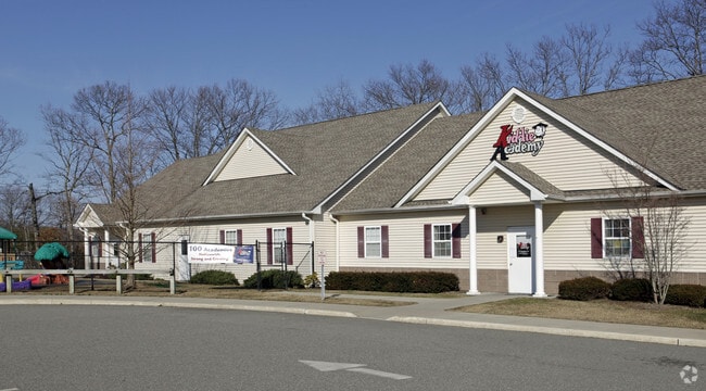
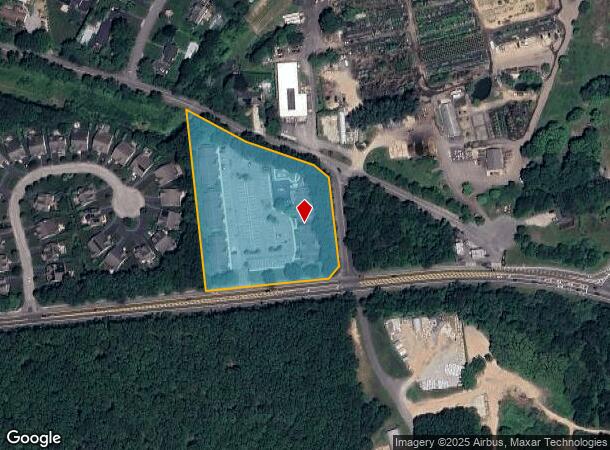
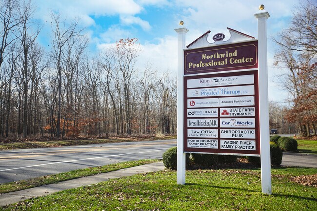
Property Record
5938 Route 25A, Wading River, NY 11792
NEARBY LISTINGS FOR SALE OR LEASE
Property Detail
5938 Route 25A
0600-075-00-01-00-009-000
Suffolk
Commercialnec
New York
X
9
36103C0429H
3.90 AC
2024
Eastern Suffolk
2024
Long Island (New York)
169701
Nassau County-Suffolk County, NY
5,180 SF
DEMOGRAPHICS near 5938 Route 25A
1 Mile
3 Mile
5 Mile
2024 Total Population
1,782
12,659
32,443
2029 Population
1,761
12,634
32,435
Pop Growth 2024-2029
(1.18%)
(0.20%)
(0.02%)
Average Age
45
43
46
2024 Total Households
677
4,593
12,814
HH Growth 2024-2029
(1.33%)
(0.28%)
+ 0.11%
Median Household Inc
$129,561
$118,545
$98,273
Avg Household Size
2.60
2.70
2.50
2024 Avg HH Vehicles
2.00
2.00
2.00
Median Home Value
$550,859
$487,560
$436,334
Median Year Built
1973
1974
1977
Nearby Places
- Restaurants
- Banks
- Shops
- Fitness
- Groceries
PUBLIC TRANSPORTATION
COMMUTER RAIL
Riverhead Station (Greenport Branch - Long Island Rail Road)
DRIVE
WALK
Distance
Riverhead Station (Greenport Branch - Long Island Rail Road)
16 min
9.3 mi
AIRPORT
Long Island MacArthur
DRIVE
WALK
Distance
Long Island MacArthur
39 min
24.4 mi
Freight Ports
Port of New Haven
DRIVE
WALK
Distance
Port of New Haven
133 min
50.8 mi
SALE & LEASE HISTORY
LISTING DATE
SALE/LEASE

Mar 17, 2021
For Sale
Nearby Properties
Address
Land Use
TOTAL SIZE
Lot Size
Zoning
Address
Land Use
TOTAL SIZE
Lot Size
Zoning
Address
Land Use
TOTAL SIZE
Lot Size
Zoning
41,075 SF
101 AC
02
Address
Land Use
TOTAL SIZE
Lot Size
Zoning
738.20 AC
02
Address
Land Use
TOTAL SIZE
Lot Size
Zoning
42 AC
PRP
Address
Land Use
TOTAL SIZE
Lot Size
Zoning
13.42 AC
02
Address
Land Use
TOTAL SIZE
Lot Size
Zoning
32.33 AC
Address
Land Use
TOTAL SIZE
Lot Size
Zoning
286.40 AC
4
Address
Land Use
TOTAL SIZE
Lot Size
Zoning
385.40 AC
9
Address
Land Use
TOTAL SIZE
Lot Size
Zoning
32.44 AC
Address
Land Use
TOTAL SIZE
Lot Size
Zoning
107,000 SF
11.40 AC
9
Address
Land Use
TOTAL SIZE
Lot Size
Zoning
15,840 SF
50 AC
LI
Address
Land Use
TOTAL SIZE
Lot Size
Zoning
17.70 AC
Address
Land Use
TOTAL SIZE
Lot Size
Zoning
1.14 AC
CR80
Address
Land Use
TOTAL SIZE
Lot Size
Zoning
2.50 AC
CR80
Address
Land Use
TOTAL SIZE
Lot Size
Zoning
388.50 AC
10
Address
Land Use
TOTAL SIZE
Lot Size
Zoning
26.11 AC
Address
Land Use
TOTAL SIZE
Lot Size
Zoning
20.60 AC
PIP
Address
Land Use
TOTAL SIZE
Lot Size
Zoning
593 SF
21.29 AC
02
Address
Land Use
TOTAL SIZE
Lot Size
Zoning
14.78 AC
Address
Land Use
TOTAL SIZE
Lot Size
Zoning
63,631 SF
14.38 AC
02
Address
Land Use
TOTAL SIZE
Lot Size
Zoning
864 SF
6.49 AC
02
Address
Land Use
TOTAL SIZE
Lot Size
Zoning
3,736 SF
1.14 AC
R2
Address
Land Use
TOTAL SIZE
Lot Size
Zoning
265 AC
NRP
Address
Land Use
TOTAL SIZE
Lot Size
Zoning
14.30 AC
9
Address
Land Use
TOTAL SIZE
Lot Size
Zoning
3,980 SF
191.40 AC
02
Address
Land Use
TOTAL SIZE
Lot Size
Zoning
21,775 SF
2.20 AC
2
Address
Land Use
TOTAL SIZE
Lot Size
Zoning
Address
Land Use
TOTAL SIZE
Lot Size
Zoning
4.14 AC
MRP
Address
Land Use
TOTAL SIZE
Lot Size
Zoning
The World's #1 Commercial Real Estate Marketplace
Connect with us
© 2025 CoStar Group
The information above has been obtained from sources believed reliable. While we do not doubt its accuracy we have not verified it and make no guarantee, warranty or representation about it. It is your responsibility to independently confirm its accuracy and completeness. Any projections, opinions, assumptions, or estimates used are for example only and do not represent the current or future performance of the property. The value of this transaction to you depends on tax and other factors which should be evaluated by your tax, financial, and legal advisors. You and your advisors should conduct a careful, independent investigation of the property to determine to your satisfaction the suitability of the property for your needs.