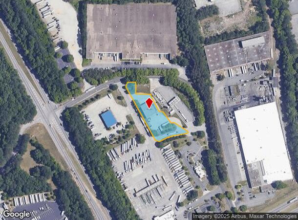
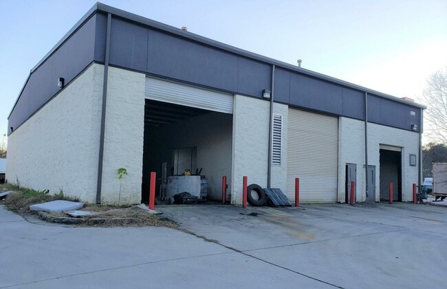
Property Record
5955 Bakers Ferry Rd Sw, Atlanta, GA 30336
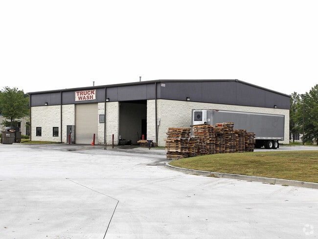

This Property Is For Sale
NEARBY LISTINGS FOR SALE OR LEASE
Property Detail
5955 Bakers Ferry Rd Sw
14F-0114-LL-093-4
Fulton
Carwash
Georgia
X
114
13121C0327F
1.16 AC
2024
Fulton District
2025
Atlanta
010312
Atlanta-Sandy Springs-Roswell, GA
7,512 SF
DEMOGRAPHICS near 5955 Bakers Ferry Rd Sw
1 Mile
3 Mile
5 Mile
2024 Total Population
2,726
19,548
99,184
2029 Population
2,779
20,111
102,397
Pop Growth 2024-2029
+ 1.94%
+ 2.88%
+ 3.24%
Average Age
37
39
38
2024 Total Households
1,218
7,689
38,003
HH Growth 2024-2029
+ 2.05%
+ 3.02%
+ 3.30%
Median Household Inc
$67,826
$72,990
$63,489
Avg Household Size
2.20
2.50
2.60
2024 Avg HH Vehicles
2.00
2.00
2.00
Median Home Value
$273,683
$323,221
$245,221
Median Year Built
1988
1994
1991
Nearby Places
- Restaurants
- Banks
- Shops
- Fitness
- Groceries
PUBLIC TRANSPORTATION
AIRPORT
Hartsfield - Jackson Atlanta International
DRIVE
WALK
Distance
Hartsfield - Jackson Atlanta International
28 min
18.1 mi
Freight Ports
Georgia Ports - Savannah
DRIVE
WALK
Distance
Georgia Ports - Savannah
290 min
255.4 mi
Nearby Properties
Address
Land Use
TOTAL SIZE
Lot Size
Zoning
Address
Land Use
TOTAL SIZE
Lot Size
Zoning
454,000 SF
68.17 AC
LI-R
Address
Land Use
TOTAL SIZE
Lot Size
Zoning
312,984 SF
19.88 AC
Address
Land Use
TOTAL SIZE
Lot Size
Zoning
830,966 SF
23 AC
MIXU
Address
Land Use
TOTAL SIZE
Lot Size
Zoning
1,045,610 SF
110.63 AC
SUBA
Address
Land Use
TOTAL SIZE
Lot Size
Zoning
652,500 SF
52.87 AC
LI-R
Address
Land Use
TOTAL SIZE
Lot Size
Zoning
913,620 SF
58.88 AC
Address
Land Use
TOTAL SIZE
Lot Size
Zoning
709,289 SF
112.06 AC
DCD
Address
Land Use
TOTAL SIZE
Lot Size
Zoning
359,608 SF
29.73 AC
DCD
Address
Land Use
TOTAL SIZE
Lot Size
Zoning
603,096 SF
38.38 AC
HI
Address
Land Use
TOTAL SIZE
Lot Size
Zoning
728,121 SF
48.95 AC
LI
Address
Land Use
TOTAL SIZE
Lot Size
Zoning
295,590 SF
10.25 AC
MIX
Address
Land Use
TOTAL SIZE
Lot Size
Zoning
602,400 SF
30.91 AC
DCD
Address
Land Use
TOTAL SIZE
Lot Size
Zoning
205,390 SF
24.28 AC
Address
Land Use
TOTAL SIZE
Lot Size
Zoning
340,131 SF
24.60 AC
DCD
Address
Land Use
TOTAL SIZE
Lot Size
Zoning
732,688 SF
47.23 AC
LI-R
Address
Land Use
TOTAL SIZE
Lot Size
Zoning
546,600 SF
32.19 AC
M1
Address
Land Use
TOTAL SIZE
Lot Size
Zoning
538,748 SF
35.64 AC
LI
Address
Land Use
TOTAL SIZE
Lot Size
Zoning
453,106 SF
36.69 AC
DCD
Address
Land Use
TOTAL SIZE
Lot Size
Zoning
540,000 SF
35.76 AC
DCD
Address
Land Use
TOTAL SIZE
Lot Size
Zoning
274,956 SF
74.20 AC
AG1
Address
Land Use
TOTAL SIZE
Lot Size
Zoning
523,551 SF
50.93 AC
LI
Address
Land Use
TOTAL SIZE
Lot Size
Zoning
490,726 SF
50.62 AC
LI-R
Address
Land Use
TOTAL SIZE
Lot Size
Zoning
457,703 SF
72.15 AC
DCD
Address
Land Use
TOTAL SIZE
Lot Size
Zoning
567,480 SF
44.13 AC
LI
Address
Land Use
TOTAL SIZE
Lot Size
Zoning
611,500 SF
37.74 AC
M2
Address
Land Use
TOTAL SIZE
Lot Size
Zoning
70.12 AC
Address
Land Use
TOTAL SIZE
Lot Size
Zoning
241,200 SF
18.40 AC
RM-12
Address
Land Use
TOTAL SIZE
Lot Size
Zoning
459,006 SF
21.49 AC
M1
Address
Land Use
TOTAL SIZE
Lot Size
Zoning
479,591 SF
29.76 AC
LI-R
Address
Land Use
TOTAL SIZE
Lot Size
Zoning
729,946 SF
34.07 AC
M2
The World's #1 Commercial Real Estate Marketplace
Connect with us
© 2025 CoStar Group
The information above has been obtained from sources believed reliable. While we do not doubt its accuracy we have not verified it and make no guarantee, warranty or representation about it. It is your responsibility to independently confirm its accuracy and completeness. Any projections, opinions, assumptions, or estimates used are for example only and do not represent the current or future performance of the property. The value of this transaction to you depends on tax and other factors which should be evaluated by your tax, financial, and legal advisors. You and your advisors should conduct a careful, independent investigation of the property to determine to your satisfaction the suitability of the property for your needs.