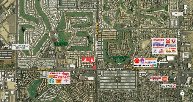
Property Record
5958 E Mckellips Rd, Mesa, AZ 85215


Property Detail
5958 E Mckellips Rd
141-43-003W
W 200F OF E 275F N 185F OF S 250F SE4 SEC 2 EX 15F X 15F TRI IN SE COR
Parkinglot
Maricopa
X
Arizona
04013C2280L
0.85 AC
2025
Mesa East
2025
Phoenix
420206
Phoenix-Mesa-Chandler, AZ
912 SF
NEARBY LISTINGS FOR SALE OR LEASE
DEMOGRAPHICS near 5958 E Mckellips Rd
1 mile
3 mile
5 mile
2024 Total Population
14,002
81,644
205,064
2029 Population
15,432
89,215
223,735
Pop Growth 2024-2029
+ 10.21%
+ 9.27%
+ 9.10%
Average Age
50
47
46
2024 Total Households
6,621
34,929
86,385
HH Growth 2024-2029
+ 10.56%
+ 9.75%
+ 9.57%
Median Household Inc
$69,615
$72,144
$69,336
Avg Household Size
2.10
2.30
2.30
2024 Avg HH Vehicles
2.00
2.00
2.00
Median Home Value
$337,301
$337,747
$333,444
Median Year Built
1988
1989
1989
Nearby Places
Map Layers
Map Styles
 Street
 Aerial
Transit
 Traffic
 Biking
Places
Listings with unknown addresses are not visible on the map
- Restaurants
- Banks
- Shops
- Fitness
- Groceries
PUBLIC TRANSPORTATION
AIRPORT
Phoenix-Mesa Gateway
Drive
Walk
Distance
Phoenix-Mesa Gateway
23 min
12.4 mi
Phoenix Sky Harbor International
Drive
Walk
Distance
Phoenix Sky Harbor International
29 min
20.9 mi
SALE & LEASE HISTORY
LISTING DATE
SALE/LEASE

Nov 12, 2019
For Sale
Jun 04, 2020
For Lease
Nearby Properties
Address
Land Use
TOTAL SIZE
Lot Size
Zoning
Address
Land Use
TOTAL SIZE
Lot Size
Zoning
1,522,034 SF
32.67 AC
C-N
Address
Land Use
TOTAL SIZE
Lot Size
Zoning
53,910 SF
4.98 AC
C-G
Address
Land Use
TOTAL SIZE
Lot Size
Zoning
1,691,248 SF
528.80 AC
I-1
Address
Land Use
TOTAL SIZE
Lot Size
Zoning
29.74 AC
Address
Land Use
TOTAL SIZE
Lot Size
Zoning
22.19 AC
Address
Land Use
TOTAL SIZE
Lot Size
Zoning
1,217,466 SF
102.41 AC
I-1
Address
Land Use
TOTAL SIZE
Lot Size
Zoning
22.71 AC
Address
Land Use
TOTAL SIZE
Lot Size
Zoning
57.25 AC
PF
Address
Land Use
TOTAL SIZE
Lot Size
Zoning
324,534 SF
50.86 AC
PF
Address
Land Use
TOTAL SIZE
Lot Size
Zoning
271,098 SF
142.75 AC
PF
Address
Land Use
TOTAL SIZE
Lot Size
Zoning
279,338 SF
39.90 AC
PF
Address
Land Use
TOTAL SIZE
Lot Size
Zoning
122,042 SF
15.79 AC
PF
Address
Land Use
TOTAL SIZE
Lot Size
Zoning
242,794 SF
14.29 AC
PEP
Address
Land Use
TOTAL SIZE
Lot Size
Zoning
140,141 SF
37.70 AC
PF
Address
Land Use
TOTAL SIZE
Lot Size
Zoning
66,350 SF
22.32 AC
I-1
Address
Land Use
TOTAL SIZE
Lot Size
Zoning
158,514 SF
21.39 AC
Address
Land Use
TOTAL SIZE
Lot Size
Zoning
8.82 AC
Address
Land Use
TOTAL SIZE
Lot Size
Zoning
82,772 SF
131.12 AC
PF
Address
Land Use
TOTAL SIZE
Lot Size
Zoning
359,204 SF
40.94 AC
LI
Address
Land Use
TOTAL SIZE
Lot Size
Zoning
267,380 SF
17.08 AC
M-H
Address
Land Use
TOTAL SIZE
Lot Size
Zoning
7.90 AC
Address
Land Use
TOTAL SIZE
Lot Size
Zoning
214,197 SF
10.43 AC
RM3
Address
Land Use
TOTAL SIZE
Lot Size
Zoning
190,630 SF
6.61 AC
M-H
Address
Land Use
TOTAL SIZE
Lot Size
Zoning
187,297 SF
3.99 AC
R-9
Address
Land Use
TOTAL SIZE
Lot Size
Zoning
4.79 AC
Address
Land Use
TOTAL SIZE
Lot Size
Zoning
7.26 AC
Address
Land Use
TOTAL SIZE
Lot Size
Zoning
225,233 SF
21.66 AC
C-G
Address
Land Use
TOTAL SIZE
Lot Size
Zoning
125,534 SF
19.59 AC
I-2
Address
Land Use
TOTAL SIZE
Lot Size
Zoning
146,107 SF
10.12 AC
LI
Address
Land Use
TOTAL SIZE
Lot Size
Zoning
308,103 SF
14.78 AC
M-H
The World's #1 Commercial Real Estate Marketplace
Connect with us
© 2026 CoStar Group
The information above has been obtained from sources believed reliable. While we do not doubt its accuracy we have not verified it and make no guarantee, warranty or representation about it. It is your responsibility to independently confirm its accuracy and completeness. Any projections, opinions, assumptions, or estimates used are for example only and do not represent the current or future performance of the property. The value of this transaction to you depends on tax and other factors which should be evaluated by your tax, financial, and legal advisors. You and your advisors should conduct a careful, independent investigation of the property to determine to your satisfaction the suitability of the property for your needs.