Property Record
5959 Royal Ln, Dallas, TX 75230

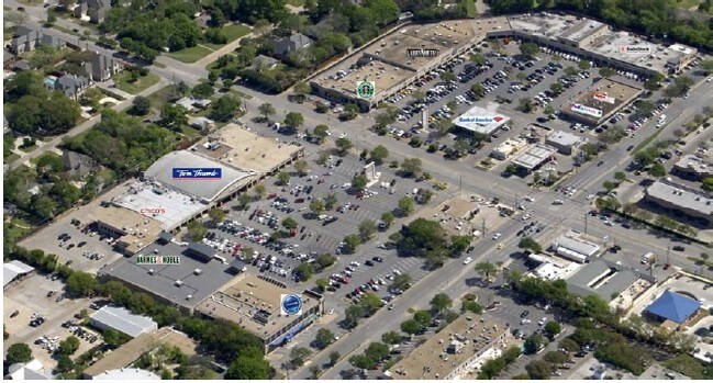
Property Detail
5959 Royal Ln
00000413407000000
BLK 5501 ACS 8.217 PRESTON RD & ROYAL LANE INT201200368607 DD12122012 CO-DC 5501 000 00000 1005501 000
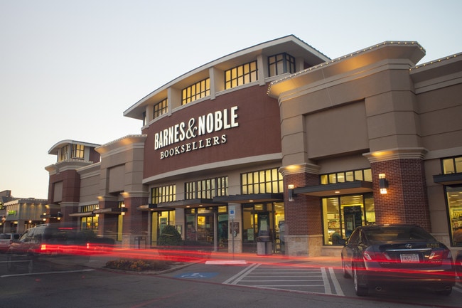
Restaurantbuilding
DALLAS
Z59
Texas
B and X Area of moderate flood hazard, usually the area between the limits of the 100-year and 500-year floods.
8.21 AC
2024
North Dallas
2025
Dallas/Ft Worth
013400
Dallas-Fort Worth-Arlington, TX
124,481 SF
NEARBY LISTINGS FOR SALE OR LEASE
DEMOGRAPHICS near 5959 Royal Ln
1 mile
3 mile
5 mile
2024 Total Population
7,490
106,327
412,154
2029 Population
7,778
110,264
426,077
Pop Growth 2024-2029
+ 3.85%
+ 3.70%
+ 3.38%
Average Age
45
42
38
2024 Total Households
2,762
47,633
178,108
HH Growth 2024-2029
+ 3.98%
+ 3.86%
+ 3.50%
Median Household Inc
$245,642
$107,759
$82,458
Avg Household Size
2.70
2.20
2.20
2024 Avg HH Vehicles
2.00
2.00
2.00
Median Home Value
$1,092,009
$924,691
$692,211
Median Year Built
1975
1979
1979
Nearby Places
Map Layers
Map Styles
 Street
 Aerial
Transit
 Traffic
 Biking
Places
Listings with unknown addresses are not visible on the map
- Restaurants
- Banks
- Shops
- Fitness
- Groceries
PUBLIC TRANSPORTATION
COMMUTER RAIL
Medical/Market Ctr Station (TRINITY RAILWAY - Dallas Area Rapid Transit (DART))
Drive
Walk
Distance
Medical/Market Ctr Station (TRINITY RAILWAY - Dallas Area Rapid Transit (DART))
12 min
7.9 mi
Victory Station (DART LIGHT RAIL - GREEN LINE - Dallas Area Rapid Transit (DART), DART LIGHT RAIL - ORANGE LINE - Dallas Area Rapid Transit (DART), TRINITY RAILWAY - Dallas Area Rapid Transit (DART))
Drive
Walk
Distance
Victory Station (DART LIGHT RAIL - GREEN LINE - Dallas Area Rapid Transit (DART), DART LIGHT RAIL - ORANGE LINE - Dallas Area Rapid Transit (DART), TRINITY RAILWAY - Dallas Area Rapid Transit (DART))
12 min
8.7 mi
AIRPORT
Dallas Love Field
Drive
Walk
Distance
Dallas Love Field
13 min
7.1 mi
Dallas-Fort Worth International
Drive
Walk
Distance
Dallas-Fort Worth International
27 min
20.9 mi
Freight Ports
Port of Shreveport
Drive
Walk
Distance
Port of Shreveport
220 min
203.0 mi
SALE & LEASE HISTORY
LISTING DATE
SALE/LEASE

Sep 25, 2016
For Lease
Oct 31, 2017
For Lease
Feb 20, 2020
For Lease
Aug 22, 2017
For Lease
Aug 01, 2019
For Lease
Apr 17, 2018
For Lease
Nearby Properties
Address
Land Use
TOTAL SIZE
Lot Size
Zoning
Address
Land Use
TOTAL SIZE
Lot Size
Zoning
4,157,377 SF
76.79 AC
Z248
Address
Land Use
TOTAL SIZE
Lot Size
Zoning
3,240,143 SF
28.52 AC
Z151
Address
Land Use
TOTAL SIZE
Lot Size
Zoning
2,186,362 SF
48.27 AC
Z239
Address
Land Use
TOTAL SIZE
Lot Size
Zoning
502,529 SF
3.08 AC
Z239
Address
Land Use
TOTAL SIZE
Lot Size
Zoning
1,252,860 SF
57.08 AC
Z239
Address
Land Use
TOTAL SIZE
Lot Size
Zoning
3,423,779 SF
32.42 AC
Z151
Address
Land Use
TOTAL SIZE
Lot Size
Zoning
450,131 SF
39.95 AC
Z296
Address
Land Use
TOTAL SIZE
Lot Size
Zoning
77.76 AC
Z239
Address
Land Use
TOTAL SIZE
Lot Size
Zoning
1,086,919 SF
5.85 AC
Z239
Address
Land Use
TOTAL SIZE
Lot Size
Zoning
812,701 SF
3.73 AC
Address
Land Use
TOTAL SIZE
Lot Size
Zoning
557,392 SF
10.06 AC
Z239
Address
Land Use
TOTAL SIZE
Lot Size
Zoning
1,009,256 SF
23.64 AC
Z239
Address
Land Use
TOTAL SIZE
Lot Size
Zoning
875,990 SF
4.30 AC
Z239
Address
Land Use
TOTAL SIZE
Lot Size
Zoning
662,911 SF
4.36 AC
Z239
Address
Land Use
TOTAL SIZE
Lot Size
Zoning
990,541 SF
3.87 AC
Z239
Address
Land Use
TOTAL SIZE
Lot Size
Zoning
395,377 SF
14.61 AC
Z163
Address
Land Use
TOTAL SIZE
Lot Size
Zoning
137,075 SF
84.16 AC
Z239
Address
Land Use
TOTAL SIZE
Lot Size
Zoning
601,951 SF
2.10 AC
Z239
Address
Land Use
TOTAL SIZE
Lot Size
Zoning
735,000 SF
2.05 AC
Z239
Address
Land Use
TOTAL SIZE
Lot Size
Zoning
835,301 SF
9.29 AC
Z239
Address
Land Use
TOTAL SIZE
Lot Size
Zoning
493,925 SF
2.63 AC
Z239
Address
Land Use
TOTAL SIZE
Lot Size
Zoning
1,156,000 SF
4 AC
Z236
Address
Land Use
TOTAL SIZE
Lot Size
Zoning
957,985 SF
1.97 AC
Z239
Address
Land Use
TOTAL SIZE
Lot Size
Zoning
421,798 SF
9 AC
Z151
Address
Land Use
TOTAL SIZE
Lot Size
Zoning
540,436 SF
1.86 AC
Z239
Address
Land Use
TOTAL SIZE
Lot Size
Zoning
852,562 SF
13.86 AC
Z151
Address
Land Use
TOTAL SIZE
Lot Size
Zoning
665,996 SF
5.60 AC
Z236
Address
Land Use
TOTAL SIZE
Lot Size
Zoning
184,388 SF
18.89 AC
Z298
Address
Land Use
TOTAL SIZE
Lot Size
Zoning
485,067 SF
14.87 AC
Z239
Address
Land Use
TOTAL SIZE
Lot Size
Zoning
611,288 SF
8.80 AC
Z163
The World's #1 Commercial Real Estate Marketplace
Connect with us
© 2026 CoStar Group
The information above has been obtained from sources believed reliable. While we do not doubt its accuracy we have not verified it and make no guarantee, warranty or representation about it. It is your responsibility to independently confirm its accuracy and completeness. Any projections, opinions, assumptions, or estimates used are for example only and do not represent the current or future performance of the property. The value of this transaction to you depends on tax and other factors which should be evaluated by your tax, financial, and legal advisors. You and your advisors should conduct a careful, independent investigation of the property to determine to your satisfaction the suitability of the property for your needs.