Property Record
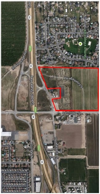
5959 E Lathrop Rd, Manteca, CA 95336

Property Detail
5959 E Lathrop Rd
197-100-16
15-PT TO RD PER 13141774
Commercialacreage
SAN JOAQUIN
CFS
California
B and X Area of moderate flood hazard, usually the area between the limits of the 100-year and 500-year floods.
4.38 AC
2025
Tracy/Manteca
2025
Stockton/Modesto
005131
Stockton-Lodi, CA
NEARBY LISTINGS FOR SALE OR LEASE
DEMOGRAPHICS near 5959 E Lathrop Rd
1 mile
3 mile
5 mile
2025 Total Population
7,244
66,079
117,966
2030 Population
7,578
69,153
124,158
Pop Growth 2025-2030
+ 4.61%
+ 4.65%
+ 5.25%
Average Age
39
40
39
2025 Total Households
2,445
22,367
36,564
HH Growth 2025-2030
+ 4.74%
+ 4.78%
+ 5.35%
Median Household Inc
$81,560
$83,923
$95,947
Avg Household Size
2.90
2.90
3.10
2025 Avg HH Vehicles
2.00
2.00
2.00
Median Home Value
$636,933
$583,872
$644,357
Median Year Built
1982
1985
1994
Nearby Places
Map Layers
Map Styles
 Street
 Aerial
Transit
 Traffic
 Biking
Places
Listings with unknown addresses are not visible on the map
- Restaurants
- Banks
- Shops
- Fitness
- Groceries
PUBLIC TRANSPORTATION
COMMUTER RAIL
Lathrop Station (ACE Train - Altamont Corridor Express)
Drive
Walk
Distance
Lathrop Station (ACE Train - Altamont Corridor Express)
9 min
5.2 mi
AIRPORT
Stockton Metro
Drive
Walk
Distance
Stockton Metro
12 min
6.7 mi
Freight Ports
Port of Stockton
Drive
Walk
Distance
Port of Stockton
21 min
15.3 mi
Nearby Properties
Address
Land Use
TOTAL SIZE
Lot Size
Zoning
Address
Land Use
TOTAL SIZE
Lot Size
Zoning
730,300 SF
41.44 AC
Address
Land Use
TOTAL SIZE
Lot Size
Zoning
600 SF
19.12 AC
Address
Land Use
TOTAL SIZE
Lot Size
Zoning
552,450 SF
27.84 AC
Address
Land Use
TOTAL SIZE
Lot Size
Zoning
746,790 SF
39.23 AC
M2
Address
Land Use
TOTAL SIZE
Lot Size
Zoning
830,175 SF
46.57 AC
IG
Address
Land Use
TOTAL SIZE
Lot Size
Zoning
Address
Land Use
TOTAL SIZE
Lot Size
Zoning
565,580 SF
56.99 AC
Address
Land Use
TOTAL SIZE
Lot Size
Zoning
350,415 SF
17.45 AC
Address
Land Use
TOTAL SIZE
Lot Size
Zoning
16.02 AC
Address
Land Use
TOTAL SIZE
Lot Size
Zoning
106,576 SF
6.85 AC
Address
Land Use
TOTAL SIZE
Lot Size
Zoning
19,912 SF
6.49 AC
C1
Address
Land Use
TOTAL SIZE
Lot Size
Zoning
608,500 SF
31.59 AC
Address
Land Use
TOTAL SIZE
Lot Size
Zoning
82,329 SF
5.96 AC
Address
Land Use
TOTAL SIZE
Lot Size
Zoning
404,657 SF
24.89 AC
AG40
Address
Land Use
TOTAL SIZE
Lot Size
Zoning
161,474 SF
10.03 AC
Address
Land Use
TOTAL SIZE
Lot Size
Zoning
110,000 SF
15.10 AC
Address
Land Use
TOTAL SIZE
Lot Size
Zoning
Address
Land Use
TOTAL SIZE
Lot Size
Zoning
6,000 SF
3.96 AC
Address
Land Use
TOTAL SIZE
Lot Size
Zoning
85,933 SF
3.32 AC
Address
Land Use
TOTAL SIZE
Lot Size
Zoning
2.98 AC
Address
Land Use
TOTAL SIZE
Lot Size
Zoning
37,020 SF
1.95 AC
Address
Land Use
TOTAL SIZE
Lot Size
Zoning
45,967 SF
26.19 AC
Address
Land Use
TOTAL SIZE
Lot Size
Zoning
129,117 SF
11.36 AC
Address
Land Use
TOTAL SIZE
Lot Size
Zoning
108,000 SF
12.30 AC
Address
Land Use
TOTAL SIZE
Lot Size
Zoning
125,381 SF
11.75 AC
Address
Land Use
TOTAL SIZE
Lot Size
Zoning
26,141 SF
2.80 AC
Address
Land Use
TOTAL SIZE
Lot Size
Zoning
34,960 SF
2.58 AC
Address
Land Use
TOTAL SIZE
Lot Size
Zoning
5,500 SF
5.47 AC
Address
Land Use
TOTAL SIZE
Lot Size
Zoning
3.03 AC
Address
Land Use
TOTAL SIZE
Lot Size
Zoning
77,245 SF
3.46 AC
The World's #1 Commercial Real Estate Marketplace
Connect with us
© 2026 CoStar Group
The information above has been obtained from sources believed reliable. While we do not doubt its accuracy we have not verified it and make no guarantee, warranty or representation about it. It is your responsibility to independently confirm its accuracy and completeness. Any projections, opinions, assumptions, or estimates used are for example only and do not represent the current or future performance of the property. The value of this transaction to you depends on tax and other factors which should be evaluated by your tax, financial, and legal advisors. You and your advisors should conduct a careful, independent investigation of the property to determine to your satisfaction the suitability of the property for your needs.