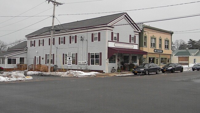
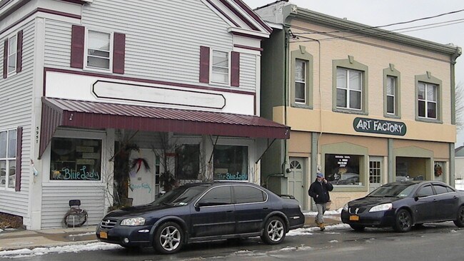
Property Record
5959 Main St, Olcott, NY 14126
NEARBY LISTINGS FOR SALE OR LEASE
-
-
View all Olcott listings for lease on LoopNet.com
Property Detail
5959 Main St
292800-005-083-0001-025-000
OLCOTT 212782
Commercialofficeresidentialmixeduse
Niagara
X
New York
36063C0079F
26.000
2016
0.06 AC
2024
Outlying Niagara County
024202
Buffalo/Niagara Falls
4,014 SF
Buffalo-Cheektowaga, NY
DEMOGRAPHICS near 5959 Main St
1 mile
3 mile
5 mile
2024 Total Population
735
2,180
6,571
2029 Population
720
2,137
6,447
Pop Growth 2024-2029
(2.04%)
(1.97%)
(1.89%)
Average Age
48
46
44
2024 Total Households
350
950
2,686
HH Growth 2024-2029
(2.00%)
(2.00%)
(1.90%)
Median Household Inc
$64,643
$64,635
$63,510
Avg Household Size
2.10
2.20
2.30
2024 Avg HH Vehicles
2.00
2.00
2.00
Median Home Value
$171,176
$170,329
$167,424
Median Year Built
1952
1953
1953
Nearby Places
Map Layers
Map Styles
 Street
 Aerial
Transit
 Traffic
 Biking
Places
Listings with unknown addresses are not visible on the map
- Restaurants
- Banks
- Shops
- Fitness
- Groceries
PUBLIC TRANSPORTATION
AIRPORT
Buffalo Niagara International
Drive
Walk
Distance
Buffalo Niagara International
49 min
33.4 mi
Freight Ports
Albany, NY Port
Drive
Walk
Distance
Albany, NY Port
1 min
255.3 mi
SALE & LEASE HISTORY
LISTING DATE
SALE/LEASE

Sep 25, 2016
For Lease
Sep 24, 2016
For Sale
Jun 06, 2018
For Lease
Jun 06, 2018
For Sale
Nearby Properties
Address
Land Use
TOTAL SIZE
Lot Size
Zoning
Address
Land Use
TOTAL SIZE
Lot Size
Zoning
3,480 SF
9.60 AC
Address
Land Use
TOTAL SIZE
Lot Size
Zoning
48,858 SF
28.40 AC
Address
Land Use
TOTAL SIZE
Lot Size
Zoning
21,240 SF
47.19 AC
Address
Land Use
TOTAL SIZE
Lot Size
Zoning
810 SF
313.70 AC
Address
Land Use
TOTAL SIZE
Lot Size
Zoning
720 SF
12.80 AC
Address
Land Use
TOTAL SIZE
Lot Size
Zoning
47,883 SF
6.30 AC
Address
Land Use
TOTAL SIZE
Lot Size
Zoning
24,035 SF
0.80 AC
Address
Land Use
TOTAL SIZE
Lot Size
Zoning
28 SF
6.30 AC
Address
Land Use
TOTAL SIZE
Lot Size
Zoning
42,000 SF
4.30 AC
05 - COMME
Address
Land Use
TOTAL SIZE
Lot Size
Zoning
3,600 SF
28.58 AC
Address
Land Use
TOTAL SIZE
Lot Size
Zoning
41,490 SF
1.30 AC
Address
Land Use
TOTAL SIZE
Lot Size
Zoning
5,698 SF
1.61 AC
Address
Land Use
TOTAL SIZE
Lot Size
Zoning
6,012 SF
97.60 AC
Address
Land Use
TOTAL SIZE
Lot Size
Zoning
3,675 SF
18.14 AC
Address
Land Use
TOTAL SIZE
Lot Size
Zoning
15,040 SF
5.10 AC
Address
Land Use
TOTAL SIZE
Lot Size
Zoning
18,540 SF
3.80 AC
Address
Land Use
TOTAL SIZE
Lot Size
Zoning
5,741 SF
Address
Land Use
TOTAL SIZE
Lot Size
Zoning
840 SF
2.50 AC
Address
Land Use
TOTAL SIZE
Lot Size
Zoning
0.45 AC
Address
Land Use
TOTAL SIZE
Lot Size
Zoning
3,126 SF
8.40 AC
Address
Land Use
TOTAL SIZE
Lot Size
Zoning
13,065 SF
30 AC
Address
Land Use
TOTAL SIZE
Lot Size
Zoning
18.90 AC
Address
Land Use
TOTAL SIZE
Lot Size
Zoning
7,500 SF
1.35 AC
Address
Land Use
TOTAL SIZE
Lot Size
Zoning
2,109 SF
113.84 AC
Address
Land Use
TOTAL SIZE
Lot Size
Zoning
2,109 SF
113.84 AC
Address
Land Use
TOTAL SIZE
Lot Size
Zoning
2,109 SF
113.84 AC
Address
Land Use
TOTAL SIZE
Lot Size
Zoning
3,469 SF
5.70 AC
Address
Land Use
TOTAL SIZE
Lot Size
Zoning
3,797 SF
2.10 AC
Address
Land Use
TOTAL SIZE
Lot Size
Zoning
2,228 SF
1.05 AC
Address
Land Use
TOTAL SIZE
Lot Size
Zoning
3,856 SF
8.50 AC
The World's #1 Commercial Real Estate Marketplace
Connect with us
© 2026 CoStar Group
The information above has been obtained from sources believed reliable. While we do not doubt its accuracy we have not verified it and make no guarantee, warranty or representation about it. It is your responsibility to independently confirm its accuracy and completeness. Any projections, opinions, assumptions, or estimates used are for example only and do not represent the current or future performance of the property. The value of this transaction to you depends on tax and other factors which should be evaluated by your tax, financial, and legal advisors. You and your advisors should conduct a careful, independent investigation of the property to determine to your satisfaction the suitability of the property for your needs.