Property Record
5959 Shallowford Rd, Chattanooga, TN 37421


NEARBY LISTINGS FOR SALE OR LEASE
Property Detail
5959 Shallowford Rd
Chattanooga, TN-GA
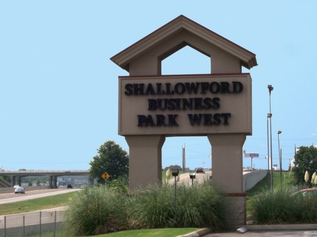
Shallowford Business Park
138I-A-002
LT 1 SHALLOWFORD BUSINESS PARK 39-268 REV 41-199 REV 42-155 REV 58-61 REV 58-119 REV 86-85
Manufacturinglight
Hamilton
X
Tennessee
47065C0362G
1
2024
20.11 AC
2024
Outlying Chattanooga
011444
Chattanooga
274,060 SF
DEMOGRAPHICS near 5959 Shallowford Rd
1 Mile
3 Mile
5 Mile
2024 Total Population
1,725
38,645
110,587
2029 Population
1,837
41,141
118,193
Pop Growth 2024-2029
+ 6.49%
+ 6.46%
+ 6.88%
Average Age
41
42
41
2024 Total Households
829
16,941
46,765
HH Growth 2024-2029
+ 6.63%
+ 6.62%
+ 7.00%
Median Household Inc
$39,703
$48,894
$53,586
Avg Household Size
2.00
2.20
2.30
2024 Avg HH Vehicles
1.00
2.00
2.00
Median Home Value
$213,084
$174,999
$199,904
Median Year Built
1983
1972
1974
Nearby Places
Map Layers
Map Styles
 Street
 Aerial
- Restaurants
- Banks
- Shops
- Fitness
- Groceries
PUBLIC TRANSPORTATION
AIRPORT
Lovell Field
DRIVE
WALK
Distance
Lovell Field
12 min
5.0 mi
Freight Ports
Georgia Ports - Savannah
DRIVE
WALK
Distance
Georgia Ports - Savannah
407 min
363.0 mi
SALE & LEASE HISTORY
LISTING DATE
SALE/LEASE

Jun 08, 2017
For Lease
Nearby Properties
Address
Land Use
TOTAL SIZE
Lot Size
Zoning
Address
Land Use
TOTAL SIZE
Lot Size
Zoning
832.10 AC
M1
Address
Land Use
TOTAL SIZE
Lot Size
Zoning
523,520 SF
12.03 AC
M1
Address
Land Use
TOTAL SIZE
Lot Size
Zoning
564,883 SF
27.46 AC
C2
Address
Land Use
TOTAL SIZE
Lot Size
Zoning
292,309 SF
45.28 AC
M1
Address
Land Use
TOTAL SIZE
Lot Size
Zoning
183 AC
R1
Address
Land Use
TOTAL SIZE
Lot Size
Zoning
1,015,861 SF
83.82 AC
M1
Address
Land Use
TOTAL SIZE
Lot Size
Zoning
242,788 SF
27 AC
Address
Land Use
TOTAL SIZE
Lot Size
Zoning
43,576 SF
6.66 AC
C2
Address
Land Use
TOTAL SIZE
Lot Size
Zoning
291,314 SF
29.69 AC
M1
Address
Land Use
TOTAL SIZE
Lot Size
Zoning
82,000 SF
22.45 AC
M1
Address
Land Use
TOTAL SIZE
Lot Size
Zoning
254,362 SF
14.41 AC
R4
Address
Land Use
TOTAL SIZE
Lot Size
Zoning
99,202 SF
17.32 AC
Address
Land Use
TOTAL SIZE
Lot Size
Zoning
254,432 SF
16.20 AC
R1
Address
Land Use
TOTAL SIZE
Lot Size
Zoning
2,460 SF
15.30 AC
R3
Address
Land Use
TOTAL SIZE
Lot Size
Zoning
5,008 SF
17.97 AC
R1
Address
Land Use
TOTAL SIZE
Lot Size
Zoning
5,865 SF
21.90 AC
Address
Land Use
TOTAL SIZE
Lot Size
Zoning
245,744 SF
24.84 AC
Address
Land Use
TOTAL SIZE
Lot Size
Zoning
50,506 SF
5.14 AC
MD
Address
Land Use
TOTAL SIZE
Lot Size
Zoning
8,557 SF
14.30 AC
R2
Address
Land Use
TOTAL SIZE
Lot Size
Zoning
236,880 SF
18.90 AC
R2
Address
Land Use
TOTAL SIZE
Lot Size
Zoning
110,710 SF
6.69 AC
M1
Address
Land Use
TOTAL SIZE
Lot Size
Zoning
193,486 SF
14.18 AC
Address
Land Use
TOTAL SIZE
Lot Size
Zoning
266,271 SF
26.27 AC
R2
Address
Land Use
TOTAL SIZE
Lot Size
Zoning
1,200 SF
14.10 AC
Address
Land Use
TOTAL SIZE
Lot Size
Zoning
32,261 SF
6.43 AC
R1
Address
Land Use
TOTAL SIZE
Lot Size
Zoning
121,263 SF
13.51 AC
C4
Address
Land Use
TOTAL SIZE
Lot Size
Zoning
186,892 SF
19.97 AC
Address
Land Use
TOTAL SIZE
Lot Size
Zoning
67,735 SF
17.32 AC
M1
Address
Land Use
TOTAL SIZE
Lot Size
Zoning
66 AC
R4
Address
Land Use
TOTAL SIZE
Lot Size
Zoning
111,196 SF
9.67 AC
C2
The World's #1 Commercial Real Estate Marketplace
Connect with us
© 2025 CoStar Group
The information above has been obtained from sources believed reliable. While we do not doubt its accuracy we have not verified it and make no guarantee, warranty or representation about it. It is your responsibility to independently confirm its accuracy and completeness. Any projections, opinions, assumptions, or estimates used are for example only and do not represent the current or future performance of the property. The value of this transaction to you depends on tax and other factors which should be evaluated by your tax, financial, and legal advisors. You and your advisors should conduct a careful, independent investigation of the property to determine to your satisfaction the suitability of the property for your needs.