Property Record
596 Carroll St, Sunnyvale, CA 94086
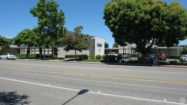


Property Detail
596 Carroll St
209-31-069
LOT 1 RECORDERS BOOK 573 PAGE 35
Financialbuilding
SANTA CLARA
RO
California
C and X Area of minimal flood hazard, usually depicted on FIRMs as above the 500-year flood level.
3.24 AC
2024
Sunnyvale
2025
South Bay/San Jose
508602
San Jose-Sunnyvale-Santa Clara, CA
116,450 SF
NEARBY LISTINGS FOR SALE OR LEASE
DEMOGRAPHICS near 596 Carroll St
1 mile
3 mile
5 mile
2025 Total Population
35,520
239,159
496,358
2030 Population
36,501
246,240
510,638
Pop Growth 2025-2030
+ 2.76%
+ 2.96%
+ 2.88%
Average Age
37
39
39
2025 Total Households
14,133
89,433
184,451
HH Growth 2025-2030
+ 2.87%
+ 3.04%
+ 2.95%
Median Household Inc
$173,962
$189,640
$188,195
Avg Household Size
2.50
2.60
2.60
2025 Avg HH Vehicles
2.00
2.00
2.00
Median Home Value
$1,132,520
$1,117,404
$1,122,375
Median Year Built
1976
1974
1973
Nearby Places
Map Layers
Map Styles
 Street
 Aerial
Layers
 Traffic
 Biking
Places
Listings with unknown addresses are not visible on the map
- Restaurants
- Banks
- Shops
- Fitness
- Groceries
PUBLIC TRANSPORTATION
TRANSIT/SUBWAY
Sunnyvale (Caltrain - Caltrain (Caltrain))
Drive
Walk
Distance
Sunnyvale (Caltrain - Caltrain (Caltrain))
4 min
18 min
0.9 mi
COMMUTER RAIL
Drive
Walk
Distance
4 min
18 min
0.9 mi
Drive
Walk
Distance
6 min
2.2 mi
AIRPORT
Norman Y Mineta San Jose International
Drive
Walk
Distance
Norman Y Mineta San Jose International
14 min
6.9 mi
San Francisco International
Drive
Walk
Distance
San Francisco International
39 min
28.7 mi
Metro Oakland International
Drive
Walk
Distance
Metro Oakland International
51 min
38.1 mi
Freight Ports
Port of Redwood City
Drive
Walk
Distance
Port of Redwood City
24 min
15.5 mi
Nearby Properties
Address
Land Use
TOTAL SIZE
Lot Size
Zoning
Address
Land Use
TOTAL SIZE
Lot Size
Zoning
2,819,800 SF
91.85 AC
CU
Address
Land Use
TOTAL SIZE
Lot Size
Zoning
777,000 SF
17.84 AC
MS
Address
Land Use
TOTAL SIZE
Lot Size
Zoning
57,096 SF
58.04 AC
PM0
Address
Land Use
TOTAL SIZE
Lot Size
Zoning
424,316 SF
22.37 AC
SU
Address
Land Use
TOTAL SIZE
Lot Size
Zoning
318,172 SF
60.47 AC
MP-TO
Address
Land Use
TOTAL SIZE
Lot Size
Zoning
107,203 SF
21.74 AC
MXD2
Address
Land Use
TOTAL SIZE
Lot Size
Zoning
16.72 AC
MSLSP
Address
Land Use
TOTAL SIZE
Lot Size
Zoning
196,100 SF
1.32 AC
PCMR
Address
Land Use
TOTAL SIZE
Lot Size
Zoning
73,425 SF
14.20 AC
MS
Address
Land Use
TOTAL SIZE
Lot Size
Zoning
4 AC
DSP/1
Address
Land Use
TOTAL SIZE
Lot Size
Zoning
431,256 SF
12.43 AC
PPSP
Address
Land Use
TOTAL SIZE
Lot Size
Zoning
350,633 SF
1.08 AC
MPTOD
Address
Land Use
TOTAL SIZE
Lot Size
Zoning
350,633 SF
1.27 AC
MPTOD
Address
Land Use
TOTAL SIZE
Lot Size
Zoning
350,633 SF
1.08 AC
MPTOD
Address
Land Use
TOTAL SIZE
Lot Size
Zoning
587,826 SF
2.54 AC
DSP/1
Address
Land Use
TOTAL SIZE
Lot Size
Zoning
353,745 SF
14.82 AC
PPSP
Address
Land Use
TOTAL SIZE
Lot Size
Zoning
531,132 SF
21.33 AC
R4PD
Address
Land Use
TOTAL SIZE
Lot Size
Zoning
162,205 SF
18.69 AC
MS
Address
Land Use
TOTAL SIZE
Lot Size
Zoning
23,709 SF
7.48 AC
PPSP
Address
Land Use
TOTAL SIZE
Lot Size
Zoning
22,400 SF
11.43 AC
MP-TO
Address
Land Use
TOTAL SIZE
Lot Size
Zoning
350,633 SF
1.27 AC
MPTOD
Address
Land Use
TOTAL SIZE
Lot Size
Zoning
350,633 SF
1.27 AC
MPTOD
Address
Land Use
TOTAL SIZE
Lot Size
Zoning
312,510 SF
23.46 AC
P41
Address
Land Use
TOTAL SIZE
Lot Size
Zoning
211,024 SF
9.92 AC
P
Address
Land Use
TOTAL SIZE
Lot Size
Zoning
309,559 SF
5.69 AC
ML
Address
Land Use
TOTAL SIZE
Lot Size
Zoning
8.22 AC
PD
Address
Land Use
TOTAL SIZE
Lot Size
Zoning
314,352 SF
0.95 AC
MP-TO
Address
Land Use
TOTAL SIZE
Lot Size
Zoning
314,352 SF
0.91 AC
MPTOD
Address
Land Use
TOTAL SIZE
Lot Size
Zoning
314,352 SF
0.94 AC
MP-TO
Address
Land Use
TOTAL SIZE
Lot Size
Zoning
288,259 SF
0.94 AC
MP-TO
The World's #1 Commercial Real Estate Marketplace
Connect with us
© 2026 CoStar Group
The information above has been obtained from sources believed reliable. While we do not doubt its accuracy we have not verified it and make no guarantee, warranty or representation about it. It is your responsibility to independently confirm its accuracy and completeness. Any projections, opinions, assumptions, or estimates used are for example only and do not represent the current or future performance of the property. The value of this transaction to you depends on tax and other factors which should be evaluated by your tax, financial, and legal advisors. You and your advisors should conduct a careful, independent investigation of the property to determine to your satisfaction the suitability of the property for your needs.