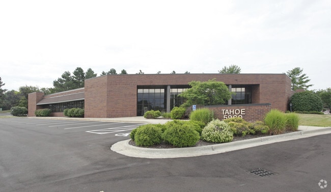
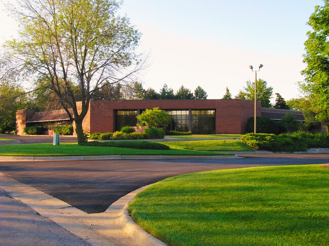
Property Record
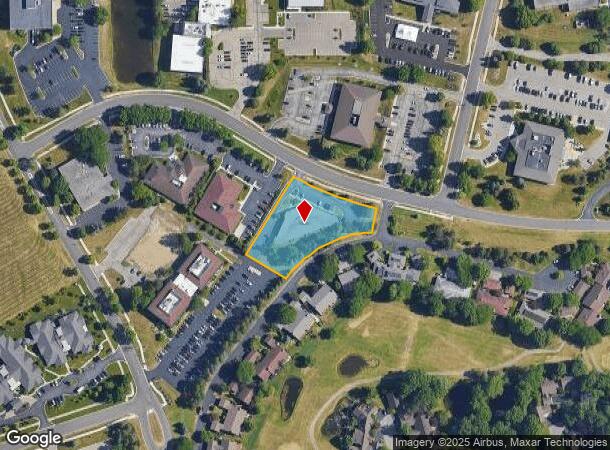
5960 Tahoe Dr Se, Grand Rapids, MI 49546
NEARBY LISTINGS FOR SALE OR LEASE
Property Detail
5960 Tahoe Dr Se
41-19-17-203-003
LOT 7 EX COM AT NW COR THEREOF TH SELY ALONG S LINE OF TAHOE DR /86 FT WIDE/ 200.04 FT TH S 31D 13M 33S W 252.23 FT TO SLY
Commercialnec
Kent
X
Michigan
26081C0442D
7
2024
1.24 AC
2025
SE Grand Rapids/Cascade
012203
West Michigan
11,117 SF
Grand Rapids-Wyoming, MI
DEMOGRAPHICS near 5960 Tahoe Dr Se
1 Mile
3 Mile
5 Mile
2024 Total Population
4,097
29,325
83,846
2029 Population
4,120
29,631
84,679
Pop Growth 2024-2029
+ 0.56%
+ 1.04%
+ 0.99%
Average Age
45
40
40
2024 Total Households
1,801
11,316
32,364
HH Growth 2024-2029
+ 0.50%
+ 1.09%
+ 0.99%
Median Household Inc
$92,061
$93,198
$88,068
Avg Household Size
2.20
2.50
2.40
2024 Avg HH Vehicles
2.00
2.00
2.00
Median Home Value
$321,086
$372,296
$331,393
Median Year Built
1983
1985
1984
Nearby Places
Map Layers
Map Styles
 Street
 Aerial
- Restaurants
- Banks
- Shops
- Fitness
- Groceries
PUBLIC TRANSPORTATION
AIRPORT
Gerald R Ford International
DRIVE
WALK
Distance
Gerald R Ford International
14 min
6.4 mi
SALE & LEASE HISTORY
LISTING DATE
SALE/LEASE

Sep 24, 2016
For Lease
Jul 02, 2019
For Lease
Jan 03, 2022
For Lease
Feb 19, 2019
For Lease
Dec 16, 2019
For Lease
Aug 12, 2022
For Lease
Nearby Properties
Address
Land Use
TOTAL SIZE
Lot Size
Zoning
Address
Land Use
TOTAL SIZE
Lot Size
Zoning
476,572 SF
51.60 AC
R4
Address
Land Use
TOTAL SIZE
Lot Size
Zoning
23.99 AC
PUD
Address
Land Use
TOTAL SIZE
Lot Size
Zoning
22.46 AC
MON-MDR
Address
Land Use
TOTAL SIZE
Lot Size
Zoning
455,880 SF
24.91 AC
I1
Address
Land Use
TOTAL SIZE
Lot Size
Zoning
285,875 SF
37.86 AC
TI
Address
Land Use
TOTAL SIZE
Lot Size
Zoning
400,646 SF
23.78 AC
I1
Address
Land Use
TOTAL SIZE
Lot Size
Zoning
619,165 SF
37 AC
I1
Address
Land Use
TOTAL SIZE
Lot Size
Zoning
51,148 SF
26.38 AC
R-PUD-1
Address
Land Use
TOTAL SIZE
Lot Size
Zoning
184,186 SF
19.24 AC
R4
Address
Land Use
TOTAL SIZE
Lot Size
Zoning
209,417 SF
19.51 AC
C4
Address
Land Use
TOTAL SIZE
Lot Size
Zoning
140,700 SF
15.45 AC
R4
Address
Land Use
TOTAL SIZE
Lot Size
Zoning
18.86 AC
MON-MDR
Address
Land Use
TOTAL SIZE
Lot Size
Zoning
236,061 SF
11.09 AC
PUD
Address
Land Use
TOTAL SIZE
Lot Size
Zoning
529,904 SF
20.04 AC
I1
Address
Land Use
TOTAL SIZE
Lot Size
Zoning
9.94 AC
MON-MDR
Address
Land Use
TOTAL SIZE
Lot Size
Zoning
45,075 SF
20.54 AC
C2
Address
Land Use
TOTAL SIZE
Lot Size
Zoning
362,686 SF
20.99 AC
TI
Address
Land Use
TOTAL SIZE
Lot Size
Zoning
116,672 SF
11.74 AC
C2
Address
Land Use
TOTAL SIZE
Lot Size
Zoning
117,572 SF
14.89 AC
B2
Address
Land Use
TOTAL SIZE
Lot Size
Zoning
169,873 SF
12.33 AC
R4
Address
Land Use
TOTAL SIZE
Lot Size
Zoning
317,875 SF
24.04 AC
I
Address
Land Use
TOTAL SIZE
Lot Size
Zoning
203,434 SF
14.70 AC
R4
Address
Land Use
TOTAL SIZE
Lot Size
Zoning
108,484 SF
7.22 AC
R4
Address
Land Use
TOTAL SIZE
Lot Size
Zoning
57,495 SF
R1
Address
Land Use
TOTAL SIZE
Lot Size
Zoning
Address
Land Use
TOTAL SIZE
Lot Size
Zoning
247,984 SF
21.68 AC
B2
Address
Land Use
TOTAL SIZE
Lot Size
Zoning
104,404 SF
7.04 AC
R4
Address
Land Use
TOTAL SIZE
Lot Size
Zoning
110,706 SF
23.76 AC
C4
Address
Land Use
TOTAL SIZE
Lot Size
Zoning
260,629 SF
14.24 AC
I
Address
Land Use
TOTAL SIZE
Lot Size
Zoning
11,200 SF
9.92 AC
PUD
The World's #1 Commercial Real Estate Marketplace
Connect with us
© 2025 CoStar Group
The information above has been obtained from sources believed reliable. While we do not doubt its accuracy we have not verified it and make no guarantee, warranty or representation about it. It is your responsibility to independently confirm its accuracy and completeness. Any projections, opinions, assumptions, or estimates used are for example only and do not represent the current or future performance of the property. The value of this transaction to you depends on tax and other factors which should be evaluated by your tax, financial, and legal advisors. You and your advisors should conduct a careful, independent investigation of the property to determine to your satisfaction the suitability of the property for your needs.