Property Record
5962 Foothill Rd, Central Point, OR 97502


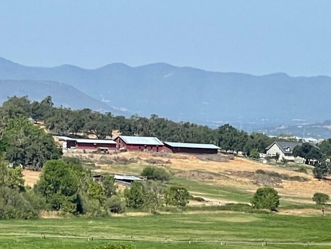
Property Detail
5962 Foothill Rd
Stateproperty
JACKSON
EFU
Oregon
B and X Area of moderate flood hazard, usually the area between the limits of the 100-year and 500-year floods.
198.58 AC
2022
Medford/Grants Pass
2026
Other Market Areas
001002
Medford, OR
3,444 SF
10459942
NEARBY LISTINGS FOR SALE OR LEASE
DEMOGRAPHICS near 5962 Foothill Rd
1 mile
3 mile
5 mile
2025 Total Population
163
13,825
54,601
2030 Population
164
13,707
54,025
Pop Growth 2025-2030
+ 0.61%
(0.85%)
(1.05%)
Average Age
40
38
42
2025 Total Households
53
4,613
20,292
HH Growth 2025-2030
0.00%
(1.02%)
(1.18%)
Median Household Inc
$92,856
$74,452
$83,812
Avg Household Size
2.90
2.90
2.60
2025 Avg HH Vehicles
3.00
2.00
2.00
Median Home Value
$376,315
$340,221
$410,241
Median Year Built
1997
1989
1991
Nearby Places
Map Layers
Map Styles
 Street
 Aerial
Layers
 Traffic
 Biking
Places
Listings with unknown addresses are not visible on the map
- Restaurants
- Banks
- Shops
- Fitness
- Groceries
PUBLIC TRANSPORTATION
AIRPORT
Rogue Valley International - Medford
Drive
Walk
Distance
Rogue Valley International - Medford
15 min
6.6 mi
Freight Ports
Port of Coos Bay, OR
Drive
Walk
Distance
Port of Coos Bay, OR
225 min
169.2 mi
SALE & LEASE HISTORY
LISTING DATE
SALE/LEASE

Jan 25, 2023
For Sale
Nearby Properties
Address
Land Use
TOTAL SIZE
Lot Size
Zoning
Address
Land Use
TOTAL SIZE
Lot Size
Zoning
145.26 AC
GI
Address
Land Use
TOTAL SIZE
Lot Size
Zoning
73.48 AC
GI
Address
Land Use
TOTAL SIZE
Lot Size
Zoning
54,823 SF
15.17 AC
I-L
Address
Land Use
TOTAL SIZE
Lot Size
Zoning
27.82 AC
I-H
Address
Land Use
TOTAL SIZE
Lot Size
Zoning
1,584 SF
2.01 AC
WCUR-30
Address
Land Use
TOTAL SIZE
Lot Size
Zoning
27.49 AC
WCUR-8
Address
Land Use
TOTAL SIZE
Lot Size
Zoning
6,108 SF
7.84 AC
GC
Address
Land Use
TOTAL SIZE
Lot Size
Zoning
39,334 SF
5.54 AC
I-L
Address
Land Use
TOTAL SIZE
Lot Size
Zoning
19.25 AC
I-H
Address
Land Use
TOTAL SIZE
Lot Size
Zoning
82,520 SF
10.05 AC
GC
Address
Land Use
TOTAL SIZE
Lot Size
Zoning
6.22 AC
I-L
Address
Land Use
TOTAL SIZE
Lot Size
Zoning
34,707 SF
3.21 AC
I-L
Address
Land Use
TOTAL SIZE
Lot Size
Zoning
30,965 SF
3.15 AC
I-L
Address
Land Use
TOTAL SIZE
Lot Size
Zoning
15,331 SF
6.79 AC
GC
Address
Land Use
TOTAL SIZE
Lot Size
Zoning
73.49 AC
GI
Address
Land Use
TOTAL SIZE
Lot Size
Zoning
41,526 SF
9.86 AC
C-H
Address
Land Use
TOTAL SIZE
Lot Size
Zoning
56,427 SF
6.40 AC
I-H
Address
Land Use
TOTAL SIZE
Lot Size
Zoning
6 AC
I-L
Address
Land Use
TOTAL SIZE
Lot Size
Zoning
54,368 SF
3.24 AC
MFR-20
Address
Land Use
TOTAL SIZE
Lot Size
Zoning
45,179 SF
1.74 AC
GC
Address
Land Use
TOTAL SIZE
Lot Size
Zoning
5.27 AC
GC
Address
Land Use
TOTAL SIZE
Lot Size
Zoning
7,844 SF
5.12 AC
WCUR-30
Address
Land Use
TOTAL SIZE
Lot Size
Zoning
30,560 SF
4.07 AC
GC
Address
Land Use
TOTAL SIZE
Lot Size
Zoning
100 SF
25.15 AC
WCUR-6
Address
Land Use
TOTAL SIZE
Lot Size
Zoning
47,465 SF
4.90 AC
C-H
Address
Land Use
TOTAL SIZE
Lot Size
Zoning
123,209 SF
5.47 AC
GC
Address
Land Use
TOTAL SIZE
Lot Size
Zoning
43,092 SF
2.34 AC
I-H
Address
Land Use
TOTAL SIZE
Lot Size
Zoning
24,830 SF
3.39 AC
WCUR-8
Address
Land Use
TOTAL SIZE
Lot Size
Zoning
22,076 SF
3.23 AC
I-H
Address
Land Use
TOTAL SIZE
Lot Size
Zoning
17,441 SF
99.56 AC
EFU
The World's #1 Commercial Real Estate Marketplace
Connect with us
© 2026 CoStar Group
The information above has been obtained from sources believed reliable. While we do not doubt its accuracy we have not verified it and make no guarantee, warranty or representation about it. It is your responsibility to independently confirm its accuracy and completeness. Any projections, opinions, assumptions, or estimates used are for example only and do not represent the current or future performance of the property. The value of this transaction to you depends on tax and other factors which should be evaluated by your tax, financial, and legal advisors. You and your advisors should conduct a careful, independent investigation of the property to determine to your satisfaction the suitability of the property for your needs.