Property Record
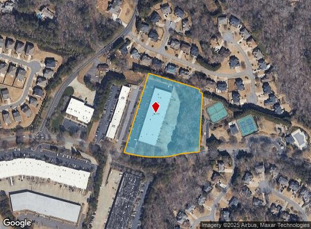
5965 Shiloh Rd E, Alpharetta, GA 30005

NEARBY LISTINGS FOR SALE OR LEASE
Property Detail
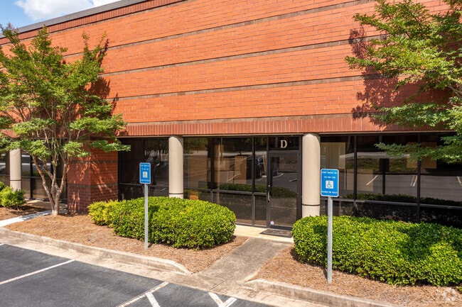
5965 Shiloh Rd E
Atlanta-Sandy Springs-Roswell, GA
Myers Bluegrass Llc
087-168
2-1 815 TRACT 2
Industrialgeneral
Forsyth
X
Georgia
13121C0077F
815
2024
4.29 AC
2025
N Fulton/Forsyth Cnty
130603
Atlanta
38,356 SF
DEMOGRAPHICS near 5965 Shiloh Rd E
1 Mile
3 Mile
5 Mile
2024 Total Population
3,486
56,221
167,028
2029 Population
4,071
64,175
185,685
Pop Growth 2024-2029
+ 16.78%
+ 14.15%
+ 11.17%
Average Age
37
38
38
2024 Total Households
1,166
18,896
55,752
HH Growth 2024-2029
+ 17.07%
+ 14.43%
+ 10.98%
Median Household Inc
$182,700
$140,223
$134,094
Avg Household Size
3.00
2.90
3.00
2024 Avg HH Vehicles
2.00
2.00
2.00
Median Home Value
$498,639
$474,000
$476,963
Median Year Built
2009
2004
2001
Nearby Places
Map Layers
Map Styles
 Street
 Aerial
- Restaurants
- Banks
- Shops
- Fitness
- Groceries
PUBLIC TRANSPORTATION
AIRPORT
Hartsfield - Jackson Atlanta International
DRIVE
WALK
Distance
Hartsfield - Jackson Atlanta International
61 min
41.9 mi
SALE & LEASE HISTORY
LISTING DATE
SALE/LEASE

Sep 24, 2016
For Lease
Mar 06, 2025
For Lease
Mar 06, 2025
For Sale
Dec 19, 2019
For Lease
Nearby Properties
Address
Land Use
TOTAL SIZE
Lot Size
Zoning
Address
Land Use
TOTAL SIZE
Lot Size
Zoning
383,859 SF
9.55 AC
CBD
Address
Land Use
TOTAL SIZE
Lot Size
Zoning
406,800 SF
11.61 AC
MP
Address
Land Use
TOTAL SIZE
Lot Size
Zoning
477,112 SF
20.58 AC
MP
Address
Land Use
TOTAL SIZE
Lot Size
Zoning
475,011 SF
39.64 AC
CBD
Address
Land Use
TOTAL SIZE
Lot Size
Zoning
997,824 SF
32.63 AC
CUP
Address
Land Use
TOTAL SIZE
Lot Size
Zoning
328,265 SF
4 AC
MP
Address
Land Use
TOTAL SIZE
Lot Size
Zoning
281,780 SF
19.08 AC
PUD
Address
Land Use
TOTAL SIZE
Lot Size
Zoning
9.04 AC
CBD
Address
Land Use
TOTAL SIZE
Lot Size
Zoning
10,908 SF
107.57 AC
RES3
Address
Land Use
TOTAL SIZE
Lot Size
Zoning
309,293 SF
16 AC
CBD
Address
Land Use
TOTAL SIZE
Lot Size
Zoning
47,721 SF
12.99 AC
CBD
Address
Land Use
TOTAL SIZE
Lot Size
Zoning
2.12 AC
MP
Address
Land Use
TOTAL SIZE
Lot Size
Zoning
504,893 SF
17.14 AC
CUP
Address
Land Use
TOTAL SIZE
Lot Size
Zoning
119,926 SF
23.23 AC
M1
Address
Land Use
TOTAL SIZE
Lot Size
Zoning
249,386 SF
33.24 AC
RES6
Address
Land Use
TOTAL SIZE
Lot Size
Zoning
4,616 SF
12.30 AC
R3
Address
Land Use
TOTAL SIZE
Lot Size
Zoning
170,400 SF
24.98 AC
M1
Address
Land Use
TOTAL SIZE
Lot Size
Zoning
83,161 SF
277.43 AC
A1
Address
Land Use
TOTAL SIZE
Lot Size
Zoning
222,893 SF
103.13 AC
M1
Address
Land Use
TOTAL SIZE
Lot Size
Zoning
141,728 SF
32.45 AC
M1
Address
Land Use
TOTAL SIZE
Lot Size
Zoning
255,201 SF
19.87 AC
CUP
Address
Land Use
TOTAL SIZE
Lot Size
Zoning
182,039 SF
19.40 AC
CUP
Address
Land Use
TOTAL SIZE
Lot Size
Zoning
232,832 SF
17.74 AC
M1
Address
Land Use
TOTAL SIZE
Lot Size
Zoning
206,400 SF
7.26 AC
CUP
Address
Land Use
TOTAL SIZE
Lot Size
Zoning
167,705 SF
14.46 AC
CUP
Address
Land Use
TOTAL SIZE
Lot Size
Zoning
122,964 SF
7.82 AC
RES6
Address
Land Use
TOTAL SIZE
Lot Size
Zoning
184,680 SF
18.22 AC
M1
Address
Land Use
TOTAL SIZE
Lot Size
Zoning
60,235 SF
11.94 AC
CBD
Address
Land Use
TOTAL SIZE
Lot Size
Zoning
192,316 SF
51.53 AC
A1
Address
Land Use
TOTAL SIZE
Lot Size
Zoning
16.56 AC
MP
The World's #1 Commercial Real Estate Marketplace
Connect with us
© 2025 CoStar Group
The information above has been obtained from sources believed reliable. While we do not doubt its accuracy we have not verified it and make no guarantee, warranty or representation about it. It is your responsibility to independently confirm its accuracy and completeness. Any projections, opinions, assumptions, or estimates used are for example only and do not represent the current or future performance of the property. The value of this transaction to you depends on tax and other factors which should be evaluated by your tax, financial, and legal advisors. You and your advisors should conduct a careful, independent investigation of the property to determine to your satisfaction the suitability of the property for your needs.