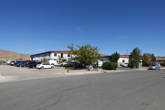
Property Record
5966 Morgan Mill Rd, Carson City, NV 89701


NEARBY LISTINGS FOR SALE OR LEASE
Property Detail
5966 Morgan Mill Rd
Carson City, NV
Parcel C-2 Map #869
008-531-25
PARCEL C-2 MAP #869
Lightindustrial
Carson City
X
Nevada
3200010112F
c-2
2025
0.96 AC
2025
Carson City County
001002
Reno/Sparks
19,050 SF
DEMOGRAPHICS near 5966 Morgan Mill Rd
1 Mile
3 Mile
5 Mile
2024 Total Population
541
17,962
53,262
2029 Population
540
18,069
53,710
Pop Growth 2024-2029
(0.18%)
+ 0.60%
+ 0.84%
Average Age
42
42
43
2024 Total Households
198
7,036
21,669
HH Growth 2024-2029
(0.51%)
+ 0.50%
+ 0.85%
Median Household Inc
$86,250
$69,136
$66,952
Avg Household Size
2.60
2.50
2.30
2024 Avg HH Vehicles
2.00
2.00
2.00
Median Home Value
$355,223
$323,563
$369,629
Median Year Built
1977
1983
1980
Nearby Places
Map Layers
Map Styles
 Street
 Aerial
- Restaurants
- Banks
- Shops
- Fitness
- Groceries
PUBLIC TRANSPORTATION
AIRPORT
Reno/Tahoe International
DRIVE
WALK
Distance
Reno/Tahoe International
55 min
33.9 mi
Freight Ports
Port of Stockton
DRIVE
WALK
Distance
Port of Stockton
224 min
155.6 mi
SALE & LEASE HISTORY
LISTING DATE
SALE/LEASE

Oct 02, 2017
For Sale
Jan 29, 2021
For Lease
Nearby Properties
Address
Land Use
TOTAL SIZE
Lot Size
Zoning
Address
Land Use
TOTAL SIZE
Lot Size
Zoning
356,776 SF
64.42 AC
P
Address
Land Use
TOTAL SIZE
Lot Size
Zoning
7,419 SF
0.71 AC
PR
Address
Land Use
TOTAL SIZE
Lot Size
Zoning
272,519 SF
102.35 AC
P
Address
Land Use
TOTAL SIZE
Lot Size
Zoning
96,057 SF
10 AC
LI
Address
Land Use
TOTAL SIZE
Lot Size
Zoning
240 AC
PR
Address
Land Use
TOTAL SIZE
Lot Size
Zoning
109,200 SF
9.35 AC
GC
Address
Land Use
TOTAL SIZE
Lot Size
Zoning
89,408 SF
39.22 AC
P
Address
Land Use
TOTAL SIZE
Lot Size
Zoning
29.98 AC
PC
Address
Land Use
TOTAL SIZE
Lot Size
Zoning
375 SF
520 AC
PR
Address
Land Use
TOTAL SIZE
Lot Size
Zoning
178.40 AC
PR
Address
Land Use
TOTAL SIZE
Lot Size
Zoning
156,408 SF
2.08 AC
MFA-GC
Address
Land Use
TOTAL SIZE
Lot Size
Zoning
160,769 SF
15 AC
LI
Address
Land Use
TOTAL SIZE
Lot Size
Zoning
86,783 SF
52 AC
PR
Address
Land Use
TOTAL SIZE
Lot Size
Zoning
256.42 AC
Address
Land Use
TOTAL SIZE
Lot Size
Zoning
107,063 SF
10.96 AC
GC
Address
Land Use
TOTAL SIZE
Lot Size
Zoning
70,763 SF
9.54 AC
P
Address
Land Use
TOTAL SIZE
Lot Size
Zoning
85,751 SF
3.41 AC
Address
Land Use
TOTAL SIZE
Lot Size
Zoning
71,719 SF
1.89 AC
MFA
Address
Land Use
TOTAL SIZE
Lot Size
Zoning
30,481 SF
4.94 AC
Address
Land Use
TOTAL SIZE
Lot Size
Zoning
69,316 SF
2.91 AC
Address
Land Use
TOTAL SIZE
Lot Size
Zoning
80,880 SF
4 AC
Address
Land Use
TOTAL SIZE
Lot Size
Zoning
59,130 SF
10.43 AC
P
Address
Land Use
TOTAL SIZE
Lot Size
Zoning
76,770 SF
2.92 AC
MFA
Address
Land Use
TOTAL SIZE
Lot Size
Zoning
30,228 SF
395.78 AC
PR
Address
Land Use
TOTAL SIZE
Lot Size
Zoning
270 AC
PC
Address
Land Use
TOTAL SIZE
Lot Size
Zoning
3,504 SF
39.83 AC
PR
Address
Land Use
TOTAL SIZE
Lot Size
Zoning
30,565 SF
9.99 AC
LI
Address
Land Use
TOTAL SIZE
Lot Size
Zoning
1,197.80 AC
CR
Address
Land Use
TOTAL SIZE
Lot Size
Zoning
99,544 SF
4.08 AC
RC
Address
Land Use
TOTAL SIZE
Lot Size
Zoning
39,411 SF
4.65 AC
LI
The World's #1 Commercial Real Estate Marketplace
Connect with us
© 2025 CoStar Group
The information above has been obtained from sources believed reliable. While we do not doubt its accuracy we have not verified it and make no guarantee, warranty or representation about it. It is your responsibility to independently confirm its accuracy and completeness. Any projections, opinions, assumptions, or estimates used are for example only and do not represent the current or future performance of the property. The value of this transaction to you depends on tax and other factors which should be evaluated by your tax, financial, and legal advisors. You and your advisors should conduct a careful, independent investigation of the property to determine to your satisfaction the suitability of the property for your needs.