Property Record
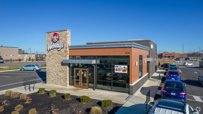
5970 N Hamilton Rd, Westerville, OH 43081


NEARBY LISTINGS FOR SALE OR LEASE
Property Detail
5970 N Hamilton Rd
010-301098
United States Military Lands
Restaurantdrivein
N HAMILTON RD R16 T2 S3 1.036 ACRES
X
Franklin
39049C0181K
Ohio
2024
1.04 AC
2024
Westerville
007101
Columbus
2,674 SF
Columbus, OH
DEMOGRAPHICS near 5970 N Hamilton Rd
1 Mile
3 Mile
5 Mile
2024 Total Population
10,439
69,238
159,916
2029 Population
10,473
69,431
160,572
Pop Growth 2024-2029
+ 0.33%
+ 0.28%
+ 0.41%
Average Age
38
39
39
2024 Total Households
4,876
30,932
65,545
HH Growth 2024-2029
+ 0.18%
+ 0.16%
+ 0.33%
Median Household Inc
$88,263
$93,964
$88,742
Avg Household Size
2.10
2.20
2.40
2024 Avg HH Vehicles
2.00
2.00
2.00
Median Home Value
$310,247
$300,202
$283,717
Median Year Built
2003
2000
1991
Nearby Places
Map Layers
Map Styles
 Street
 Aerial
- Restaurants
- Banks
- Shops
- Fitness
- Groceries
PUBLIC TRANSPORTATION
AIRPORT
John Glenn Columbus International
DRIVE
WALK
Distance
John Glenn Columbus International
17 min
8.9 mi
Rickenbacker International
DRIVE
WALK
Distance
Rickenbacker International
32 min
21.7 mi
Nearby Properties
Address
Land Use
TOTAL SIZE
Lot Size
Zoning
Address
Land Use
TOTAL SIZE
Lot Size
Zoning
696,736 SF
76.73 AC
Address
Land Use
TOTAL SIZE
Lot Size
Zoning
253,127 SF
31.59 AC
Address
Land Use
TOTAL SIZE
Lot Size
Zoning
186,557 SF
35.69 AC
Address
Land Use
TOTAL SIZE
Lot Size
Zoning
316,548 SF
145.20 AC
Address
Land Use
TOTAL SIZE
Lot Size
Zoning
25,298 SF
33.25 AC
Address
Land Use
TOTAL SIZE
Lot Size
Zoning
112,126 SF
19.09 AC
Address
Land Use
TOTAL SIZE
Lot Size
Zoning
67,754 SF
37.90 AC
Address
Land Use
TOTAL SIZE
Lot Size
Zoning
260,944 SF
17.30 AC
Address
Land Use
TOTAL SIZE
Lot Size
Zoning
602,448 SF
24.71 AC
Address
Land Use
TOTAL SIZE
Lot Size
Zoning
45,135 SF
22.02 AC
Address
Land Use
TOTAL SIZE
Lot Size
Zoning
47,003 SF
24.68 AC
Address
Land Use
TOTAL SIZE
Lot Size
Zoning
299,890 SF
74.80 AC
Address
Land Use
TOTAL SIZE
Lot Size
Zoning
132,276 SF
36.17 AC
Address
Land Use
TOTAL SIZE
Lot Size
Zoning
62,660 SF
41.24 AC
Address
Land Use
TOTAL SIZE
Lot Size
Zoning
195,837 SF
31.48 AC
Address
Land Use
TOTAL SIZE
Lot Size
Zoning
80,007 SF
27.54 AC
Address
Land Use
TOTAL SIZE
Lot Size
Zoning
180,968 SF
12.77 AC
Address
Land Use
TOTAL SIZE
Lot Size
Zoning
3,263 SF
989.66 AC
Address
Land Use
TOTAL SIZE
Lot Size
Zoning
204,829 SF
37.69 AC
Address
Land Use
TOTAL SIZE
Lot Size
Zoning
94,416 SF
13.95 AC
Address
Land Use
TOTAL SIZE
Lot Size
Zoning
71,592 SF
32.42 AC
Address
Land Use
TOTAL SIZE
Lot Size
Zoning
74,620 SF
9.03 AC
Address
Land Use
TOTAL SIZE
Lot Size
Zoning
45,849 SF
29.64 AC
Address
Land Use
TOTAL SIZE
Lot Size
Zoning
144,900 SF
11.04 AC
Address
Land Use
TOTAL SIZE
Lot Size
Zoning
100,116 SF
18.80 AC
Address
Land Use
TOTAL SIZE
Lot Size
Zoning
151,892 SF
8.63 AC
Address
Land Use
TOTAL SIZE
Lot Size
Zoning
266,057 SF
26 AC
Address
Land Use
TOTAL SIZE
Lot Size
Zoning
151,935 SF
9 AC
Address
Land Use
TOTAL SIZE
Lot Size
Zoning
17,088 SF
16.31 AC
Address
Land Use
TOTAL SIZE
Lot Size
Zoning
51,376 SF
12.65 AC
The World's #1 Commercial Real Estate Marketplace
Connect with us
© 2025 CoStar Group
The information above has been obtained from sources believed reliable. While we do not doubt its accuracy we have not verified it and make no guarantee, warranty or representation about it. It is your responsibility to independently confirm its accuracy and completeness. Any projections, opinions, assumptions, or estimates used are for example only and do not represent the current or future performance of the property. The value of this transaction to you depends on tax and other factors which should be evaluated by your tax, financial, and legal advisors. You and your advisors should conduct a careful, independent investigation of the property to determine to your satisfaction the suitability of the property for your needs.