Property Record
5982 Mill Rd, Rural El Pomar Estrella, CA 93446

NEARBY LISTINGS FOR SALE OR LEASE
-
-
View all Rural El Pomar Estrella listings for sale on LoopNet.com
Property Detail
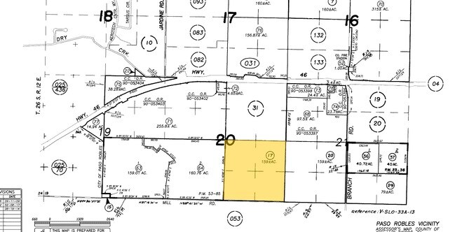
5982 Mill Rd
015-031-017
T26S R13E PTN SEC 20
Agriculturalland
San Luis Obispo
X
California
06079C0425G
159 AC
2024
North 101 Corridor
2025
San Luis Obispo/Paso Robles
010102
San Luis Obispo-Paso Robles-Arroyo Grande, CA
DEMOGRAPHICS near 5982 Mill Rd
1 Mile
3 Mile
5 Mile
2024 Total Population
169
3,110
22,874
2029 Population
166
3,048
22,590
Pop Growth 2024-2029
(1.78%)
(1.99%)
(1.24%)
Average Age
40
42
41
2024 Total Households
54
1,071
8,169
HH Growth 2024-2029
(1.85%)
(2.24%)
(1.44%)
Median Household Inc
$149,999
$129,293
$92,369
Avg Household Size
2.80
2.70
2.70
2024 Avg HH Vehicles
3.00
3.00
2.00
Median Home Value
$592,592
$619,801
$592,371
Median Year Built
1991
1993
1989
Nearby Places
Map Layers
Map Styles
 Street
 Aerial
- Restaurants
- Banks
- Shops
- Fitness
- Groceries
PUBLIC TRANSPORTATION
COMMUTER RAIL
Paso Robles Amtrak Station (Coast Starlight - Amtrak)
DRIVE
WALK
Distance
Paso Robles Amtrak Station (Coast Starlight - Amtrak)
16 min
6.4 mi
AIRPORT
San Luis County Regional
DRIVE
WALK
Distance
San Luis County Regional
59 min
40.5 mi
Freight Ports
The Port of Hueneme
DRIVE
WALK
Distance
The Port of Hueneme
216 min
167.5 mi
Nearby Properties
Address
Land Use
TOTAL SIZE
Lot Size
Zoning
Address
Land Use
TOTAL SIZE
Lot Size
Zoning
160 AC
AG
Address
Land Use
TOTAL SIZE
Lot Size
Zoning
115,054 SF
18.78 AC
PM
Address
Land Use
TOTAL SIZE
Lot Size
Zoning
77,710 SF
44 AC
AG
Address
Land Use
TOTAL SIZE
Lot Size
Zoning
24.74 AC
AG
Address
Land Use
TOTAL SIZE
Lot Size
Zoning
34.76 AC
Address
Land Use
TOTAL SIZE
Lot Size
Zoning
Address
Land Use
TOTAL SIZE
Lot Size
Zoning
14,995 SF
10.74 AC
Address
Land Use
TOTAL SIZE
Lot Size
Zoning
14.75 AC
Address
Land Use
TOTAL SIZE
Lot Size
Zoning
1,386 SF
315 AC
AG
Address
Land Use
TOTAL SIZE
Lot Size
Zoning
Address
Land Use
TOTAL SIZE
Lot Size
Zoning
1,584 SF
255.80 AC
AG
Address
Land Use
TOTAL SIZE
Lot Size
Zoning
6,025 SF
224.27 AC
POS
Address
Land Use
TOTAL SIZE
Lot Size
Zoning
201.46 AC
Address
Land Use
TOTAL SIZE
Lot Size
Zoning
149.62 AC
AG
Address
Land Use
TOTAL SIZE
Lot Size
Zoning
12,639 SF
8.26 AC
C2
Address
Land Use
TOTAL SIZE
Lot Size
Zoning
141 AC
PF
Address
Land Use
TOTAL SIZE
Lot Size
Zoning
1,008 SF
224.50 AC
POS
Address
Land Use
TOTAL SIZE
Lot Size
Zoning
159 AC
AG
Address
Land Use
TOTAL SIZE
Lot Size
Zoning
82.10 AC
AG
Address
Land Use
TOTAL SIZE
Lot Size
Zoning
Address
Land Use
TOTAL SIZE
Lot Size
Zoning
3.73 AC
AP
Address
Land Use
TOTAL SIZE
Lot Size
Zoning
11,840 SF
5 AC
AG
Address
Land Use
TOTAL SIZE
Lot Size
Zoning
137.33 AC
AG
Address
Land Use
TOTAL SIZE
Lot Size
Zoning
16.16 AC
C2
Address
Land Use
TOTAL SIZE
Lot Size
Zoning
149 AC
AG
Address
Land Use
TOTAL SIZE
Lot Size
Zoning
97.50 AC
AG
Address
Land Use
TOTAL SIZE
Lot Size
Zoning
77.90 AC
AG
Address
Land Use
TOTAL SIZE
Lot Size
Zoning
2,224 SF
19.48 AC
AG
Address
Land Use
TOTAL SIZE
Lot Size
Zoning
74.53 AC
AG
The World's #1 Commercial Real Estate Marketplace
Connect with us
© 2025 CoStar Group
The information above has been obtained from sources believed reliable. While we do not doubt its accuracy we have not verified it and make no guarantee, warranty or representation about it. It is your responsibility to independently confirm its accuracy and completeness. Any projections, opinions, assumptions, or estimates used are for example only and do not represent the current or future performance of the property. The value of this transaction to you depends on tax and other factors which should be evaluated by your tax, financial, and legal advisors. You and your advisors should conduct a careful, independent investigation of the property to determine to your satisfaction the suitability of the property for your needs.