Property Record
5983 S Farm Road 181, Springfield, MO 65804

Property Detail
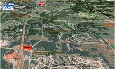
5983 S Farm Road 181
Springfield, MO
4.32A M/L BEG 479.59 FT S SW COR LOT 44 WOODCLIFFE 1ST ADD E 684.28 FT TO W R/WFR 181 SLY TO N R/W EVANS RD W 260.17 FT N 30 FT W 30 FT N 120 FT W 325.93 FT NTO BEG 28/28/21
19-28-102-010
GREENE
Residentialacreage
Missouri
C-1;R-1
44
B and X Area of moderate flood hazard, usually the area between the limits of the 100-year and 500-year floods.
4.32 AC
2025
Southeast
2025
Springfield
003801
NEARBY LISTINGS FOR SALE OR LEASE
DEMOGRAPHICS near 5983 S Farm Road 181
1 mile
3 mile
5 mile
2025 Total Population
1,966
20,453
82,020
2030 Population
2,035
21,178
85,039
Pop Growth 2025-2030
+ 3.51%
+ 3.54%
+ 3.68%
Average Age
46
43
42
2025 Total Households
806
8,440
34,866
HH Growth 2025-2030
+ 3.72%
+ 3.50%
+ 3.56%
Median Household Inc
$148,584
$89,991
$73,823
Avg Household Size
2.40
2.40
2.30
2025 Avg HH Vehicles
2.00
2.00
2.00
Median Home Value
$558,642
$359,677
$315,630
Median Year Built
1996
1994
1991
Nearby Places
Map Layers
Map Styles
 Street
 Aerial
Layers
 Traffic
 Biking
Places
Listings with unknown addresses are not visible on the map
- Restaurants
- Banks
- Shops
- Fitness
- Groceries
PUBLIC TRANSPORTATION
AIRPORT
Springfield-Branson Ntl
Drive
Walk
Distance
Springfield-Branson Ntl
37 min
24.0 mi
Nearby Properties
Address
Land Use
TOTAL SIZE
Lot Size
Zoning
Address
Land Use
TOTAL SIZE
Lot Size
Zoning
2,400 SF
41.33 AC
Address
Land Use
TOTAL SIZE
Lot Size
Zoning
15.46 AC
Address
Land Use
TOTAL SIZE
Lot Size
Zoning
1,632 SF
12 AC
Address
Land Use
TOTAL SIZE
Lot Size
Zoning
15.46 AC
INC.
Address
Land Use
TOTAL SIZE
Lot Size
Zoning
8.08 AC
INC
Address
Land Use
TOTAL SIZE
Lot Size
Zoning
3.43 AC
INC
Address
Land Use
TOTAL SIZE
Lot Size
Zoning
13.11 AC
INC
Address
Land Use
TOTAL SIZE
Lot Size
Zoning
Address
Land Use
TOTAL SIZE
Lot Size
Zoning
114,021 SF
12.83 AC
INC
Address
Land Use
TOTAL SIZE
Lot Size
Zoning
1,836 SF
35.65 AC
Address
Land Use
TOTAL SIZE
Lot Size
Zoning
9,474 SF
8.90 AC
Address
Land Use
TOTAL SIZE
Lot Size
Zoning
3,025 SF
2.20 AC
Address
Land Use
TOTAL SIZE
Lot Size
Zoning
54.39 AC
INC
Address
Land Use
TOTAL SIZE
Lot Size
Zoning
11,421 SF
163.10 AC
Address
Land Use
TOTAL SIZE
Lot Size
Zoning
167.92 AC
PAD
Address
Land Use
TOTAL SIZE
Lot Size
Zoning
14,700 SF
2.42 AC
INC
Address
Land Use
TOTAL SIZE
Lot Size
Zoning
3,910 SF
6.33 AC
Address
Land Use
TOTAL SIZE
Lot Size
Zoning
7,472 SF
4.51 AC
Address
Land Use
TOTAL SIZE
Lot Size
Zoning
5,184 SF
5.30 AC
Address
Land Use
TOTAL SIZE
Lot Size
Zoning
8,933 SF
8.64 AC
Address
Land Use
TOTAL SIZE
Lot Size
Zoning
16.23 AC
INC
Address
Land Use
TOTAL SIZE
Lot Size
Zoning
5,824 SF
6.68 AC
Address
Land Use
TOTAL SIZE
Lot Size
Zoning
32,600 SF
3.70 AC
INC
Address
Land Use
TOTAL SIZE
Lot Size
Zoning
9,285 SF
5.49 AC
Address
Land Use
TOTAL SIZE
Lot Size
Zoning
8.62 AC
A-1;C-2
Address
Land Use
TOTAL SIZE
Lot Size
Zoning
4,545 SF
4.16 AC
Address
Land Use
TOTAL SIZE
Lot Size
Zoning
20,708 SF
31.97 AC
INC
Address
Land Use
TOTAL SIZE
Lot Size
Zoning
89,024 SF
2.59 AC
INC
Address
Land Use
TOTAL SIZE
Lot Size
Zoning
1,860 SF
6.23 AC
Address
Land Use
TOTAL SIZE
Lot Size
Zoning
15,125 SF
1.41 AC
INC
The World's #1 Commercial Real Estate Marketplace
Connect with us
© 2026 CoStar Group
The information above has been obtained from sources believed reliable. While we do not doubt its accuracy we have not verified it and make no guarantee, warranty or representation about it. It is your responsibility to independently confirm its accuracy and completeness. Any projections, opinions, assumptions, or estimates used are for example only and do not represent the current or future performance of the property. The value of this transaction to you depends on tax and other factors which should be evaluated by your tax, financial, and legal advisors. You and your advisors should conduct a careful, independent investigation of the property to determine to your satisfaction the suitability of the property for your needs.