Property Record
599 W Valpico Rd, Tracy, CA 95376


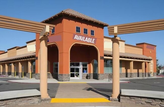

Property Detail
599 W Valpico Rd
246-140-15
02-FM PT OF 11/PT TO 13/14/RD 01154964/PM 22-31
Storemultistory
SAN JOAQUIN
B and X Area of moderate flood hazard, usually the area between the limits of the 100-year and 500-year floods.
California
2025
1.80 AC
2025
Tracy/Manteca
005406
Stockton/Modesto
17,272 SF
Stockton-Lodi, CA
NEARBY LISTINGS FOR SALE OR LEASE
DEMOGRAPHICS near 599 W Valpico Rd
1 mile
3 mile
5 mile
2025 Total Population
15,670
71,068
108,309
2030 Population
16,436
74,221
113,560
Pop Growth 2025-2030
+ 4.89%
+ 4.44%
+ 4.85%
Average Age
39
38
38
2025 Total Households
4,674
21,313
31,860
HH Growth 2025-2030
+ 4.84%
+ 4.47%
+ 4.96%
Median Household Inc
$136,012
$122,962
$122,582
Avg Household Size
3.30
3.30
3.30
2025 Avg HH Vehicles
3.00
3.00
3.00
Median Home Value
$776,298
$734,282
$737,623
Median Year Built
1999
1994
1995
Nearby Places
Map Layers
Map Styles
 Street
 Aerial
Layers
 Traffic
 Biking
Places
Listings with unknown addresses are not visible on the map
- Restaurants
- Banks
- Shops
- Fitness
- Groceries
PUBLIC TRANSPORTATION
COMMUTER RAIL
Drive
Walk
Distance
5 min
2.0 mi
AIRPORT
Stockton Metro
Drive
Walk
Distance
Stockton Metro
30 min
20.2 mi
Freight Ports
Port of Stockton
Drive
Walk
Distance
Port of Stockton
32 min
23.7 mi
SALE & LEASE HISTORY
LISTING DATE
SALE/LEASE

Nov 15, 2023
For Lease
Nov 15, 2023
For Sale
May 25, 2022
For Lease
Nearby Properties
Address
Land Use
TOTAL SIZE
Lot Size
Zoning
Address
Land Use
TOTAL SIZE
Lot Size
Zoning
3,485,402 SF
86.48 AC
Address
Land Use
TOTAL SIZE
Lot Size
Zoning
3.77 AC
Address
Land Use
TOTAL SIZE
Lot Size
Zoning
1,124,201 SF
53.72 AC
Address
Land Use
TOTAL SIZE
Lot Size
Zoning
22,926 SF
11.63 AC
Address
Land Use
TOTAL SIZE
Lot Size
Zoning
749,840 SF
37.96 AC
Address
Land Use
TOTAL SIZE
Lot Size
Zoning
115.53 AC
IG
Address
Land Use
TOTAL SIZE
Lot Size
Zoning
567,870 SF
36.41 AC
M1
Address
Land Use
TOTAL SIZE
Lot Size
Zoning
29,442 SF
6.52 AC
Address
Land Use
TOTAL SIZE
Lot Size
Zoning
827,280 SF
36.18 AC
Address
Land Use
TOTAL SIZE
Lot Size
Zoning
143,280 SF
20 AC
Address
Land Use
TOTAL SIZE
Lot Size
Zoning
382,260 SF
18.70 AC
Address
Land Use
TOTAL SIZE
Lot Size
Zoning
265,868 SF
11.99 AC
Address
Land Use
TOTAL SIZE
Lot Size
Zoning
265,000 SF
10.83 AC
Address
Land Use
TOTAL SIZE
Lot Size
Zoning
225,000 SF
11.13 AC
M
Address
Land Use
TOTAL SIZE
Lot Size
Zoning
258,520 SF
16.74 AC
Address
Land Use
TOTAL SIZE
Lot Size
Zoning
6,000 SF
22.88 AC
IL
Address
Land Use
TOTAL SIZE
Lot Size
Zoning
32.90 AC
Address
Land Use
TOTAL SIZE
Lot Size
Zoning
155,942 SF
11.90 AC
Address
Land Use
TOTAL SIZE
Lot Size
Zoning
65.83 AC
Address
Land Use
TOTAL SIZE
Lot Size
Zoning
95.54 AC
Address
Land Use
TOTAL SIZE
Lot Size
Zoning
398,400 SF
28.40 AC
Address
Land Use
TOTAL SIZE
Lot Size
Zoning
10,202 SF
4.50 AC
Address
Land Use
TOTAL SIZE
Lot Size
Zoning
6,500 SF
86.80 AC
IG
Address
Land Use
TOTAL SIZE
Lot Size
Zoning
158,064 SF
10.01 AC
Address
Land Use
TOTAL SIZE
Lot Size
Zoning
62,246 SF
5.82 AC
NS
Address
Land Use
TOTAL SIZE
Lot Size
Zoning
506,552 SF
22.01 AC
Address
Land Use
TOTAL SIZE
Lot Size
Zoning
204,641 SF
10.97 AC
Address
Land Use
TOTAL SIZE
Lot Size
Zoning
47,064 SF
2.36 AC
GC
The World's #1 Commercial Real Estate Marketplace
Connect with us
© 2026 CoStar Group
The information above has been obtained from sources believed reliable. While we do not doubt its accuracy we have not verified it and make no guarantee, warranty or representation about it. It is your responsibility to independently confirm its accuracy and completeness. Any projections, opinions, assumptions, or estimates used are for example only and do not represent the current or future performance of the property. The value of this transaction to you depends on tax and other factors which should be evaluated by your tax, financial, and legal advisors. You and your advisors should conduct a careful, independent investigation of the property to determine to your satisfaction the suitability of the property for your needs.