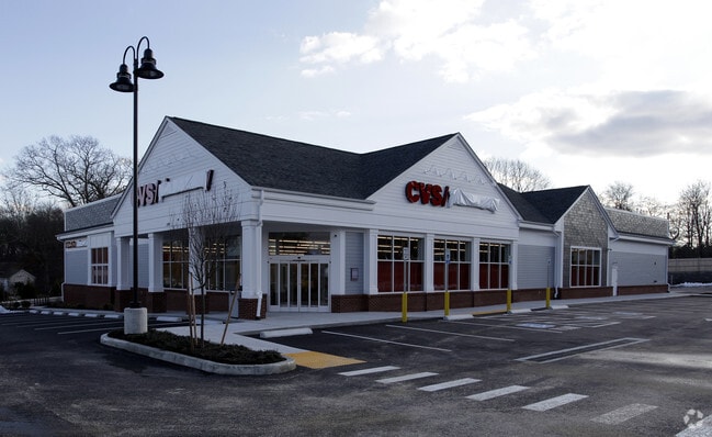
Property Record
599 State Rd, Westport, MA 02790

Property Detail
599 State Rd
WPOR-000007-000000-000345-000348
Bristol
Storebuilding
Massachusetts
HISTOR
345-348
B and X Area of moderate flood hazard, usually the area between the limits of the 100-year and 500-year floods.
1.86 AC
2025
Attleboro/New Bedford
2025
Boston
646101
Providence-Warwick, RI-MA
14,033 SF
NEARBY LISTINGS FOR SALE OR LEASE
DEMOGRAPHICS near 599 State Rd
1 mile
3 mile
5 mile
2025 Total Population
1,965
16,768
94,586
2030 Population
1,985
17,025
95,945
Pop Growth 2025-2030
+ 1.02%
+ 1.53%
+ 1.44%
Average Age
45
44
41
2025 Total Households
798
6,870
40,168
HH Growth 2025-2030
+ 1.13%
+ 1.47%
+ 1.52%
Median Household Inc
$92,594
$83,601
$61,663
Avg Household Size
2.40
2.40
2.30
2025 Avg HH Vehicles
2.00
2.00
2.00
Median Home Value
$452,160
$470,490
$433,006
Median Year Built
1964
1970
1952
Nearby Places
Map Layers
Map Styles
 Street
 Aerial
Layers
 Traffic
 Biking
Places
Listings with unknown addresses are not visible on the map
- Restaurants
- Banks
- Shops
- Fitness
- Groceries
PUBLIC TRANSPORTATION
AIRPORT
Rhode Island Tf Green International
Drive
Walk
Distance
Rhode Island Tf Green International
44 min
29.0 mi
Freight Ports
Port of New Bedford Harbor
Drive
Walk
Distance
Port of New Bedford Harbor
17 min
11.3 mi
Nearby Properties
Address
Land Use
TOTAL SIZE
Lot Size
Zoning
Address
Land Use
TOTAL SIZE
Lot Size
Zoning
36.70 AC
E1
Address
Land Use
TOTAL SIZE
Lot Size
Zoning
174,416 SF
29.20 AC
CEMETA
Address
Land Use
TOTAL SIZE
Lot Size
Zoning
11.17 AC
MBD
Address
Land Use
TOTAL SIZE
Lot Size
Zoning
84,256 SF
1.18 AC
B
Address
Land Use
TOTAL SIZE
Lot Size
Zoning
57,084 SF
1.70 AC
R1
Address
Land Use
TOTAL SIZE
Lot Size
Zoning
56,772 SF
2.65 AC
R1
Address
Land Use
TOTAL SIZE
Lot Size
Zoning
60,358 SF
3.83 AC
MBD
Address
Land Use
TOTAL SIZE
Lot Size
Zoning
29,100 SF
1.21 AC
N/A
Address
Land Use
TOTAL SIZE
Lot Size
Zoning
164,219 SF
8.50 AC
IND
Address
Land Use
TOTAL SIZE
Lot Size
Zoning
51,709 SF
2.32 AC
GB
Address
Land Use
TOTAL SIZE
Lot Size
Zoning
52,190 SF
2.60 AC
Address
Land Use
TOTAL SIZE
Lot Size
Zoning
Address
Land Use
TOTAL SIZE
Lot Size
Zoning
21.38 AC
LI
Address
Land Use
TOTAL SIZE
Lot Size
Zoning
4.93 AC
IND
Address
Land Use
TOTAL SIZE
Lot Size
Zoning
40,985 SF
15.17 AC
R60
Address
Land Use
TOTAL SIZE
Lot Size
Zoning
49,662 SF
1.44 AC
MBD
Address
Land Use
TOTAL SIZE
Lot Size
Zoning
31,444 SF
13 AC
E1
Address
Land Use
TOTAL SIZE
Lot Size
Zoning
55,908 SF
13.72 AC
LI
Address
Land Use
TOTAL SIZE
Lot Size
Zoning
35,343 SF
3.40 AC
R1
Address
Land Use
TOTAL SIZE
Lot Size
Zoning
34,830 SF
3.10 AC
R1
Address
Land Use
TOTAL SIZE
Lot Size
Zoning
53,708 SF
2.19 AC
GB
Address
Land Use
TOTAL SIZE
Lot Size
Zoning
11,976 SF
2.34 AC
R1
Address
Land Use
TOTAL SIZE
Lot Size
Zoning
63,300 SF
6 AC
LI
Address
Land Use
TOTAL SIZE
Lot Size
Zoning
6.49 AC
LI
Address
Land Use
TOTAL SIZE
Lot Size
Zoning
20.20 AC
R1
Address
Land Use
TOTAL SIZE
Lot Size
Zoning
8,565 SF
5.30 AC
R1
Address
Land Use
TOTAL SIZE
Lot Size
Zoning
7 AC
E1
Address
Land Use
TOTAL SIZE
Lot Size
Zoning
33,400 SF
3.37 AC
R1
Address
Land Use
TOTAL SIZE
Lot Size
Zoning
279.33 AC
R-80
The World's #1 Commercial Real Estate Marketplace
Connect with us
© 2026 CoStar Group
The information above has been obtained from sources believed reliable. While we do not doubt its accuracy we have not verified it and make no guarantee, warranty or representation about it. It is your responsibility to independently confirm its accuracy and completeness. Any projections, opinions, assumptions, or estimates used are for example only and do not represent the current or future performance of the property. The value of this transaction to you depends on tax and other factors which should be evaluated by your tax, financial, and legal advisors. You and your advisors should conduct a careful, independent investigation of the property to determine to your satisfaction the suitability of the property for your needs.