Property Record
599 W Mount Pleasant Ave, Livingston, NJ 07039


Current Lease Availabilities
NEARBY LISTINGS FOR SALE OR LEASE
Property Detail
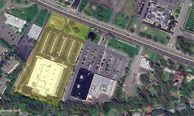
599 W Mount Pleasant Ave
Newark, NJ-PA
5.8 AC.
10-06001-0000-00012
Essex
Storemultistory
New Jersey
X
12
34013C0086G
5.80 AC
2023
Suburban Essex/Rt 280
2025
Northern New Jersey
020800
DEMOGRAPHICS near 599 W Mount Pleasant Ave
1 Mile
3 Mile
5 Mile
2024 Total Population
4,942
50,634
156,066
2029 Population
4,938
50,400
155,438
Pop Growth 2024-2029
(0.08%)
(0.46%)
(0.40%)
Average Age
45
43
42
2024 Total Households
1,793
17,686
54,424
HH Growth 2024-2029
(0.17%)
(0.67%)
(0.55%)
Median Household Inc
$150,106
$155,585
$156,750
Avg Household Size
2.70
2.80
2.70
2024 Avg HH Vehicles
2.00
2.00
2.00
Median Home Value
$734,477
$714,071
$725,859
Median Year Built
1989
1968
1965
Nearby Places
Map Layers
Map Styles
 Street
 Aerial
- Restaurants
- Banks
- Shops
- Fitness
- Groceries
PUBLIC TRANSPORTATION
COMMUTER RAIL
Chatham (Morris & Essex Morristown Line - NJ Transit Commuter Rail (NJ Transit))
DRIVE
WALK
Distance
Chatham (Morris & Essex Morristown Line - NJ Transit Commuter Rail (NJ Transit))
13 min
6.0 mi
Short Hills (Morris & Essex Gladstone Branch - NJ Transit Commuter Rail (NJ Transit), Morris & Essex Morristown Line - NJ Transit Commuter Rail (NJ Transit))
DRIVE
WALK
Distance
Short Hills (Morris & Essex Gladstone Branch - NJ Transit Commuter Rail (NJ Transit), Morris & Essex Morristown Line - NJ Transit Commuter Rail (NJ Transit))
16 min
6.6 mi
AIRPORT
Newark Liberty International
DRIVE
WALK
Distance
Newark Liberty International
30 min
19.0 mi
LaGuardia
DRIVE
WALK
Distance
LaGuardia
57 min
39.5 mi
John F Kennedy International
DRIVE
WALK
Distance
John F Kennedy International
68 min
42.7 mi
Freight Ports
Maher Terminal
DRIVE
WALK
Distance
Maher Terminal
34 min
19.5 mi
Nearby Properties
Address
Land Use
TOTAL SIZE
Lot Size
Zoning
Address
Land Use
TOTAL SIZE
Lot Size
Zoning
701 SF
111.59 AC
SED
Address
Land Use
TOTAL SIZE
Lot Size
Zoning
37.70 AC
R-6
Address
Land Use
TOTAL SIZE
Lot Size
Zoning
42.64 AC
D-S
Address
Land Use
TOTAL SIZE
Lot Size
Zoning
9.80 AC
Address
Land Use
TOTAL SIZE
Lot Size
Zoning
31.03 AC
R-L
Address
Land Use
TOTAL SIZE
Lot Size
Zoning
41.19 AC
MF-C
Address
Land Use
TOTAL SIZE
Lot Size
Zoning
59,369 SF
86.79 AC
R-44
Address
Land Use
TOTAL SIZE
Lot Size
Zoning
18.98 AC
R-5B
Address
Land Use
TOTAL SIZE
Lot Size
Zoning
19.70 AC
R-4
Address
Land Use
TOTAL SIZE
Lot Size
Zoning
13 AC
RM
Address
Land Use
TOTAL SIZE
Lot Size
Zoning
147,871 SF
26.50 AC
PB-3
Address
Land Use
TOTAL SIZE
Lot Size
Zoning
17.26 AC
R-L
Address
Land Use
TOTAL SIZE
Lot Size
Zoning
20.97 AC
R-2
Address
Land Use
TOTAL SIZE
Lot Size
Zoning
60 AC
R-L
Address
Land Use
TOTAL SIZE
Lot Size
Zoning
51.24 AC
OB-2
Address
Land Use
TOTAL SIZE
Lot Size
Zoning
55.22 AC
R-2
Address
Land Use
TOTAL SIZE
Lot Size
Zoning
58.20 AC
I
Address
Land Use
TOTAL SIZE
Lot Size
Zoning
336,832 SF
46.12 AC
R-L
Address
Land Use
TOTAL SIZE
Lot Size
Zoning
35.55 AC
P-B2
Address
Land Use
TOTAL SIZE
Lot Size
Zoning
19.70 AC
R-3
Address
Land Use
TOTAL SIZE
Lot Size
Zoning
15.50 AC
R-1
Address
Land Use
TOTAL SIZE
Lot Size
Zoning
49.53 AC
P
Address
Land Use
TOTAL SIZE
Lot Size
Zoning
25.40 AC
I-3
Address
Land Use
TOTAL SIZE
Lot Size
Zoning
5.35 AC
MF-6
Address
Land Use
TOTAL SIZE
Lot Size
Zoning
Address
Land Use
TOTAL SIZE
Lot Size
Zoning
24.60 AC
R-L
Address
Land Use
TOTAL SIZE
Lot Size
Zoning
1,443 SF
165.75 AC
I-R2
Address
Land Use
TOTAL SIZE
Lot Size
Zoning
1,889 SF
3.26 AC
R-1
Address
Land Use
TOTAL SIZE
Lot Size
Zoning
26,162 SF
72.70 AC
OSM
Address
Land Use
TOTAL SIZE
Lot Size
Zoning
21.31 AC
R-6
The World's #1 Commercial Real Estate Marketplace
Connect with us
© 2026 CoStar Group
The information above has been obtained from sources believed reliable. While we do not doubt its accuracy we have not verified it and make no guarantee, warranty or representation about it. It is your responsibility to independently confirm its accuracy and completeness. Any projections, opinions, assumptions, or estimates used are for example only and do not represent the current or future performance of the property. The value of this transaction to you depends on tax and other factors which should be evaluated by your tax, financial, and legal advisors. You and your advisors should conduct a careful, independent investigation of the property to determine to your satisfaction the suitability of the property for your needs.