Property Record
5Th Ave E, Springfield, TN 37172
NEARBY LISTINGS FOR SALE OR LEASE
-
-
View all Springfield listings for sale on LoopNet.com
Property Detail
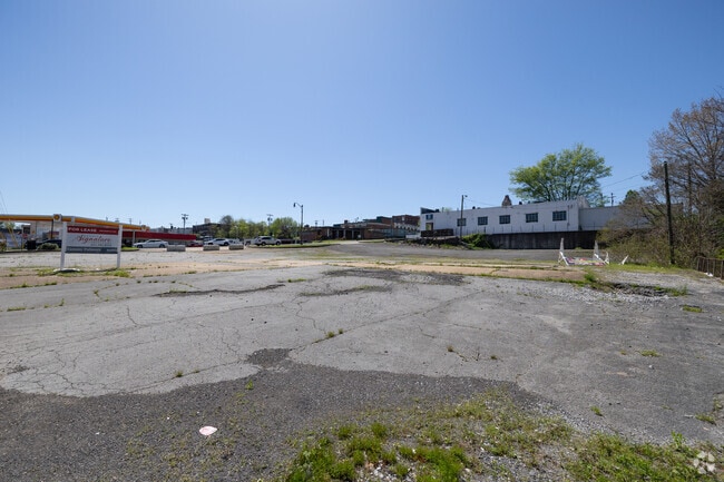
5Th Ave E
080G-E-020.00
81L J 081E 020.00 000
Commercialnec
Robertson
X
Tennessee
47147C0219C
0.22 AC
0
Robertson County
2025
Nashville
080401
Nashville-Davidson--Murfreesboro--Franklin, TN
DEMOGRAPHICS near 5Th Ave E
1 Mile
3 Mile
5 Mile
2024 Total Population
7,250
21,605
28,570
2029 Population
8,631
25,747
33,991
Pop Growth 2024-2029
+ 19.05%
+ 19.17%
+ 18.97%
Average Age
37
38
39
2024 Total Households
2,708
8,000
10,596
HH Growth 2024-2029
+ 20.01%
+ 20.03%
+ 19.78%
Median Household Inc
$41,428
$50,050
$54,188
Avg Household Size
2.50
2.60
2.60
2024 Avg HH Vehicles
2.00
2.00
2.00
Median Home Value
$196,867
$217,017
$246,164
Median Year Built
1972
1987
1990
Nearby Places
Map Layers
Map Styles
 Street
 Aerial
- Restaurants
- Banks
- Shops
- Fitness
- Groceries
PUBLIC TRANSPORTATION
AIRPORT
Nashville International
DRIVE
WALK
Distance
Nashville International
44 min
32.9 mi
Freight Ports
Port of Mobile
DRIVE
WALK
Distance
Port of Mobile
517 min
470.5 mi
Nearby Properties
Address
Land Use
TOTAL SIZE
Lot Size
Zoning
Address
Land Use
TOTAL SIZE
Lot Size
Zoning
424,134 SF
54.60 AC
Address
Land Use
TOTAL SIZE
Lot Size
Zoning
101,373 SF
11.41 AC
Address
Land Use
TOTAL SIZE
Lot Size
Zoning
146,808 SF
10.90 AC
Address
Land Use
TOTAL SIZE
Lot Size
Zoning
184,590 SF
34.99 AC
Address
Land Use
TOTAL SIZE
Lot Size
Zoning
37,137 SF
1.79 AC
Address
Land Use
TOTAL SIZE
Lot Size
Zoning
205,851 SF
21.02 AC
Address
Land Use
TOTAL SIZE
Lot Size
Zoning
9,355 SF
15.48 AC
Address
Land Use
TOTAL SIZE
Lot Size
Zoning
3,600 SF
18.60 AC
Address
Land Use
TOTAL SIZE
Lot Size
Zoning
33,644 SF
7.50 AC
Address
Land Use
TOTAL SIZE
Lot Size
Zoning
13,792 SF
5.59 AC
Address
Land Use
TOTAL SIZE
Lot Size
Zoning
133,056 SF
15.81 AC
Address
Land Use
TOTAL SIZE
Lot Size
Zoning
276,812 SF
23.21 AC
Address
Land Use
TOTAL SIZE
Lot Size
Zoning
72,742 SF
7.50 AC
Address
Land Use
TOTAL SIZE
Lot Size
Zoning
20,431 SF
4 AC
Address
Land Use
TOTAL SIZE
Lot Size
Zoning
90,750 SF
7.41 AC
Address
Land Use
TOTAL SIZE
Lot Size
Zoning
19,988 SF
10.44 AC
Address
Land Use
TOTAL SIZE
Lot Size
Zoning
97,331 SF
6.92 AC
Address
Land Use
TOTAL SIZE
Lot Size
Zoning
146,162 SF
15.41 AC
Address
Land Use
TOTAL SIZE
Lot Size
Zoning
36,737 SF
8.55 AC
Address
Land Use
TOTAL SIZE
Lot Size
Zoning
4,924 SF
11.38 AC
Address
Land Use
TOTAL SIZE
Lot Size
Zoning
16,248 SF
8 AC
Address
Land Use
TOTAL SIZE
Lot Size
Zoning
34,830 SF
5 AC
Address
Land Use
TOTAL SIZE
Lot Size
Zoning
71,012 SF
4.28 AC
Address
Land Use
TOTAL SIZE
Lot Size
Zoning
120,715 SF
6.24 AC
Address
Land Use
TOTAL SIZE
Lot Size
Zoning
29,955 SF
2.44 AC
Address
Land Use
TOTAL SIZE
Lot Size
Zoning
14,186 SF
2.06 AC
Address
Land Use
TOTAL SIZE
Lot Size
Zoning
23,082 SF
7.84 AC
Address
Land Use
TOTAL SIZE
Lot Size
Zoning
30,688 SF
3.69 AC
Address
Land Use
TOTAL SIZE
Lot Size
Zoning
101,566 SF
8.73 AC
Address
Land Use
TOTAL SIZE
Lot Size
Zoning
9,359 SF
4.80 AC
The World's #1 Commercial Real Estate Marketplace
Connect with us
© 2026 CoStar Group
The information above has been obtained from sources believed reliable. While we do not doubt its accuracy we have not verified it and make no guarantee, warranty or representation about it. It is your responsibility to independently confirm its accuracy and completeness. Any projections, opinions, assumptions, or estimates used are for example only and do not represent the current or future performance of the property. The value of this transaction to you depends on tax and other factors which should be evaluated by your tax, financial, and legal advisors. You and your advisors should conduct a careful, independent investigation of the property to determine to your satisfaction the suitability of the property for your needs.