Property Record
5Th St, , AL
Save to a Folder
{{folder.Name}}
{{folder.ListingIds.length}} Properties
{{folder.ListingIds.length}} Property
Create a New Folder
Property Detail
5Th St
31-04-18-2-002-003.001
BEG 401 S OF AND 195 E OF NW COR S18 T21S R10W; N 455; SELY 347.6; SW 60; SE 222.4; W 309.2 TO POB
Vacantlandnec
TUSCALOOSA
C-6
Alabama
B and X Area of moderate flood hazard, usually the area between the limits of the 100-year and 500-year floods.
1.95 AC
2025
Tuscaloosa
2025
Birmingham
0103023123
Tuscaloosa, AL
NEARBY LISTINGS FOR SALE OR LEASE
DEMOGRAPHICS near 5Th St
1 mile
3 mile
5 mile
2025 Total Population
2,449
14,298
59,727
2030 Population
2,480
14,472
60,779
Pop Growth 2025-2030
+ 1.27%
+ 1.22%
+ 1.76%
Average Age
40
42
38
2025 Total Households
938
5,320
23,459
HH Growth 2025-2030
+ 1.81%
+ 0.66%
+ 1.64%
Median Household Inc
$61,956
$71,394
$54,828
Avg Household Size
2.50
2.40
2.20
2025 Avg HH Vehicles
2.00
2.00
2.00
Median Home Value
$233,580
$244,669
$240,992
Median Year Built
1991
1989
1985
Nearby Places
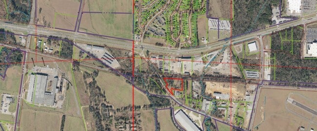
Map Layers
Map Styles
 Street
 Aerial
Layers
 Traffic
 Biking
Places
Listings with unknown addresses are not visible on the map
- Restaurants
- Banks
- Shops
- Fitness
- Groceries
PUBLIC TRANSPORTATION
COMMUTER RAIL
Drive
Walk
Distance
11 min
6.1 mi
SALE & LEASE HISTORY
LISTING DATE
SALE/LEASE

Sep 11, 2020
For Sale
May 20, 2020
For Sale
Jun 16, 2025
For Sale
Nearby Properties
Address
Land Use
TOTAL SIZE
Lot Size
Zoning
Address
Land Use
TOTAL SIZE
Lot Size
Zoning
174,000 SF
28.67 AC
R1
Address
Land Use
TOTAL SIZE
Lot Size
Zoning
361,935 SF
133.67 AC
MH
Address
Land Use
TOTAL SIZE
Lot Size
Zoning
301,560 SF
15 AC
ML
Address
Land Use
TOTAL SIZE
Lot Size
Zoning
10,440 SF
12 AC
Address
Land Use
TOTAL SIZE
Lot Size
Zoning
143,038 SF
36 AC
O-I
Address
Land Use
TOTAL SIZE
Lot Size
Zoning
50,652 SF
19.03 AC
ML
Address
Land Use
TOTAL SIZE
Lot Size
Zoning
211,838 SF
11.71 AC
ML
Address
Land Use
TOTAL SIZE
Lot Size
Zoning
213,549 SF
11.57 AC
ML
Address
Land Use
TOTAL SIZE
Lot Size
Zoning
176,846 SF
21.27 AC
ML
Address
Land Use
TOTAL SIZE
Lot Size
Zoning
213,276 SF
25 AC
C-6
Address
Land Use
TOTAL SIZE
Lot Size
Zoning
16,920 SF
6.84 AC
AG
Address
Land Use
TOTAL SIZE
Lot Size
Zoning
108,000 SF
11.87 AC
Address
Land Use
TOTAL SIZE
Lot Size
Zoning
140,412 SF
14.35 AC
C6
Address
Land Use
TOTAL SIZE
Lot Size
Zoning
89,820 SF
5.33 AC
MH
Address
Land Use
TOTAL SIZE
Lot Size
Zoning
8,952 SF
5 AC
RM2
Address
Land Use
TOTAL SIZE
Lot Size
Zoning
7,208 SF
6.10 AC
RM2
Address
Land Use
TOTAL SIZE
Lot Size
Zoning
11,244 SF
5.60 AC
RM2
Address
Land Use
TOTAL SIZE
Lot Size
Zoning
17,304 SF
7.20 AC
C6
Address
Land Use
TOTAL SIZE
Lot Size
Zoning
36,144 SF
22.50 AC
Address
Land Use
TOTAL SIZE
Lot Size
Zoning
97,250 SF
4.79 AC
ML
Address
Land Use
TOTAL SIZE
Lot Size
Zoning
2,400 SF
11 AC
ML
Address
Land Use
TOTAL SIZE
Lot Size
Zoning
70,416 SF
3.13 AC
O-I
Address
Land Use
TOTAL SIZE
Lot Size
Zoning
60,068 SF
7.95 AC
C6
Address
Land Use
TOTAL SIZE
Lot Size
Zoning
7,376 SF
10.50 AC
ML
Address
Land Use
TOTAL SIZE
Lot Size
Zoning
8,152 SF
18 AC
ML
Address
Land Use
TOTAL SIZE
Lot Size
Zoning
1,019 SF
12 AC
MHP
Address
Land Use
TOTAL SIZE
Lot Size
Zoning
1,800 SF
142 AC
I
Address
Land Use
TOTAL SIZE
Lot Size
Zoning
14,400 SF
5.20 AC
RS-1
Address
Land Use
TOTAL SIZE
Lot Size
Zoning
437 SF
117 AC
I
Address
Land Use
TOTAL SIZE
Lot Size
Zoning
50,951 SF
3.03 AC
O-I
The World's #1 Commercial Real Estate Marketplace
Connect with us
© 2026 CoStar Group
The information above has been obtained from sources believed reliable. While we do not doubt its accuracy we have not verified it and make no guarantee, warranty or representation about it. It is your responsibility to independently confirm its accuracy and completeness. Any projections, opinions, assumptions, or estimates used are for example only and do not represent the current or future performance of the property. The value of this transaction to you depends on tax and other factors which should be evaluated by your tax, financial, and legal advisors. You and your advisors should conduct a careful, independent investigation of the property to determine to your satisfaction the suitability of the property for your needs.