Property Record
5Th St Se, Moultrie, GA 31768
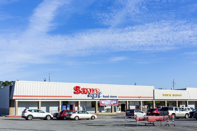
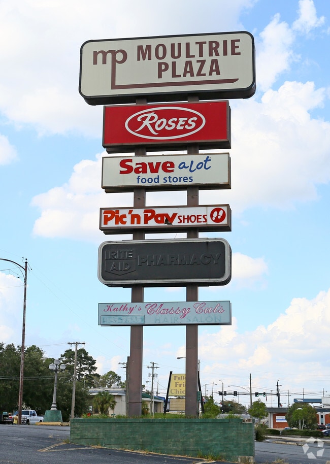
Property Detail
5Th St Se
Moultrie, GA
PART LOT 6 BLOCK 56 (ROSES SHO CNTR)
M035-009
COLQUITT
Stripcommercialcenter
Georgia
B and X Area of moderate flood hazard, usually the area between the limits of the 100-year and 500-year floods.
6
2025
9.95 AC
2025
Albany/Southwest
970301
Other Market Areas
83,415 SF
NEARBY LISTINGS FOR SALE OR LEASE
-
-
-
-
No Photo
-
View all Moultrie listings for sale on LoopNet.com
DEMOGRAPHICS near 5Th St Se
1 mile
3 mile
5 mile
2025 Total Population
5,723
18,825
26,952
2030 Population
5,996
19,399
27,777
Pop Growth 2025-2030
+ 4.77%
+ 3.05%
+ 3.06%
Average Age
39
39
39
2025 Total Households
2,216
7,230
10,215
HH Growth 2025-2030
+ 4.78%
+ 3.02%
+ 3.07%
Median Household Inc
$31,395
$41,521
$44,947
Avg Household Size
2.50
2.50
2.50
2025 Avg HH Vehicles
1.00
2.00
2.00
Median Home Value
$92,098
$144,123
$162,522
Median Year Built
1967
1974
1979
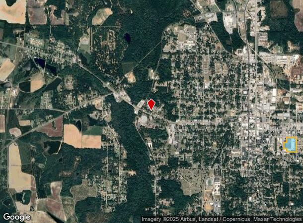
Nearby Places
Map Layers
Map Styles
 Street
 Aerial
Transit
 Traffic
 Biking
Places
Listings with unknown addresses are not visible on the map
- Restaurants
- Banks
- Shops
- Fitness
- Groceries
SALE & LEASE HISTORY
LISTING DATE
SALE/LEASE

Oct 30, 2024
For Sale
Jul 13, 2017
For Lease
Feb 27, 2019
For Sale
Nearby Properties
Address
Land Use
TOTAL SIZE
Lot Size
Zoning
Address
Land Use
TOTAL SIZE
Lot Size
Zoning
38,268 SF
2.07 AC
Address
Land Use
TOTAL SIZE
Lot Size
Zoning
73.72 AC
Address
Land Use
TOTAL SIZE
Lot Size
Zoning
24.25 AC
Address
Land Use
TOTAL SIZE
Lot Size
Zoning
21,678 SF
5.75 AC
Address
Land Use
TOTAL SIZE
Lot Size
Zoning
112.93 AC
COMMERCIAL
Address
Land Use
TOTAL SIZE
Lot Size
Zoning
21,866 SF
1.44 AC
Address
Land Use
TOTAL SIZE
Lot Size
Zoning
15.56 AC
Address
Land Use
TOTAL SIZE
Lot Size
Zoning
2,606 SF
15 AC
Address
Land Use
TOTAL SIZE
Lot Size
Zoning
17,574 SF
1.59 AC
Address
Land Use
TOTAL SIZE
Lot Size
Zoning
149,407 SF
15.29 AC
Address
Land Use
TOTAL SIZE
Lot Size
Zoning
111,860 SF
13.50 AC
002
Address
Land Use
TOTAL SIZE
Lot Size
Zoning
105,612 SF
13.19 AC
002
Address
Land Use
TOTAL SIZE
Lot Size
Zoning
18,096 SF
12.13 AC
Address
Land Use
TOTAL SIZE
Lot Size
Zoning
61,200 SF
9.50 AC
Address
Land Use
TOTAL SIZE
Lot Size
Zoning
90,694 SF
19.17 AC
Address
Land Use
TOTAL SIZE
Lot Size
Zoning
48,965 SF
5.24 AC
Address
Land Use
TOTAL SIZE
Lot Size
Zoning
27,217 SF
20.32 AC
Address
Land Use
TOTAL SIZE
Lot Size
Zoning
9,916 SF
6.24 AC
002
Address
Land Use
TOTAL SIZE
Lot Size
Zoning
21,574 SF
1.11 AC
Address
Land Use
TOTAL SIZE
Lot Size
Zoning
64,840 SF
9 AC
Address
Land Use
TOTAL SIZE
Lot Size
Zoning
2,614 SF
8.30 AC
Address
Land Use
TOTAL SIZE
Lot Size
Zoning
41,170 SF
1.63 AC
Address
Land Use
TOTAL SIZE
Lot Size
Zoning
36,782 SF
300.68 AC
Address
Land Use
TOTAL SIZE
Lot Size
Zoning
38,848 SF
0.52 AC
Address
Land Use
TOTAL SIZE
Lot Size
Zoning
36,355 SF
7.08 AC
Address
Land Use
TOTAL SIZE
Lot Size
Zoning
9,396 SF
10.05 AC
Address
Land Use
TOTAL SIZE
Lot Size
Zoning
7,404 SF
3.66 AC
Address
Land Use
TOTAL SIZE
Lot Size
Zoning
16.27 AC
Address
Land Use
TOTAL SIZE
Lot Size
Zoning
13,638 SF
3.29 AC
Address
Land Use
TOTAL SIZE
Lot Size
Zoning
68,600 SF
11.95 AC
The World's #1 Commercial Real Estate Marketplace
Connect with us
© 2026 CoStar Group
The information above has been obtained from sources believed reliable. While we do not doubt its accuracy we have not verified it and make no guarantee, warranty or representation about it. It is your responsibility to independently confirm its accuracy and completeness. Any projections, opinions, assumptions, or estimates used are for example only and do not represent the current or future performance of the property. The value of this transaction to you depends on tax and other factors which should be evaluated by your tax, financial, and legal advisors. You and your advisors should conduct a careful, independent investigation of the property to determine to your satisfaction the suitability of the property for your needs.