Property Record
6 Brook Rd, Westhampton Beach, NY 11978
NEARBY LISTINGS FOR SALE OR LEASE
-
-
View all Westhampton Beach listings for sale on LoopNet.com
Property Detail
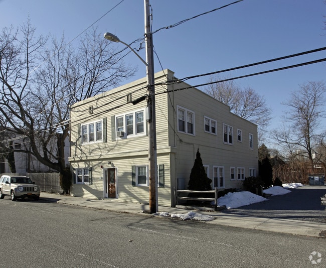
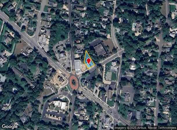
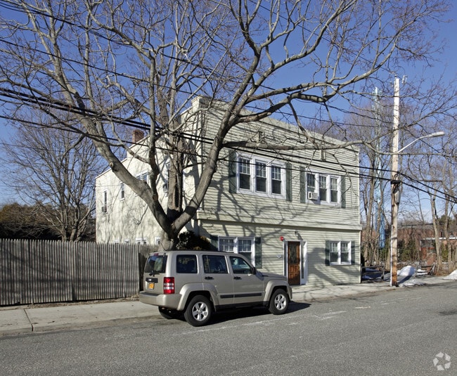
6 Brook Rd
Nassau County-Suffolk County, NY
Redfield & Humphrey
0905-008-00-03-00-040-000
1987 LD EQ + 22001988 EQ 0
Apartment
Suffolk
X
New York
36103C0759H
40
2024
0.23 AC
2024
Outlying Eastern Suffolk
190502
Long Island (New York)
3,672 SF
DEMOGRAPHICS near 6 Brook Rd
1 Mile
3 Mile
5 Mile
2024 Total Population
5,162
14,121
23,266
2029 Population
5,540
14,870
24,082
Pop Growth 2024-2029
+ 7.32%
+ 5.30%
+ 3.51%
Average Age
44
45
44
2024 Total Households
2,015
5,414
8,816
HH Growth 2024-2029
+ 7.49%
+ 5.58%
+ 3.60%
Median Household Inc
$122,115
$118,380
$117,957
Avg Household Size
2.50
2.50
2.60
2024 Avg HH Vehicles
2.00
2.00
2.00
Median Home Value
$890,663
$855,159
$817,471
Median Year Built
1977
1980
1979
Nearby Places
- Restaurants
- Banks
- Shops
- Fitness
- Groceries
PUBLIC TRANSPORTATION
COMMUTER RAIL
Westhampton Station (Montauk Branch - Long Island Rail Road)
DRIVE
WALK
Distance
Westhampton Station (Montauk Branch - Long Island Rail Road)
4 min
1.6 mi
Speonk Station (Montauk Branch - Long Island Rail Road)
DRIVE
WALK
Distance
Speonk Station (Montauk Branch - Long Island Rail Road)
7 min
4.0 mi
AIRPORT
Long Island MacArthur
DRIVE
WALK
Distance
Long Island MacArthur
42 min
27.0 mi
Freight Ports
Port of New Haven
DRIVE
WALK
Distance
Port of New Haven
158 min
67.5 mi
Nearby Properties
Address
Land Use
TOTAL SIZE
Lot Size
Zoning
Address
Land Use
TOTAL SIZE
Lot Size
Zoning
1,229.10 AC
LI200
Address
Land Use
TOTAL SIZE
Lot Size
Zoning
53,067 SF
6.20 AC
R2
Address
Land Use
TOTAL SIZE
Lot Size
Zoning
55,202 SF
18.50 AC
R2
Address
Land Use
TOTAL SIZE
Lot Size
Zoning
68,676 SF
9.70 AC
CR200
Address
Land Use
TOTAL SIZE
Lot Size
Zoning
11.41 AC
LI200
Address
Land Use
TOTAL SIZE
Lot Size
Zoning
18.28 AC
CR200
Address
Land Use
TOTAL SIZE
Lot Size
Zoning
8.26 AC
LI200
Address
Land Use
TOTAL SIZE
Lot Size
Zoning
15,084 SF
10.25 AC
R40
Address
Land Use
TOTAL SIZE
Lot Size
Zoning
31,393 SF
4.90 AC
R3
Address
Land Use
TOTAL SIZE
Lot Size
Zoning
26,824 SF
146.40 AC
CR200
Address
Land Use
TOTAL SIZE
Lot Size
Zoning
9,191 SF
14.39 AC
VILLA
Address
Land Use
TOTAL SIZE
Lot Size
Zoning
28,458 SF
9.60 AC
LI40
Address
Land Use
TOTAL SIZE
Lot Size
Zoning
28.62 AC
R40
Address
Land Use
TOTAL SIZE
Lot Size
Zoning
17,772 SF
8.86 AC
VILLA
Address
Land Use
TOTAL SIZE
Lot Size
Zoning
22,629 SF
2.10 AC
VILLA
Address
Land Use
TOTAL SIZE
Lot Size
Zoning
19.50 AC
PC
Address
Land Use
TOTAL SIZE
Lot Size
Zoning
20,697 SF
1.91 AC
B1
Address
Land Use
TOTAL SIZE
Lot Size
Zoning
36,918 SF
6.27 AC
R40
Address
Land Use
TOTAL SIZE
Lot Size
Zoning
13.90 AC
PC
Address
Land Use
TOTAL SIZE
Lot Size
Zoning
7,270 SF
4.20 AC
R2
Address
Land Use
TOTAL SIZE
Lot Size
Zoning
6,673 SF
4.50 AC
R20
Address
Land Use
TOTAL SIZE
Lot Size
Zoning
28,544 SF
4.70 AC
R1
Address
Land Use
TOTAL SIZE
Lot Size
Zoning
16,854 SF
11.95 AC
OD
Address
Land Use
TOTAL SIZE
Lot Size
Zoning
6,720 SF
1.96 AC
VILLA
Address
Land Use
TOTAL SIZE
Lot Size
Zoning
20,822 SF
2.60 AC
B1
Address
Land Use
TOTAL SIZE
Lot Size
Zoning
6.42 AC
LI200
Address
Land Use
TOTAL SIZE
Lot Size
Zoning
1,792 SF
59.30 AC
RTPDD
Address
Land Use
TOTAL SIZE
Lot Size
Zoning
2,427 SF
3.80 AC
R3
Address
Land Use
TOTAL SIZE
Lot Size
Zoning
10.64 AC
PC
Address
Land Use
TOTAL SIZE
Lot Size
Zoning
8,851 SF
2.97 AC
R1
The World's #1 Commercial Real Estate Marketplace
Connect with us
© 2025 CoStar Group
The information above has been obtained from sources believed reliable. While we do not doubt its accuracy we have not verified it and make no guarantee, warranty or representation about it. It is your responsibility to independently confirm its accuracy and completeness. Any projections, opinions, assumptions, or estimates used are for example only and do not represent the current or future performance of the property. The value of this transaction to you depends on tax and other factors which should be evaluated by your tax, financial, and legal advisors. You and your advisors should conduct a careful, independent investigation of the property to determine to your satisfaction the suitability of the property for your needs.