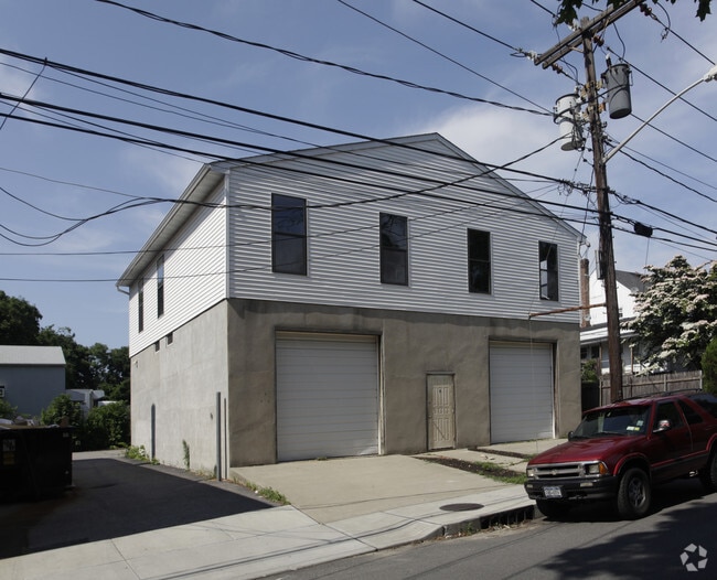
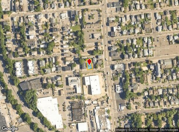
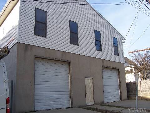
Property Record
6 Carney St, Glen Cove, NY 11542
NEARBY LISTINGS FOR SALE OR LEASE
Property Detail
6 Carney St
0600-21-079-00-0211-0
TOWN #4 SCH DIST 005
Warehouse
Nassau
X
New York
36059C0126G
211
2025
0.12 AC
2025
Northern Nassau
517202
Long Island (New York)
4,800 SF
Nassau County-Suffolk County, NY
DEMOGRAPHICS near 6 Carney St
1 Mile
3 Mile
5 Mile
2024 Total Population
16,191
53,708
122,750
2029 Population
15,982
52,999
121,215
Pop Growth 2024-2029
(1.29%)
(1.32%)
(1.25%)
Average Age
42
43
43
2024 Total Households
6,045
19,159
42,885
HH Growth 2024-2029
(1.19%)
(1.35%)
(1.30%)
Median Household Inc
$69,302
$106,238
$130,553
Avg Household Size
2.60
2.70
2.80
2024 Avg HH Vehicles
2.00
2.00
2.00
Median Home Value
$676,973
$780,956
$865,901
Median Year Built
1958
1957
1957
Nearby Places
- Restaurants
- Banks
- Shops
- Fitness
- Groceries
PUBLIC TRANSPORTATION
COMMUTER RAIL
Glen Street Station (Oyster Bay Branch - Long Island Rail Road)
DRIVE
WALK
Distance
Glen Street Station (Oyster Bay Branch - Long Island Rail Road)
1 min
7 min
0.4 mi
Sea Cliff Station (Oyster Bay Branch - Long Island Rail Road)
DRIVE
WALK
Distance
Sea Cliff Station (Oyster Bay Branch - Long Island Rail Road)
1 min
10 min
0.5 mi
AIRPORT
LaGuardia
DRIVE
WALK
Distance
LaGuardia
32 min
20.7 mi
John F Kennedy International
DRIVE
WALK
Distance
John F Kennedy International
34 min
23.5 mi
Westchester County
DRIVE
WALK
Distance
Westchester County
61 min
39.6 mi
Freight Ports
NY - Red Hook Container Terminal
DRIVE
WALK
Distance
NY - Red Hook Container Terminal
43 min
28.8 mi
Nearby Properties
Address
Land Use
TOTAL SIZE
Lot Size
Zoning
Address
Land Use
TOTAL SIZE
Lot Size
Zoning
600 SF
2.68 AC
Address
Land Use
TOTAL SIZE
Lot Size
Zoning
5,039 SF
92.07 AC
Address
Land Use
TOTAL SIZE
Lot Size
Zoning
95.70 AC
Address
Land Use
TOTAL SIZE
Lot Size
Zoning
20,000 SF
58.45 AC
Address
Land Use
TOTAL SIZE
Lot Size
Zoning
8,564 SF
38.71 AC
Address
Land Use
TOTAL SIZE
Lot Size
Zoning
83,566 SF
38.12 AC
Address
Land Use
TOTAL SIZE
Lot Size
Zoning
121,473 SF
10.34 AC
Address
Land Use
TOTAL SIZE
Lot Size
Zoning
232,700 SF
42.75 AC
Address
Land Use
TOTAL SIZE
Lot Size
Zoning
26,200 SF
186 AC
Address
Land Use
TOTAL SIZE
Lot Size
Zoning
164,742 SF
3.54 AC
Address
Land Use
TOTAL SIZE
Lot Size
Zoning
387,645 SF
7.21 AC
Address
Land Use
TOTAL SIZE
Lot Size
Zoning
237,994 SF
3.98 AC
Address
Land Use
TOTAL SIZE
Lot Size
Zoning
98,439 SF
8.94 AC
Address
Land Use
TOTAL SIZE
Lot Size
Zoning
409,120 SF
20.85 AC
Address
Land Use
TOTAL SIZE
Lot Size
Zoning
23,321 SF
43.95 AC
Address
Land Use
TOTAL SIZE
Lot Size
Zoning
195,812 SF
2.30 AC
Address
Land Use
TOTAL SIZE
Lot Size
Zoning
161,595 SF
29.91 AC
Address
Land Use
TOTAL SIZE
Lot Size
Zoning
267,367 SF
23.05 AC
Address
Land Use
TOTAL SIZE
Lot Size
Zoning
80,013 SF
51.03 AC
Address
Land Use
TOTAL SIZE
Lot Size
Zoning
18,626 SF
21.37 AC
Address
Land Use
TOTAL SIZE
Lot Size
Zoning
8,034 SF
15.75 AC
Address
Land Use
TOTAL SIZE
Lot Size
Zoning
2,103 SF
20.11 AC
Address
Land Use
TOTAL SIZE
Lot Size
Zoning
18.03 AC
Address
Land Use
TOTAL SIZE
Lot Size
Zoning
858 SF
73.93 AC
Address
Land Use
TOTAL SIZE
Lot Size
Zoning
487,862 SF
21.75 AC
Address
Land Use
TOTAL SIZE
Lot Size
Zoning
20.61 AC
Address
Land Use
TOTAL SIZE
Lot Size
Zoning
11,813 SF
20.87 AC
Address
Land Use
TOTAL SIZE
Lot Size
Zoning
1,500 SF
24.12 AC
Address
Land Use
TOTAL SIZE
Lot Size
Zoning
4,000 SF
49.55 AC
Address
Land Use
TOTAL SIZE
Lot Size
Zoning
10,142 SF
21.45 AC
The World's #1 Commercial Real Estate Marketplace
Connect with us
© 2025 CoStar Group
The information above has been obtained from sources believed reliable. While we do not doubt its accuracy we have not verified it and make no guarantee, warranty or representation about it. It is your responsibility to independently confirm its accuracy and completeness. Any projections, opinions, assumptions, or estimates used are for example only and do not represent the current or future performance of the property. The value of this transaction to you depends on tax and other factors which should be evaluated by your tax, financial, and legal advisors. You and your advisors should conduct a careful, independent investigation of the property to determine to your satisfaction the suitability of the property for your needs.