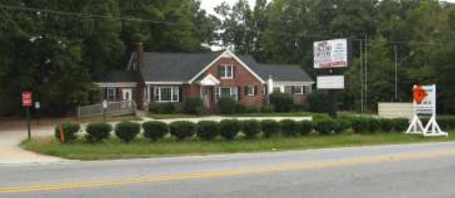
Property Record
6 E Lee Rd, Taylors, SC 29687

NEARBY LISTINGS FOR SALE OR LEASE
Property Detail
6 E Lee Rd
Greenville-Anderson-Greer, SC
Survey For W M Edwards Sr
P015.06-01-044.00
PT 50
Commercialofficeresidentialmixeduse
Greenville
X
South Carolina
45045C0339E
044.00
2025
1.90 AC
2024
Wade Hampton
001803
Greenville/Spartanburg
2,447 SF
DEMOGRAPHICS near 6 E Lee Rd
1 mile
3 mile
5 mile
2024 Total Population
6,655
64,595
151,129
2029 Population
7,264
70,590
166,347
Pop Growth 2024-2029
+ 9.15%
+ 9.28%
+ 10.07%
Average Age
40
39
39
2024 Total Households
2,731
26,548
63,397
HH Growth 2024-2029
+ 9.26%
+ 9.39%
+ 10.25%
Median Household Inc
$59,488
$65,709
$67,665
Avg Household Size
2.40
2.30
2.30
2024 Avg HH Vehicles
2.00
2.00
2.00
Median Home Value
$191,159
$251,384
$271,547
Median Year Built
1967
1978
1984
Nearby Places
Map Layers
Map Styles
 Street
 Aerial
Transit
 Traffic
 Biking
Places
Listings with unknown addresses are not visible on the map
- Restaurants
- Banks
- Shops
- Fitness
- Groceries
PUBLIC TRANSPORTATION
COMMUTER RAIL
Drive
Walk
Distance
12 min
5.8 mi
AIRPORT
Greenville Spartanburg International
Drive
Walk
Distance
Greenville Spartanburg International
17 min
8.4 mi
Nearby Properties
Address
Land Use
TOTAL SIZE
Lot Size
Zoning
Address
Land Use
TOTAL SIZE
Lot Size
Zoning
14.41 AC
RM2
Address
Land Use
TOTAL SIZE
Lot Size
Zoning
11.82 AC
RM2
Address
Land Use
TOTAL SIZE
Lot Size
Zoning
8.94 AC
RM2
Address
Land Use
TOTAL SIZE
Lot Size
Zoning
9.13 AC
RM2
Address
Land Use
TOTAL SIZE
Lot Size
Zoning
10 AC
RM
Address
Land Use
TOTAL SIZE
Lot Size
Zoning
10.59 AC
RM2
Address
Land Use
TOTAL SIZE
Lot Size
Zoning
5.61 AC
RM2
Address
Land Use
TOTAL SIZE
Lot Size
Zoning
4.95 AC
C1
Address
Land Use
TOTAL SIZE
Lot Size
Zoning
97.93 AC
OD
Address
Land Use
TOTAL SIZE
Lot Size
Zoning
4.18 AC
C2
Address
Land Use
TOTAL SIZE
Lot Size
Zoning
3,247 SF
15.64 AC
R6
Address
Land Use
TOTAL SIZE
Lot Size
Zoning
61.73 AC
OD
Address
Land Use
TOTAL SIZE
Lot Size
Zoning
8.98 AC
C1
Address
Land Use
TOTAL SIZE
Lot Size
Zoning
8.95 AC
OD
Address
Land Use
TOTAL SIZE
Lot Size
Zoning
26.30 AC
R20
Address
Land Use
TOTAL SIZE
Lot Size
Zoning
24.30 AC
PD
Address
Land Use
TOTAL SIZE
Lot Size
Zoning
85.24 AC
C2,R12
Address
Land Use
TOTAL SIZE
Lot Size
Zoning
41.90 AC
RMA
Address
Land Use
TOTAL SIZE
Lot Size
Zoning
19.31 AC
R6
Address
Land Use
TOTAL SIZE
Lot Size
Zoning
1,766 SF
55.88 AC
R12
Address
Land Use
TOTAL SIZE
Lot Size
Zoning
3.40 AC
C2
Address
Land Use
TOTAL SIZE
Lot Size
Zoning
58.81 AC
R15
Address
Land Use
TOTAL SIZE
Lot Size
Zoning
0.92 AC
C2
Address
Land Use
TOTAL SIZE
Lot Size
Zoning
15.83 AC
RM
Address
Land Use
TOTAL SIZE
Lot Size
Zoning
3.50 AC
C2
Address
Land Use
TOTAL SIZE
Lot Size
Zoning
1.20 AC
I1
Address
Land Use
TOTAL SIZE
Lot Size
Zoning
3.70 AC
C2
Address
Land Use
TOTAL SIZE
Lot Size
Zoning
16.40 AC
PDC
Address
Land Use
TOTAL SIZE
Lot Size
Zoning
1.19 AC
C3
Address
Land Use
TOTAL SIZE
Lot Size
Zoning
8.10 AC
I1
The World's #1 Commercial Real Estate Marketplace
Connect with us
© 2026 CoStar Group
The information above has been obtained from sources believed reliable. While we do not doubt its accuracy we have not verified it and make no guarantee, warranty or representation about it. It is your responsibility to independently confirm its accuracy and completeness. Any projections, opinions, assumptions, or estimates used are for example only and do not represent the current or future performance of the property. The value of this transaction to you depends on tax and other factors which should be evaluated by your tax, financial, and legal advisors. You and your advisors should conduct a careful, independent investigation of the property to determine to your satisfaction the suitability of the property for your needs.