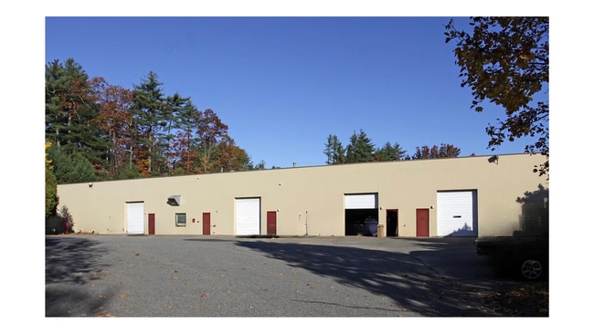
Property Record
6 Ledgerock Way, Acton, MA 01720

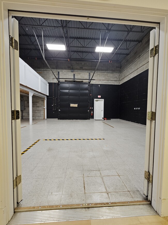
Current Lease Availabilities
Property Detail
6 Ledgerock Way
Industrialgeneral
Middlesex
NAV
Massachusetts
B and X Area of moderate flood hazard, usually the area between the limits of the 100-year and 500-year floods.
2.15 AC
2025
Concord/Maynard
2025
Boston
363106
Boston-Cambridge-Newton, MA-NH
20,144 SF
ACTO-000005C-000058
NEARBY LISTINGS FOR SALE OR LEASE
DEMOGRAPHICS near 6 Ledgerock Way
1 mile
3 mile
5 mile
2025 Total Population
5,859
22,176
63,849
2030 Population
6,185
23,269
66,678
Pop Growth 2025-2030
+ 5.56%
+ 4.93%
+ 4.43%
Average Age
42
42
43
2025 Total Households
2,331
8,164
23,562
HH Growth 2025-2030
+ 5.71%
+ 5.06%
+ 4.60%
Median Household Inc
$123,866
$161,708
$178,413
Avg Household Size
2.50
2.60
2.60
2025 Avg HH Vehicles
2.00
2.00
2.00
Median Home Value
$740,000
$833,489
$813,859
Median Year Built
1990
1982
1977
Nearby Places
Map Layers
Map Styles
 Street
 Aerial
Transit
 Traffic
 Biking
Places
Listings with unknown addresses are not visible on the map
- Restaurants
- Banks
- Shops
- Fitness
- Groceries
PUBLIC TRANSPORTATION
COMMUTER RAIL
West Concord (Fitchburg/South Acton Line - Massachusetts Bay Transportation Authority Commuter Rail (Purple Line))
Drive
Walk
Distance
West Concord (Fitchburg/South Acton Line - Massachusetts Bay Transportation Authority Commuter Rail (Purple Line))
10 min
4.8 mi
South Acton (Fitchburg/South Acton Line - Massachusetts Bay Transportation Authority Commuter Rail (Purple Line))
Drive
Walk
Distance
South Acton (Fitchburg/South Acton Line - Massachusetts Bay Transportation Authority Commuter Rail (Purple Line))
11 min
4.9 mi
AIRPORT
General Edward Lawrence Logan International
Drive
Walk
Distance
General Edward Lawrence Logan International
45 min
28.0 mi
Manchester Boston Regional
Drive
Walk
Distance
Manchester Boston Regional
57 min
35.3 mi
Worcester Regional
Drive
Walk
Distance
Worcester Regional
56 min
38.6 mi
Freight Ports
Port of Boston
Drive
Walk
Distance
Port of Boston
45 min
28.1 mi
Nearby Properties
Address
Land Use
TOTAL SIZE
Lot Size
Zoning
Address
Land Use
TOTAL SIZE
Lot Size
Zoning
2,080 SF
289.85 AC
AA
Address
Land Use
TOTAL SIZE
Lot Size
Zoning
310,328 SF
22.24 AC
IH
Address
Land Use
TOTAL SIZE
Lot Size
Zoning
8.39 AC
OP1
Address
Land Use
TOTAL SIZE
Lot Size
Zoning
7.32 AC
R
Address
Land Use
TOTAL SIZE
Lot Size
Zoning
14.47 AC
R108
Address
Land Use
TOTAL SIZE
Lot Size
Zoning
9.96 AC
OP1
Address
Land Use
TOTAL SIZE
Lot Size
Zoning
10.34 AC
LB
Address
Land Use
TOTAL SIZE
Lot Size
Zoning
79,254 SF
18.14 AC
RA
Address
Land Use
TOTAL SIZE
Lot Size
Zoning
75,917 SF
28.56 AC
AA
Address
Land Use
TOTAL SIZE
Lot Size
Zoning
396,023 SF
23.53 AC
OP1
Address
Land Use
TOTAL SIZE
Lot Size
Zoning
39,250 SF
0.39 AC
R2
Address
Land Use
TOTAL SIZE
Lot Size
Zoning
38,552 SF
5.34 AC
LB
Address
Land Use
TOTAL SIZE
Lot Size
Zoning
78,564 SF
3.43 AC
LB
Address
Land Use
TOTAL SIZE
Lot Size
Zoning
119,000 SF
11.19 AC
OP1
Address
Land Use
TOTAL SIZE
Lot Size
Zoning
56,036 SF
17.13 AC
R2
Address
Land Use
TOTAL SIZE
Lot Size
Zoning
78,722 SF
7.54 AC
LB
Address
Land Use
TOTAL SIZE
Lot Size
Zoning
3.85 AC
RA
Address
Land Use
TOTAL SIZE
Lot Size
Zoning
60,850 SF
31.75 AC
R
Address
Land Use
TOTAL SIZE
Lot Size
Zoning
66,515 SF
23.98 AC
SM
Address
Land Use
TOTAL SIZE
Lot Size
Zoning
4.49 AC
SM
Address
Land Use
TOTAL SIZE
Lot Size
Zoning
93,828 SF
6.54 AC
OP1
Address
Land Use
TOTAL SIZE
Lot Size
Zoning
20,778 SF
4.85 AC
R2
Address
Land Use
TOTAL SIZE
Lot Size
Zoning
7.16 AC
LB
Address
Land Use
TOTAL SIZE
Lot Size
Zoning
37.22 AC
AA
Address
Land Use
TOTAL SIZE
Lot Size
Zoning
3.80 AC
RA
Address
Land Use
TOTAL SIZE
Lot Size
Zoning
31,259 SF
4.50 AC
R
Address
Land Use
TOTAL SIZE
Lot Size
Zoning
24,153 SF
2.43 AC
R2
Address
Land Use
TOTAL SIZE
Lot Size
Zoning
6.44 AC
LB
Address
Land Use
TOTAL SIZE
Lot Size
Zoning
2.58 AC
RA
Address
Land Use
TOTAL SIZE
Lot Size
Zoning
3.15 AC
RA
The World's #1 Commercial Real Estate Marketplace
Connect with us
© 2026 CoStar Group
The information above has been obtained from sources believed reliable. While we do not doubt its accuracy we have not verified it and make no guarantee, warranty or representation about it. It is your responsibility to independently confirm its accuracy and completeness. Any projections, opinions, assumptions, or estimates used are for example only and do not represent the current or future performance of the property. The value of this transaction to you depends on tax and other factors which should be evaluated by your tax, financial, and legal advisors. You and your advisors should conduct a careful, independent investigation of the property to determine to your satisfaction the suitability of the property for your needs.