Property Record
6 Lenel Rd, Landing, NJ 07850

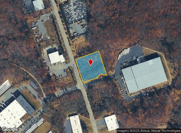

Property Detail
6 Lenel Rd
Newark, NJ
MORRIS
36-09502-0000-00005
New Jersey
Vacantlandnec
5
I-1
1.43 AC
2024
Western Morris
2025
Northern New Jersey
045402
NEARBY LISTINGS FOR SALE OR LEASE
DEMOGRAPHICS near 6 Lenel Rd
1 mile
3 mile
5 mile
2025 Total Population
3,700
42,988
93,715
2030 Population
3,853
44,131
95,983
Pop Growth 2025-2030
+ 4.14%
+ 2.66%
+ 2.42%
Average Age
41
43
42
2025 Total Households
1,370
17,260
36,006
HH Growth 2025-2030
+ 4.23%
+ 2.67%
+ 2.40%
Median Household Inc
$92,745
$112,886
$118,966
Avg Household Size
2.60
2.40
2.50
2025 Avg HH Vehicles
2.00
2.00
2.00
Median Home Value
$471,657
$398,385
$419,414
Median Year Built
1978
1972
1971
Nearby Places
Map Layers
Map Styles
 Street
 Aerial
Layers
 Traffic
 Biking
Places
Listings with unknown addresses are not visible on the map
- Restaurants
- Banks
- Shops
- Fitness
- Groceries
PUBLIC TRANSPORTATION
COMMUTER RAIL
Netcong (Montclair-Boonton Line - NJ Transit Commuter Rail (NJ Transit), Morris & Essex Morristown Line - NJ Transit Commuter Rail (NJ Transit))
Drive
Walk
Distance
Netcong (Montclair-Boonton Line - NJ Transit Commuter Rail (NJ Transit), Morris & Essex Morristown Line - NJ Transit Commuter Rail (NJ Transit))
6 min
2.2 mi
Lake Hopatcong (Montclair-Boonton Line - NJ Transit Commuter Rail (NJ Transit), Morris & Essex Morristown Line - NJ Transit Commuter Rail (NJ Transit))
Drive
Walk
Distance
Lake Hopatcong (Montclair-Boonton Line - NJ Transit Commuter Rail (NJ Transit), Morris & Essex Morristown Line - NJ Transit Commuter Rail (NJ Transit))
8 min
2.8 mi
AIRPORT
Newark Liberty International
Drive
Walk
Distance
Newark Liberty International
42 min
40.1 mi
SALE & LEASE HISTORY
LISTING DATE
SALE/LEASE

Sep 24, 2016
For Sale
May 03, 2021
For Sale
Jan 19, 2019
For Sale
Nearby Properties
Address
Land Use
TOTAL SIZE
Lot Size
Zoning
Address
Land Use
TOTAL SIZE
Lot Size
Zoning
114.47 AC
C-1
Address
Land Use
TOTAL SIZE
Lot Size
Zoning
Address
Land Use
TOTAL SIZE
Lot Size
Zoning
25.63 AC
B-3
Address
Land Use
TOTAL SIZE
Lot Size
Zoning
56.90 AC
Address
Land Use
TOTAL SIZE
Lot Size
Zoning
23.74 AC
B-3
Address
Land Use
TOTAL SIZE
Lot Size
Zoning
280,960 SF
46.25 AC
R-4
Address
Land Use
TOTAL SIZE
Lot Size
Zoning
276,378 SF
40.50 AC
OSGU
Address
Land Use
TOTAL SIZE
Lot Size
Zoning
44.67 AC
R2
Address
Land Use
TOTAL SIZE
Lot Size
Zoning
72.81 AC
LIOR
Address
Land Use
TOTAL SIZE
Lot Size
Zoning
412,816 SF
40.48 AC
FTZ2
Address
Land Use
TOTAL SIZE
Lot Size
Zoning
8.19 AC
B-3
Address
Land Use
TOTAL SIZE
Lot Size
Zoning
440.89 AC
POLI
Address
Land Use
TOTAL SIZE
Lot Size
Zoning
6.74 AC
TC
Address
Land Use
TOTAL SIZE
Lot Size
Zoning
48.48 AC
MLR
Address
Land Use
TOTAL SIZE
Lot Size
Zoning
5.19 AC
FTZ3
Address
Land Use
TOTAL SIZE
Lot Size
Zoning
136,928 SF
15.72 AC
C-LI
Address
Land Use
TOTAL SIZE
Lot Size
Zoning
126,875 SF
7.02 AC
Address
Land Use
TOTAL SIZE
Lot Size
Zoning
55.26 AC
PUD
Address
Land Use
TOTAL SIZE
Lot Size
Zoning
11.13 AC
FTZ1
Address
Land Use
TOTAL SIZE
Lot Size
Zoning
249,480 SF
5.66 AC
FTZ1
Address
Land Use
TOTAL SIZE
Lot Size
Zoning
79,962 SF
27.80 AC
GU
Address
Land Use
TOTAL SIZE
Lot Size
Zoning
13.63 AC
FTZ4
Address
Land Use
TOTAL SIZE
Lot Size
Zoning
102,512 SF
17 AC
C-LI
Address
Land Use
TOTAL SIZE
Lot Size
Zoning
185,975 SF
18.20 AC
FTZ2
Address
Land Use
TOTAL SIZE
Lot Size
Zoning
142,168 SF
14.84 AC
C-LI
Address
Land Use
TOTAL SIZE
Lot Size
Zoning
248,940 SF
22.06 AC
FTZ2
Address
Land Use
TOTAL SIZE
Lot Size
Zoning
220,912 SF
56.21 AC
FTZ1
Address
Land Use
TOTAL SIZE
Lot Size
Zoning
132,312 SF
12.13 AC
C-LI
Address
Land Use
TOTAL SIZE
Lot Size
Zoning
20.85 AC
I-3
Address
Land Use
TOTAL SIZE
Lot Size
Zoning
8.43 AC
B-3
The World's #1 Commercial Real Estate Marketplace
Connect with us
© 2026 CoStar Group
The information above has been obtained from sources believed reliable. While we do not doubt its accuracy we have not verified it and make no guarantee, warranty or representation about it. It is your responsibility to independently confirm its accuracy and completeness. Any projections, opinions, assumptions, or estimates used are for example only and do not represent the current or future performance of the property. The value of this transaction to you depends on tax and other factors which should be evaluated by your tax, financial, and legal advisors. You and your advisors should conduct a careful, independent investigation of the property to determine to your satisfaction the suitability of the property for your needs.