Property Record
6 N Centennial Rd, Toledo, OH 43617

Property Detail
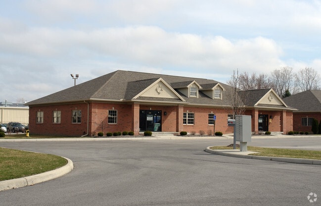
6 N Centennial Rd
79-74644
TRADITION SQUARE CONDOMINI UM BLDG 4 UNIT 4
Commercialcondominium
LUCAS
20-M2
Ohio
B and X Area of moderate flood hazard, usually the area between the limits of the 100-year and 500-year floods.
West/Sylvania
0
Toledo
2025
Toledo, OH
009205
NEARBY LISTINGS FOR SALE OR LEASE
DEMOGRAPHICS near 6 N Centennial Rd
1 mile
3 mile
5 mile
2025 Total Population
3,286
36,555
90,925
2030 Population
3,305
36,187
89,657
Pop Growth 2025-2030
+ 0.58%
(1.01%)
(1.39%)
Average Age
41
42
42
2025 Total Households
1,262
14,954
38,013
HH Growth 2025-2030
+ 0.55%
(0.90%)
(1.35%)
Median Household Inc
$154,678
$105,426
$87,826
Avg Household Size
2.60
2.40
2.30
2025 Avg HH Vehicles
2.00
2.00
2.00
Median Home Value
$368,030
$297,401
$257,302
Median Year Built
1997
1987
1980
Nearby Places
Map Layers
Map Styles
 Street
 Aerial
Layers
 Traffic
 Biking
Places
Listings with unknown addresses are not visible on the map
- Restaurants
- Banks
- Shops
- Fitness
- Groceries
PUBLIC TRANSPORTATION
AIRPORT
Eugene F Kranz Toledo Express
Drive
Walk
Distance
Eugene F Kranz Toledo Express
26 min
12.5 mi
Freight Ports
Port of Toledo
Drive
Walk
Distance
Port of Toledo
33 min
18.7 mi
Nearby Properties
Address
Land Use
TOTAL SIZE
Lot Size
Zoning
Address
Land Use
TOTAL SIZE
Lot Size
Zoning
209,351 SF
49.06 AC
31-R1
Address
Land Use
TOTAL SIZE
Lot Size
Zoning
78,678 SF
10.20 AC
31-R1
Address
Land Use
TOTAL SIZE
Lot Size
Zoning
89,031 SF
15.83 AC
31-M2
Address
Land Use
TOTAL SIZE
Lot Size
Zoning
101,635 SF
34.34 AC
20-S1
Address
Land Use
TOTAL SIZE
Lot Size
Zoning
130,387 SF
8.50 AC
20-R5
Address
Land Use
TOTAL SIZE
Lot Size
Zoning
217,992 SF
39.78 AC
20-C2
Address
Land Use
TOTAL SIZE
Lot Size
Zoning
137,081 SF
12 AC
20-C2
Address
Land Use
TOTAL SIZE
Lot Size
Zoning
90,782 SF
18.24 AC
20-RA
Address
Land Use
TOTAL SIZE
Lot Size
Zoning
119,804 SF
5.02 AC
31-R4
Address
Land Use
TOTAL SIZE
Lot Size
Zoning
140,008 SF
10 AC
19-R3
Address
Land Use
TOTAL SIZE
Lot Size
Zoning
70,550 SF
8.25 AC
31-B1
Address
Land Use
TOTAL SIZE
Lot Size
Zoning
36,153 SF
4.43 AC
20-C2
Address
Land Use
TOTAL SIZE
Lot Size
Zoning
74,418 SF
33.17 AC
20-A3
Address
Land Use
TOTAL SIZE
Lot Size
Zoning
130,168 SF
12 AC
31-R2
Address
Land Use
TOTAL SIZE
Lot Size
Zoning
218,603 SF
18 AC
10-MX
Address
Land Use
TOTAL SIZE
Lot Size
Zoning
43,755 SF
9.02 AC
20-R4PUD
Address
Land Use
TOTAL SIZE
Lot Size
Zoning
122,154 SF
10.62 AC
20-MX
Address
Land Use
TOTAL SIZE
Lot Size
Zoning
65,182 SF
8.40 AC
19-PO
Address
Land Use
TOTAL SIZE
Lot Size
Zoning
121,446 SF
8.87 AC
20-MX
Address
Land Use
TOTAL SIZE
Lot Size
Zoning
50,394 SF
4.64 AC
20-A3
Address
Land Use
TOTAL SIZE
Lot Size
Zoning
50,394 SF
3.79 AC
20-MX
Address
Land Use
TOTAL SIZE
Lot Size
Zoning
54,613 SF
0.81 AC
20-C2
Address
Land Use
TOTAL SIZE
Lot Size
Zoning
58,149 SF
6.90 AC
20-R4PUD
Address
Land Use
TOTAL SIZE
Lot Size
Zoning
161,280 SF
12.20 AC
19-R3
Address
Land Use
TOTAL SIZE
Lot Size
Zoning
79,516 SF
19.85 AC
31-R1
Address
Land Use
TOTAL SIZE
Lot Size
Zoning
46,656 SF
5.60 AC
20-C2
Address
Land Use
TOTAL SIZE
Lot Size
Zoning
79,149 SF
4.35 AC
31-R4
Address
Land Use
TOTAL SIZE
Lot Size
Zoning
92,731 SF
7 AC
31-B2
Address
Land Use
TOTAL SIZE
Lot Size
Zoning
87,252 SF
7.22 AC
20-MX
Address
Land Use
TOTAL SIZE
Lot Size
Zoning
167,800 SF
17.30 AC
19-MX
The World's #1 Commercial Real Estate Marketplace
Connect with us
© 2026 CoStar Group
The information above has been obtained from sources believed reliable. While we do not doubt its accuracy we have not verified it and make no guarantee, warranty or representation about it. It is your responsibility to independently confirm its accuracy and completeness. Any projections, opinions, assumptions, or estimates used are for example only and do not represent the current or future performance of the property. The value of this transaction to you depends on tax and other factors which should be evaluated by your tax, financial, and legal advisors. You and your advisors should conduct a careful, independent investigation of the property to determine to your satisfaction the suitability of the property for your needs.