Property Record
6 Oxbow Pond Rd, Canterbury, NH 03224
NEARBY LISTINGS FOR SALE OR LEASE
-
-
View all Canterbury listings for lease on LoopNet.com
Property Detail
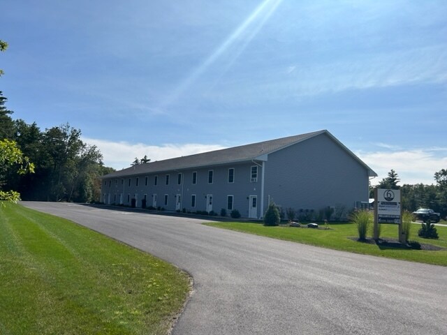
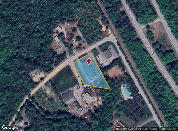
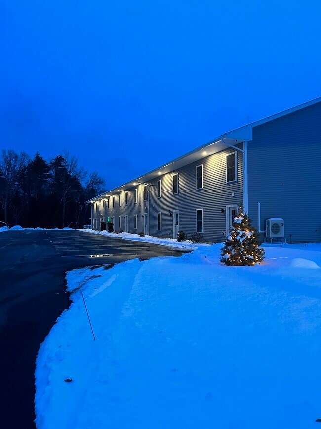
6 Oxbow Pond Rd
Commercialbuilding
Merrimack
X
New Hampshire
33013C0337E
1.49 AC
2024
Concord/New Hampshire North Area
2024
Other Market Areas
037000
Concord, NH
10,710 SF
000021000017000009
DEMOGRAPHICS near 6 Oxbow Pond Rd
1 Mile
3 Mile
5 Mile
2024 Total Population
683
14,399
22,731
2029 Population
722
15,207
23,961
Pop Growth 2024-2029
+ 5.71%
+ 5.61%
+ 5.41%
Average Age
43
41
42
2024 Total Households
268
5,805
8,718
HH Growth 2024-2029
+ 5.97%
+ 5.58%
+ 5.53%
Median Household Inc
$96,484
$80,511
$85,836
Avg Household Size
2.40
2.30
2.40
2024 Avg HH Vehicles
2.00
2.00
2.00
Median Home Value
$405,844
$274,384
$285,149
Median Year Built
1978
1982
1981
Nearby Places
Map Layers
Map Styles
 Street
 Aerial
- Restaurants
- Banks
- Shops
- Fitness
- Groceries
PUBLIC TRANSPORTATION
AIRPORT
Manchester Boston Regional
DRIVE
WALK
Distance
Manchester Boston Regional
47 min
31.1 mi
Freight Ports
Portland, ME
DRIVE
WALK
Distance
Portland, ME
139 min
92.1 mi
SALE & LEASE HISTORY
LISTING DATE
SALE/LEASE

Mar 26, 2024
For Lease
Nearby Properties
Address
Land Use
TOTAL SIZE
Lot Size
Zoning
Address
Land Use
TOTAL SIZE
Lot Size
Zoning
23.80 AC
IN
Address
Land Use
TOTAL SIZE
Lot Size
Zoning
56.19 AC
IN
Address
Land Use
TOTAL SIZE
Lot Size
Zoning
6,816 SF
64.44 AC
RO
Address
Land Use
TOTAL SIZE
Lot Size
Zoning
RES/AG
Address
Land Use
TOTAL SIZE
Lot Size
Zoning
14.41 AC
GWP
Address
Land Use
TOTAL SIZE
Lot Size
Zoning
146,511 SF
19.85 AC
RS
Address
Land Use
TOTAL SIZE
Lot Size
Zoning
8.50 AC
CG
Address
Land Use
TOTAL SIZE
Lot Size
Zoning
66,460 SF
20.98 AC
RM
Address
Land Use
TOTAL SIZE
Lot Size
Zoning
61,687 SF
8.69 AC
CG
Address
Land Use
TOTAL SIZE
Lot Size
Zoning
47,273 SF
91.79 AC
COM W
Address
Land Use
TOTAL SIZE
Lot Size
Zoning
5.50 AC
DEFAUL
Address
Land Use
TOTAL SIZE
Lot Size
Zoning
12 AC
RH
Address
Land Use
TOTAL SIZE
Lot Size
Zoning
25,363 SF
6.21 AC
CG
Address
Land Use
TOTAL SIZE
Lot Size
Zoning
4.90 AC
RH
Address
Land Use
TOTAL SIZE
Lot Size
Zoning
9.60 AC
RD
Address
Land Use
TOTAL SIZE
Lot Size
Zoning
6,316 SF
0.29 AC
R2 - R
Address
Land Use
TOTAL SIZE
Lot Size
Zoning
1,875 SF
2.30 AC
R2 - R
Address
Land Use
TOTAL SIZE
Lot Size
Zoning
2.49 AC
CG
Address
Land Use
TOTAL SIZE
Lot Size
Zoning
169 AC
RO
Address
Land Use
TOTAL SIZE
Lot Size
Zoning
630 SF
2.47 AC
R2 - R
Address
Land Use
TOTAL SIZE
Lot Size
Zoning
3,736 SF
0.56 AC
R2 - R
Address
Land Use
TOTAL SIZE
Lot Size
Zoning
70,566 SF
11.09 AC
IN
Address
Land Use
TOTAL SIZE
Lot Size
Zoning
32.08 AC
RH
Address
Land Use
TOTAL SIZE
Lot Size
Zoning
396 SF
0.19 AC
R2 - R
Address
Land Use
TOTAL SIZE
Lot Size
Zoning
2,205 SF
37 AC
ARR -
Address
Land Use
TOTAL SIZE
Lot Size
Zoning
8.21 AC
IN
Address
Land Use
TOTAL SIZE
Lot Size
Zoning
2,685 SF
11.42 AC
VD
Address
Land Use
TOTAL SIZE
Lot Size
Zoning
19,578 SF
2.88 AC
CMW&S
Address
Land Use
TOTAL SIZE
Lot Size
Zoning
3,347 SF
7.20 AC
VD
Address
Land Use
TOTAL SIZE
Lot Size
Zoning
1.25 AC
MRD
The World's #1 Commercial Real Estate Marketplace
Connect with us
© 2025 CoStar Group
The information above has been obtained from sources believed reliable. While we do not doubt its accuracy we have not verified it and make no guarantee, warranty or representation about it. It is your responsibility to independently confirm its accuracy and completeness. Any projections, opinions, assumptions, or estimates used are for example only and do not represent the current or future performance of the property. The value of this transaction to you depends on tax and other factors which should be evaluated by your tax, financial, and legal advisors. You and your advisors should conduct a careful, independent investigation of the property to determine to your satisfaction the suitability of the property for your needs.