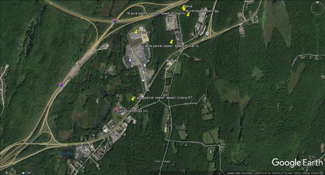
Property Record
6 Picker Rd, Sturbridge, MA 01566

Property Detail
6 Picker Rd
STUR-000510-000000-002215-000006
WORCESTER
Commercialbuilding
Massachusetts
B and X Area of moderate flood hazard, usually the area between the limits of the 100-year and 500-year floods.
2215-6
2025
18.43 AC
2025
Outlying Worcester
758104
Boston
95,040 SF
Worcester, MA
NEARBY LISTINGS FOR SALE OR LEASE
-
-
View all Sturbridge listings for sale on LoopNet.com
DEMOGRAPHICS near 6 Picker Rd
1 mile
3 mile
5 mile
2025 Total Population
517
9,068
35,742
2030 Population
534
9,347
36,648
Pop Growth 2025-2030
+ 3.29%
+ 3.08%
+ 2.53%
Average Age
43
42
42
2025 Total Households
188
3,619
14,390
HH Growth 2025-2030
+ 3.19%
+ 3.18%
+ 2.63%
Median Household Inc
$146,323
$116,692
$88,210
Avg Household Size
2.70
2.50
2.40
2025 Avg HH Vehicles
2.00
2.00
2.00
Median Home Value
$554,598
$435,068
$396,415
Median Year Built
1979
1979
1970
Nearby Places
Map Layers
Map Styles
 Street
 Aerial
Layers
 Traffic
 Biking
Places
Listings with unknown addresses are not visible on the map
- Restaurants
- Banks
- Shops
- Fitness
- Groceries
PUBLIC TRANSPORTATION
AIRPORT
Worcester Regional
Drive
Walk
Distance
Worcester Regional
35 min
17.6 mi
Freight Ports
Port of Davisville, RI
Drive
Walk
Distance
Port of Davisville, RI
96 min
73.8 mi
SALE & LEASE HISTORY
LISTING DATE
SALE/LEASE

Sep 25, 2016
For Lease
Sep 24, 2016
For Sale
May 16, 2018
For Sale
Jan 06, 2020
For Sale
Apr 06, 2017
For Sale
Nearby Properties
Address
Land Use
TOTAL SIZE
Lot Size
Zoning
Address
Land Use
TOTAL SIZE
Lot Size
Zoning
1,800 SF
10.02 AC
IG
Address
Land Use
TOTAL SIZE
Lot Size
Zoning
15,648 SF
50.82 AC
A
Address
Land Use
TOTAL SIZE
Lot Size
Zoning
127,762 SF
19.28 AC
Address
Land Use
TOTAL SIZE
Lot Size
Zoning
45.13 AC
GB
Address
Land Use
TOTAL SIZE
Lot Size
Zoning
102,966 SF
30.95 AC
Address
Land Use
TOTAL SIZE
Lot Size
Zoning
189,270 SF
97.55 AC
FB
Address
Land Use
TOTAL SIZE
Lot Size
Zoning
208,444 SF
14.09 AC
Address
Land Use
TOTAL SIZE
Lot Size
Zoning
Address
Land Use
TOTAL SIZE
Lot Size
Zoning
195.60 AC
IG
Address
Land Use
TOTAL SIZE
Lot Size
Zoning
105,660 SF
Address
Land Use
TOTAL SIZE
Lot Size
Zoning
93,552 SF
40.84 AC
Address
Land Use
TOTAL SIZE
Lot Size
Zoning
15,000 SF
2 AC
Address
Land Use
TOTAL SIZE
Lot Size
Zoning
5,024 SF
10.60 AC
Address
Land Use
TOTAL SIZE
Lot Size
Zoning
43,817 SF
3.17 AC
Address
Land Use
TOTAL SIZE
Lot Size
Zoning
56,336 SF
5 AC
GB
Address
Land Use
TOTAL SIZE
Lot Size
Zoning
55,530 SF
4.74 AC
Address
Land Use
TOTAL SIZE
Lot Size
Zoning
45.59 AC
IG
Address
Land Use
TOTAL SIZE
Lot Size
Zoning
76,734 SF
7.75 AC
IG
Address
Land Use
TOTAL SIZE
Lot Size
Zoning
226.35 AC
M
Address
Land Use
TOTAL SIZE
Lot Size
Zoning
52,255 SF
Address
Land Use
TOTAL SIZE
Lot Size
Zoning
65,104 SF
9.60 AC
Address
Land Use
TOTAL SIZE
Lot Size
Zoning
2,267 SF
10 AC
A
Address
Land Use
TOTAL SIZE
Lot Size
Zoning
22.15 AC
R40
Address
Land Use
TOTAL SIZE
Lot Size
Zoning
1,237.46 AC
Address
Land Use
TOTAL SIZE
Lot Size
Zoning
6.35 AC
A
Address
Land Use
TOTAL SIZE
Lot Size
Zoning
4,888 SF
12.33 AC
Address
Land Use
TOTAL SIZE
Lot Size
Zoning
51,006 SF
10.54 AC
Address
Land Use
TOTAL SIZE
Lot Size
Zoning
53,267 SF
4.16 AC
Address
Land Use
TOTAL SIZE
Lot Size
Zoning
73,136 SF
7.70 AC
Address
Land Use
TOTAL SIZE
Lot Size
Zoning
35,281 SF
2.68 AC
The World's #1 Commercial Real Estate Marketplace
Connect with us
© 2026 CoStar Group
The information above has been obtained from sources believed reliable. While we do not doubt its accuracy we have not verified it and make no guarantee, warranty or representation about it. It is your responsibility to independently confirm its accuracy and completeness. Any projections, opinions, assumptions, or estimates used are for example only and do not represent the current or future performance of the property. The value of this transaction to you depends on tax and other factors which should be evaluated by your tax, financial, and legal advisors. You and your advisors should conduct a careful, independent investigation of the property to determine to your satisfaction the suitability of the property for your needs.