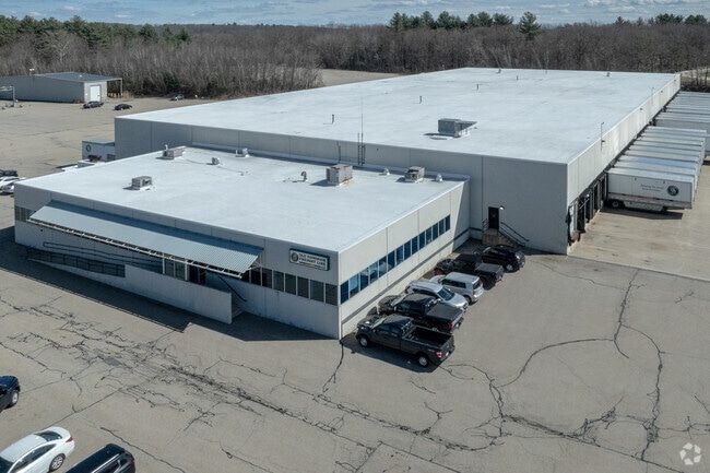
Property Record
6 Pine Ridge Dr, Oxford, MA 01540


NEARBY LISTINGS FOR SALE OR LEASE
Property Detail
6 Pine Ridge Dr
Commercialnec
Worcester
X
Massachusetts
25027C0792F
20.84 AC
2025
Outlying Worcester
2025
Boston
753100
Worcester, MA-CT
7,000 SF
OXFO-000008-000000-A000404
DEMOGRAPHICS near 6 Pine Ridge Dr
1 Mile
3 Mile
5 Mile
2024 Total Population
1,534
11,775
39,913
2029 Population
1,529
11,702
39,776
Pop Growth 2024-2029
(0.33%)
(0.62%)
(0.34%)
Average Age
44
43
43
2024 Total Households
680
4,617
15,622
HH Growth 2024-2029
(0.44%)
(0.63%)
(0.38%)
Median Household Inc
$89,224
$106,727
$105,813
Avg Household Size
2.20
2.50
2.50
2024 Avg HH Vehicles
2.00
2.00
2.00
Median Home Value
$366,556
$359,537
$351,678
Median Year Built
1980
1973
1972
Nearby Places
Map Layers
Map Styles
 Street
 Aerial
- Restaurants
- Banks
- Shops
- Fitness
- Groceries
PUBLIC TRANSPORTATION
COMMUTER RAIL
Worcester Union Station (Lake Shore Limited - Amtrak)
DRIVE
WALK
Distance
Worcester Union Station (Lake Shore Limited - Amtrak)
15 min
9.6 mi
Worcester (Framingham/Worcester Line - Massachusetts Bay Transportation Authority Commuter Rail (Purple Line))
DRIVE
WALK
Distance
Worcester (Framingham/Worcester Line - Massachusetts Bay Transportation Authority Commuter Rail (Purple Line))
15 min
9.7 mi
AIRPORT
Worcester Regional
DRIVE
WALK
Distance
Worcester Regional
21 min
10.2 mi
Freight Ports
Port of Davisville, RI
DRIVE
WALK
Distance
Port of Davisville, RI
83 min
63.0 mi
Nearby Properties
Address
Land Use
TOTAL SIZE
Lot Size
Zoning
Address
Land Use
TOTAL SIZE
Lot Size
Zoning
118,112 SF
6.54 AC
Address
Land Use
TOTAL SIZE
Lot Size
Zoning
15.60 AC
R2
Address
Land Use
TOTAL SIZE
Lot Size
Zoning
116,919 SF
17.60 AC
Address
Land Use
TOTAL SIZE
Lot Size
Zoning
42.81 AC
Address
Land Use
TOTAL SIZE
Lot Size
Zoning
107,484 SF
11.70 AC
Address
Land Use
TOTAL SIZE
Lot Size
Zoning
145,401 SF
23.20 AC
GB
Address
Land Use
TOTAL SIZE
Lot Size
Zoning
11.30 AC
Address
Land Use
TOTAL SIZE
Lot Size
Zoning
109,380 SF
27.60 AC
R2
Address
Land Use
TOTAL SIZE
Lot Size
Zoning
118,826 SF
35.73 AC
IP
Address
Land Use
TOTAL SIZE
Lot Size
Zoning
53,096 SF
5.60 AC
Address
Land Use
TOTAL SIZE
Lot Size
Zoning
50,065 SF
8.65 AC
R3
Address
Land Use
TOTAL SIZE
Lot Size
Zoning
5.80 AC
Address
Land Use
TOTAL SIZE
Lot Size
Zoning
2.60 AC
Address
Land Use
TOTAL SIZE
Lot Size
Zoning
21,156 SF
29.90 AC
A
Address
Land Use
TOTAL SIZE
Lot Size
Zoning
39,282 SF
4.94 AC
Address
Land Use
TOTAL SIZE
Lot Size
Zoning
63,120 SF
9.10 AC
Address
Land Use
TOTAL SIZE
Lot Size
Zoning
56,415 SF
4.38 AC
B1-B
Address
Land Use
TOTAL SIZE
Lot Size
Zoning
52,128 SF
9.30 AC
Address
Land Use
TOTAL SIZE
Lot Size
Zoning
3.20 AC
Address
Land Use
TOTAL SIZE
Lot Size
Zoning
76.78 AC
IP
Address
Land Use
TOTAL SIZE
Lot Size
Zoning
31,460 SF
4.64 AC
Address
Land Use
TOTAL SIZE
Lot Size
Zoning
2,605 SF
11.15 AC
R1
Address
Land Use
TOTAL SIZE
Lot Size
Zoning
70,471 SF
36.41 AC
I
Address
Land Use
TOTAL SIZE
Lot Size
Zoning
69,192 SF
22.85 AC
I
Address
Land Use
TOTAL SIZE
Lot Size
Zoning
13,308 SF
1.30 AC
Address
Land Use
TOTAL SIZE
Lot Size
Zoning
45,172 SF
9.13 AC
Address
Land Use
TOTAL SIZE
Lot Size
Zoning
43,471 SF
1.93 AC
Address
Land Use
TOTAL SIZE
Lot Size
Zoning
1,500 SF
4.45 AC
GB
Address
Land Use
TOTAL SIZE
Lot Size
Zoning
16,688 SF
6.83 AC
The World's #1 Commercial Real Estate Marketplace
Connect with us
© 2025 CoStar Group
The information above has been obtained from sources believed reliable. While we do not doubt its accuracy we have not verified it and make no guarantee, warranty or representation about it. It is your responsibility to independently confirm its accuracy and completeness. Any projections, opinions, assumptions, or estimates used are for example only and do not represent the current or future performance of the property. The value of this transaction to you depends on tax and other factors which should be evaluated by your tax, financial, and legal advisors. You and your advisors should conduct a careful, independent investigation of the property to determine to your satisfaction the suitability of the property for your needs.