Property Record
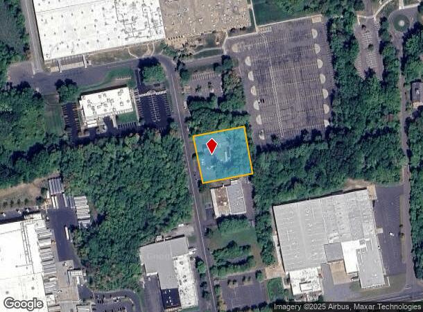
6 Print Shop Rd, Enfield, CT 06082


NEARBY LISTINGS FOR SALE OR LEASE
Property Detail
6 Print Shop Rd
ENFI-000099-000000-000004
Hartford
Industrialgeneral
Connecticut
X
4
09003C0119F
1 AC
2025
Enfield
2025
Hartford
480900
Hartford-West Hartford-East Hartford, CT
5,400 SF
DEMOGRAPHICS near 6 Print Shop Rd
1 Mile
3 Mile
5 Mile
2024 Total Population
1,625
24,759
80,941
2029 Population
1,626
24,586
80,330
Pop Growth 2024-2029
+ 0.06%
(0.70%)
(0.75%)
Average Age
43
44
43
2024 Total Households
496
8,650
30,721
HH Growth 2024-2029
(0.81%)
(1.14%)
(0.90%)
Median Household Inc
$111,875
$98,477
$95,532
Avg Household Size
2.40
2.40
2.40
2024 Avg HH Vehicles
2.00
2.00
2.00
Median Home Value
$200,645
$248,994
$274,529
Median Year Built
1958
1965
1963
Nearby Places
Map Layers
Map Styles
 Street
 Aerial
- Restaurants
- Banks
- Shops
- Fitness
- Groceries
PUBLIC TRANSPORTATION
AIRPORT
Bradley International
DRIVE
WALK
Distance
Bradley International
28 min
11.7 mi
Freight Ports
Port of New Haven
DRIVE
WALK
Distance
Port of New Haven
81 min
60.9 mi
Nearby Properties
Address
Land Use
TOTAL SIZE
Lot Size
Zoning
Address
Land Use
TOTAL SIZE
Lot Size
Zoning
750,000 SF
405 AC
A-1
Address
Land Use
TOTAL SIZE
Lot Size
Zoning
69.62 AC
MFHD
Address
Land Use
TOTAL SIZE
Lot Size
Zoning
226,545 SF
14 AC
A-1
Address
Land Use
TOTAL SIZE
Lot Size
Zoning
370.78 AC
R88
Address
Land Use
TOTAL SIZE
Lot Size
Zoning
283.30 AC
R88
Address
Land Use
TOTAL SIZE
Lot Size
Zoning
166,268 SF
36.70 AC
R44
Address
Land Use
TOTAL SIZE
Lot Size
Zoning
142,872 SF
57.41 AC
INDG
Address
Land Use
TOTAL SIZE
Lot Size
Zoning
500,000 SF
71.20 AC
I-1
Address
Land Use
TOTAL SIZE
Lot Size
Zoning
121.07 AC
I-1
Address
Land Use
TOTAL SIZE
Lot Size
Zoning
49.16 AC
I-1
Address
Land Use
TOTAL SIZE
Lot Size
Zoning
36.97 AC
I-1
Address
Land Use
TOTAL SIZE
Lot Size
Zoning
211,256 SF
41.58 AC
R33
Address
Land Use
TOTAL SIZE
Lot Size
Zoning
121 AC
A-1
Address
Land Use
TOTAL SIZE
Lot Size
Zoning
57,328 SF
11.15 AC
INDG
Address
Land Use
TOTAL SIZE
Lot Size
Zoning
24.92 AC
BL
Address
Land Use
TOTAL SIZE
Lot Size
Zoning
1.87 AC
BP
Address
Land Use
TOTAL SIZE
Lot Size
Zoning
144,625 SF
19 AC
BR
Address
Land Use
TOTAL SIZE
Lot Size
Zoning
259,093 SF
27.01 AC
INDG
Address
Land Use
TOTAL SIZE
Lot Size
Zoning
17.34 AC
R44
Address
Land Use
TOTAL SIZE
Lot Size
Zoning
54.05 AC
I-1
Address
Land Use
TOTAL SIZE
Lot Size
Zoning
106,719 SF
3.76 AC
BR
Address
Land Use
TOTAL SIZE
Lot Size
Zoning
111,890 SF
22.08 AC
INDG
Address
Land Use
TOTAL SIZE
Lot Size
Zoning
172,241 SF
11.21 AC
INDG
Address
Land Use
TOTAL SIZE
Lot Size
Zoning
15.91 AC
R44
Address
Land Use
TOTAL SIZE
Lot Size
Zoning
104,111 SF
11.16 AC
I-1
Address
Land Use
TOTAL SIZE
Lot Size
Zoning
55,096 SF
18.80 AC
R44
Address
Land Use
TOTAL SIZE
Lot Size
Zoning
212,178 SF
13.90 AC
INDG
Address
Land Use
TOTAL SIZE
Lot Size
Zoning
70,659 SF
19.62 AC
R44
Address
Land Use
TOTAL SIZE
Lot Size
Zoning
53,850 SF
8.12 AC
R33
Address
Land Use
TOTAL SIZE
Lot Size
Zoning
90,776 SF
23.48 AC
I-1
The World's #1 Commercial Real Estate Marketplace
Connect with us
© 2025 CoStar Group
The information above has been obtained from sources believed reliable. While we do not doubt its accuracy we have not verified it and make no guarantee, warranty or representation about it. It is your responsibility to independently confirm its accuracy and completeness. Any projections, opinions, assumptions, or estimates used are for example only and do not represent the current or future performance of the property. The value of this transaction to you depends on tax and other factors which should be evaluated by your tax, financial, and legal advisors. You and your advisors should conduct a careful, independent investigation of the property to determine to your satisfaction the suitability of the property for your needs.