Property Record
6 River Rd, Sturbridge, MA 01566


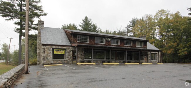
Property Detail
6 River Rd
Worcester, MA
WORCESTER
STUR-000545-000000-003432-000006
Massachusetts
Residentialacreage
3432-6
B and X Area of moderate flood hazard, usually the area between the limits of the 100-year and 500-year floods.
2.36 AC
2025
Outlying Worcester
2025
Boston
758101
NEARBY LISTINGS FOR SALE OR LEASE
DEMOGRAPHICS near 6 River Rd
1 mile
3 mile
5 mile
2025 Total Population
918
16,636
32,113
2030 Population
943
17,053
32,982
Pop Growth 2025-2030
+ 2.72%
+ 2.51%
+ 2.71%
Average Age
45
42
42
2025 Total Households
381
6,764
13,081
HH Growth 2025-2030
+ 2.89%
+ 2.62%
+ 2.81%
Median Household Inc
$102,631
$86,636
$82,788
Avg Household Size
2.40
2.40
2.40
2025 Avg HH Vehicles
2.00
2.00
2.00
Median Home Value
$406,140
$378,504
$371,717
Median Year Built
1976
1959
1966
Nearby Places
Map Layers
Map Styles
 Street
 Aerial
Transit
 Traffic
 Biking
Places
Listings with unknown addresses are not visible on the map
- Restaurants
- Banks
- Shops
- Fitness
- Groceries
PUBLIC TRANSPORTATION
AIRPORT
Worcester Regional
Drive
Walk
Distance
Worcester Regional
37 min
22.9 mi
Freight Ports
Port of Davisville, RI
Drive
Walk
Distance
Port of Davisville, RI
96 min
74.2 mi
Nearby Properties
Address
Land Use
TOTAL SIZE
Lot Size
Zoning
Address
Land Use
TOTAL SIZE
Lot Size
Zoning
127,762 SF
19.28 AC
Address
Land Use
TOTAL SIZE
Lot Size
Zoning
127,620 SF
6.40 AC
R2
Address
Land Use
TOTAL SIZE
Lot Size
Zoning
102,966 SF
30.95 AC
Address
Land Use
TOTAL SIZE
Lot Size
Zoning
Address
Land Use
TOTAL SIZE
Lot Size
Zoning
2.14 AC
CC
Address
Land Use
TOTAL SIZE
Lot Size
Zoning
93,260 SF
9.10 AC
R1
Address
Land Use
TOTAL SIZE
Lot Size
Zoning
208,444 SF
14.09 AC
Address
Land Use
TOTAL SIZE
Lot Size
Zoning
40,910 SF
25.36 AC
Address
Land Use
TOTAL SIZE
Lot Size
Zoning
100,771 SF
2.70 AC
R2
Address
Land Use
TOTAL SIZE
Lot Size
Zoning
Address
Land Use
TOTAL SIZE
Lot Size
Zoning
4,704 SF
76 AC
Address
Land Use
TOTAL SIZE
Lot Size
Zoning
58,420 SF
5 AC
R2
Address
Land Use
TOTAL SIZE
Lot Size
Zoning
105,660 SF
Address
Land Use
TOTAL SIZE
Lot Size
Zoning
93,552 SF
40.84 AC
Address
Land Use
TOTAL SIZE
Lot Size
Zoning
15,000 SF
2 AC
Address
Land Use
TOTAL SIZE
Lot Size
Zoning
5,024 SF
10.60 AC
Address
Land Use
TOTAL SIZE
Lot Size
Zoning
1 AC
CC
Address
Land Use
TOTAL SIZE
Lot Size
Zoning
7.86 AC
OR
Address
Land Use
TOTAL SIZE
Lot Size
Zoning
43,817 SF
3.17 AC
Address
Land Use
TOTAL SIZE
Lot Size
Zoning
10,210 SF
116.40 AC
R1
Address
Land Use
TOTAL SIZE
Lot Size
Zoning
22,204 SF
2.50 AC
CC
Address
Land Use
TOTAL SIZE
Lot Size
Zoning
55,530 SF
4.74 AC
Address
Land Use
TOTAL SIZE
Lot Size
Zoning
30.71 AC
Address
Land Use
TOTAL SIZE
Lot Size
Zoning
2.77 AC
R2
Address
Land Use
TOTAL SIZE
Lot Size
Zoning
68,898 SF
49.02 AC
Address
Land Use
TOTAL SIZE
Lot Size
Zoning
5.28 AC
Address
Land Use
TOTAL SIZE
Lot Size
Zoning
24,713 SF
1 AC
CC
Address
Land Use
TOTAL SIZE
Lot Size
Zoning
768 SF
12.90 AC
R1
Address
Land Use
TOTAL SIZE
Lot Size
Zoning
226.35 AC
M
Address
Land Use
TOTAL SIZE
Lot Size
Zoning
56,469 SF
0.50 AC
CC
The World's #1 Commercial Real Estate Marketplace
Connect with us
© 2026 CoStar Group
The information above has been obtained from sources believed reliable. While we do not doubt its accuracy we have not verified it and make no guarantee, warranty or representation about it. It is your responsibility to independently confirm its accuracy and completeness. Any projections, opinions, assumptions, or estimates used are for example only and do not represent the current or future performance of the property. The value of this transaction to you depends on tax and other factors which should be evaluated by your tax, financial, and legal advisors. You and your advisors should conduct a careful, independent investigation of the property to determine to your satisfaction the suitability of the property for your needs.