Property Record
6 Stanton Rd, Wilmington, DE 19804


Save to a Folder
{{folder.Name}}
{{folder.ListingIds.length}} Properties
{{folder.ListingIds.length}} Property
Create a New Folder
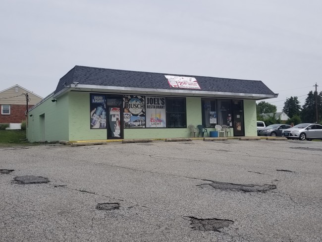
Property Detail
6 Stanton Rd
08-051.10-067
L8 THRU 10
Storebuilding
NEW CASTLE
NC5
Delaware
AE The base floodplain where base flood elevations are provided. AE Zones are now used on new format FIRMs instead of A1-A30 Zones.
8 9 1
2025
0.56 AC
2025
West New Castle County
012600
Philadelphia
1,952 SF
Philadelphia-Camden-Wilmington, PA-NJ-DE-MD
NEARBY LISTINGS FOR SALE OR LEASE
DEMOGRAPHICS near 6 Stanton Rd
1 mile
3 mile
5 mile
2025 Total Population
8,235
63,482
210,926
2030 Population
8,446
65,045
216,357
Pop Growth 2025-2030
+ 2.56%
+ 2.46%
+ 2.57%
Average Age
42
42
41
2025 Total Households
3,286
25,417
84,870
HH Growth 2025-2030
+ 2.65%
+ 2.61%
+ 2.75%
Median Household Inc
$80,370
$85,047
$79,568
Avg Household Size
2.40
2.40
2.40
2025 Avg HH Vehicles
2.00
2.00
2.00
Median Home Value
$265,574
$289,024
$295,880
Median Year Built
1958
1962
1966
Nearby Places
Map Layers
Map Styles
 Street
 Aerial
Layers
 Traffic
 Biking
Places
Listings with unknown addresses are not visible on the map
- Restaurants
- Banks
- Shops
- Fitness
- Groceries
PUBLIC TRANSPORTATION
COMMUTER RAIL
Churchmans Crossing (R2 - Southeastern Pennsylvania Transportation Authority Regional Rail (SEPTA Regional Rail))
Drive
Walk
Distance
Churchmans Crossing (R2 - Southeastern Pennsylvania Transportation Authority Regional Rail (SEPTA Regional Rail))
5 min
2.9 mi
Wilmington (R2 - Southeastern Pennsylvania Transportation Authority Regional Rail (SEPTA Regional Rail))
Drive
Walk
Distance
Wilmington (R2 - Southeastern Pennsylvania Transportation Authority Regional Rail (SEPTA Regional Rail))
12 min
5.7 mi
AIRPORT
Philadelphia International
Drive
Walk
Distance
Philadelphia International
40 min
28.0 mi
Freight Ports
Port of Wilmington, RI
Drive
Walk
Distance
Port of Wilmington, RI
14 min
7.9 mi
SALE & LEASE HISTORY
LISTING DATE
SALE/LEASE

Jun 24, 2019
For Sale
Nearby Properties
Address
Land Use
TOTAL SIZE
Lot Size
Zoning
Address
Land Use
TOTAL SIZE
Lot Size
Zoning
525,757 SF
189.70 AC
NCPUD
Address
Land Use
TOTAL SIZE
Lot Size
Zoning
467,262 SF
28.74 AC
CR
Address
Land Use
TOTAL SIZE
Lot Size
Zoning
22,013 SF
55.17 AC
S
Address
Land Use
TOTAL SIZE
Lot Size
Zoning
803,690 SF
155.50 AC
NCPUD
Address
Land Use
TOTAL SIZE
Lot Size
Zoning
819,930 SF
78.51 AC
HI
Address
Land Use
TOTAL SIZE
Lot Size
Zoning
488,637 SF
229.83 AC
NCPUD
Address
Land Use
TOTAL SIZE
Lot Size
Zoning
186,374 SF
178.45 AC
SR
Address
Land Use
TOTAL SIZE
Lot Size
Zoning
216,689 SF
16.44 AC
CR
Address
Land Use
TOTAL SIZE
Lot Size
Zoning
38,900 SF
16.31 AC
BP
Address
Land Use
TOTAL SIZE
Lot Size
Zoning
203,570 SF
83.85 AC
OR
Address
Land Use
TOTAL SIZE
Lot Size
Zoning
30,127 SF
6.53 AC
CR
Address
Land Use
TOTAL SIZE
Lot Size
Zoning
194,234 SF
67.12 AC
S
Address
Land Use
TOTAL SIZE
Lot Size
Zoning
660 SF
291.15 AC
I
Address
Land Use
TOTAL SIZE
Lot Size
Zoning
269,354 SF
29.13 AC
NCPUD
Address
Land Use
TOTAL SIZE
Lot Size
Zoning
118,400 SF
59.44 AC
S
Address
Land Use
TOTAL SIZE
Lot Size
Zoning
242,811 SF
38.77 AC
CR
Address
Land Use
TOTAL SIZE
Lot Size
Zoning
27,576 SF
216.60 AC
S
Address
Land Use
TOTAL SIZE
Lot Size
Zoning
256,666 SF
60.73 AC
OR
Address
Land Use
TOTAL SIZE
Lot Size
Zoning
2,368 SF
486.90 AC
SR
Address
Land Use
TOTAL SIZE
Lot Size
Zoning
19,080 SF
6.78 AC
OR
Address
Land Use
TOTAL SIZE
Lot Size
Zoning
94,470 SF
22.40 AC
CR
Address
Land Use
TOTAL SIZE
Lot Size
Zoning
1,815 SF
115.74 AC
S
Address
Land Use
TOTAL SIZE
Lot Size
Zoning
166,492 SF
19.73 AC
S
Address
Land Use
TOTAL SIZE
Lot Size
Zoning
220,880 SF
62.11 AC
HI
Address
Land Use
TOTAL SIZE
Lot Size
Zoning
56,352 SF
11.29 AC
I
Address
Land Use
TOTAL SIZE
Lot Size
Zoning
343,217 SF
28.26 AC
CR
Address
Land Use
TOTAL SIZE
Lot Size
Zoning
110.84 AC
CR
Address
Land Use
TOTAL SIZE
Lot Size
Zoning
125,650 SF
39.91 AC
S
Address
Land Use
TOTAL SIZE
Lot Size
Zoning
227,430 SF
10.80 AC
NCAP
Address
Land Use
TOTAL SIZE
Lot Size
Zoning
2,520 SF
9.03 AC
ST
The World's #1 Commercial Real Estate Marketplace
Connect with us
© 2026 CoStar Group
The information above has been obtained from sources believed reliable. While we do not doubt its accuracy we have not verified it and make no guarantee, warranty or representation about it. It is your responsibility to independently confirm its accuracy and completeness. Any projections, opinions, assumptions, or estimates used are for example only and do not represent the current or future performance of the property. The value of this transaction to you depends on tax and other factors which should be evaluated by your tax, financial, and legal advisors. You and your advisors should conduct a careful, independent investigation of the property to determine to your satisfaction the suitability of the property for your needs.