Property Record
60 Brookside Rd, Westford, MA 01886
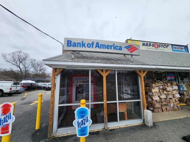


Property Detail
60 Brookside Rd
Storebuilding
Middlesex
B
Massachusetts
B and X Area of moderate flood hazard, usually the area between the limits of the 100-year and 500-year floods.
0.37 AC
2025
Groton/Townsend
2025
Boston
318100
Boston-Cambridge-Newton, MA-NH
3,072 SF
WFOR-000074-000103
NEARBY LISTINGS FOR SALE OR LEASE
DEMOGRAPHICS near 60 Brookside Rd
1 mile
3 mile
5 mile
2025 Total Population
5,474
42,135
127,875
2030 Population
5,675
43,881
132,472
Pop Growth 2025-2030
+ 3.67%
+ 4.14%
+ 3.59%
Average Age
42
42
41
2025 Total Households
1,915
15,927
45,859
HH Growth 2025-2030
+ 3.76%
+ 4.16%
+ 3.75%
Median Household Inc
$170,245
$140,569
$116,452
Avg Household Size
2.80
2.60
2.70
2025 Avg HH Vehicles
2.00
2.00
2.00
Median Home Value
$700,218
$659,449
$610,528
Median Year Built
1964
1977
1970
Nearby Places
Map Layers
Map Styles
 Street
 Aerial
Layers
 Traffic
 Biking
Places
Listings with unknown addresses are not visible on the map
- Restaurants
- Banks
- Shops
- Fitness
- Groceries
PUBLIC TRANSPORTATION
COMMUTER RAIL
Lowell (Lowell Line - Massachusetts Bay Transportation Authority Commuter Rail (Purple Line))
Drive
Walk
Distance
Lowell (Lowell Line - Massachusetts Bay Transportation Authority Commuter Rail (Purple Line))
13 min
5.9 mi
AIRPORT
Manchester Boston Regional
Drive
Walk
Distance
Manchester Boston Regional
40 min
27.1 mi
General Edward Lawrence Logan International
Drive
Walk
Distance
General Edward Lawrence Logan International
54 min
40.2 mi
Freight Ports
Port of Boston
Drive
Walk
Distance
Port of Boston
55 min
39.9 mi
SALE & LEASE HISTORY
LISTING DATE
SALE/LEASE

Mar 20, 2024
For Lease
Nearby Properties
Address
Land Use
TOTAL SIZE
Lot Size
Zoning
Address
Land Use
TOTAL SIZE
Lot Size
Zoning
23,251 SF
18.20 AC
SMF
Address
Land Use
TOTAL SIZE
Lot Size
Zoning
269,952 SF
18.11 AC
P
Address
Land Use
TOTAL SIZE
Lot Size
Zoning
68.15 AC
R1
Address
Land Use
TOTAL SIZE
Lot Size
Zoning
38.26 AC
P
Address
Land Use
TOTAL SIZE
Lot Size
Zoning
7.41 AC
CB
Address
Land Use
TOTAL SIZE
Lot Size
Zoning
44.39 AC
SMU
Address
Land Use
TOTAL SIZE
Lot Size
Zoning
18.50 AC
CC
Address
Land Use
TOTAL SIZE
Lot Size
Zoning
119,130 SF
22.36 AC
RA
Address
Land Use
TOTAL SIZE
Lot Size
Zoning
85,450 SF
32.07 AC
RA
Address
Land Use
TOTAL SIZE
Lot Size
Zoning
9.48 AC
RB
Address
Land Use
TOTAL SIZE
Lot Size
Zoning
3.85 AC
SMF
Address
Land Use
TOTAL SIZE
Lot Size
Zoning
230,037 SF
18.85 AC
IH
Address
Land Use
TOTAL SIZE
Lot Size
Zoning
4.67 AC
IA
Address
Land Use
TOTAL SIZE
Lot Size
Zoning
90,463 SF
8.56 AC
RA
Address
Land Use
TOTAL SIZE
Lot Size
Zoning
10,240 SF
0.15 AC
SMU
Address
Land Use
TOTAL SIZE
Lot Size
Zoning
2.71 AC
SMF
Address
Land Use
TOTAL SIZE
Lot Size
Zoning
12.26 AC
P
Address
Land Use
TOTAL SIZE
Lot Size
Zoning
82,182 SF
13.86 AC
P
Address
Land Use
TOTAL SIZE
Lot Size
Zoning
31.92 AC
RB
Address
Land Use
TOTAL SIZE
Lot Size
Zoning
58,766 SF
21.98 AC
RA
Address
Land Use
TOTAL SIZE
Lot Size
Zoning
181,578 SF
11.40 AC
IH
Address
Land Use
TOTAL SIZE
Lot Size
Zoning
8.54 AC
CB
Address
Land Use
TOTAL SIZE
Lot Size
Zoning
74,816 SF
3.01 AC
RR
Address
Land Use
TOTAL SIZE
Lot Size
Zoning
50,000 SF
33.40 AC
IA
Address
Land Use
TOTAL SIZE
Lot Size
Zoning
27.80 AC
P
Address
Land Use
TOTAL SIZE
Lot Size
Zoning
37.75 AC
RMH
Address
Land Use
TOTAL SIZE
Lot Size
Zoning
43,200 SF
2.82 AC
IA
Address
Land Use
TOTAL SIZE
Lot Size
Zoning
1.66 AC
SMF
Address
Land Use
TOTAL SIZE
Lot Size
Zoning
Address
Land Use
TOTAL SIZE
Lot Size
Zoning
24,010 SF
7.49 AC
RA
The World's #1 Commercial Real Estate Marketplace
Connect with us
© 2026 CoStar Group
The information above has been obtained from sources believed reliable. While we do not doubt its accuracy we have not verified it and make no guarantee, warranty or representation about it. It is your responsibility to independently confirm its accuracy and completeness. Any projections, opinions, assumptions, or estimates used are for example only and do not represent the current or future performance of the property. The value of this transaction to you depends on tax and other factors which should be evaluated by your tax, financial, and legal advisors. You and your advisors should conduct a careful, independent investigation of the property to determine to your satisfaction the suitability of the property for your needs.