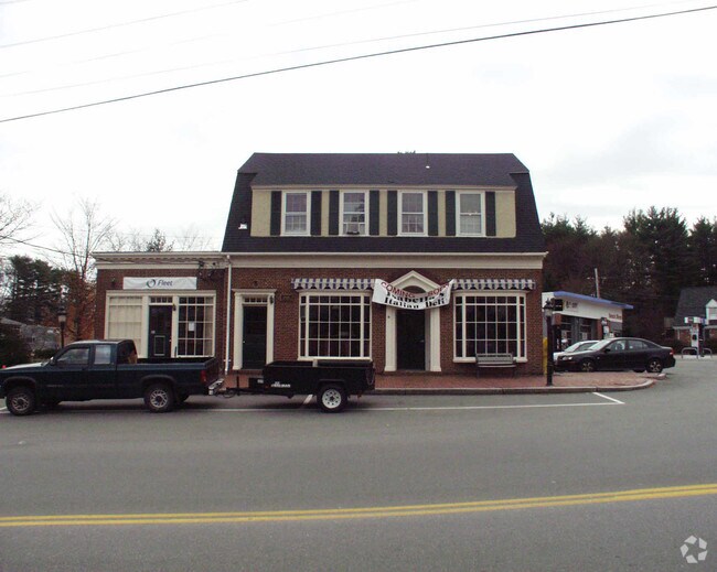
Property Record
60 Centre St, Dover, MA 02030

Property Detail
60 Centre St
Officebuilding
Norfolk
B
Massachusetts
B and X Area of moderate flood hazard, usually the area between the limits of the 100-year and 500-year floods.
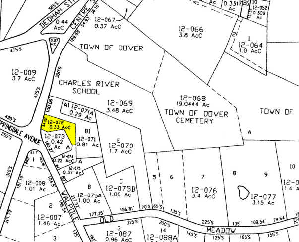
0.33 AC
2025
Wellesley/Needham
2025
Boston
405100
Boston-Cambridge-Newton, MA-NH
3,135 SF
DOVE-000012-000072
NEARBY LISTINGS FOR SALE OR LEASE
-
-
View all Dover listings for sale on LoopNet.com
DEMOGRAPHICS near 60 Centre St
1 mile
3 mile
5 mile
2025 Total Population
1,760
16,990
112,325
2030 Population
1,814
17,558
115,853
Pop Growth 2025-2030
+ 3.07%
+ 3.34%
+ 3.14%
Average Age
42
42
41
2025 Total Households
581
5,704
38,548
HH Growth 2025-2030
+ 3.27%
+ 3.51%
+ 3.36%
Median Household Inc
$257,248
$240,436
$208,204
Avg Household Size
3.00
2.90
2.70
2025 Avg HH Vehicles
2.00
2.00
2.00
Median Home Value
$1,098,415
$1,089,081
$1,035,287
Median Year Built
1972
1969
1963
Nearby Places
Map Layers
Map Styles
 Street
 Aerial
Transit
 Traffic
 Biking
Places
Listings with unknown addresses are not visible on the map
- Restaurants
- Banks
- Shops
- Fitness
- Groceries
PUBLIC TRANSPORTATION
COMMUTER RAIL
Needham Junction (Needham Line - Massachusetts Bay Transportation Authority Commuter Rail (Purple Line))
Drive
Walk
Distance
Needham Junction (Needham Line - Massachusetts Bay Transportation Authority Commuter Rail (Purple Line))
7 min
3.8 mi
Needham Center (Needham Line - Massachusetts Bay Transportation Authority Commuter Rail (Purple Line))
Drive
Walk
Distance
Needham Center (Needham Line - Massachusetts Bay Transportation Authority Commuter Rail (Purple Line))
8 min
3.8 mi
AIRPORT
General Edward Lawrence Logan International
Drive
Walk
Distance
General Edward Lawrence Logan International
38 min
20.9 mi
Freight Ports
Port of Boston
Drive
Walk
Distance
Port of Boston
36 min
19.2 mi
Nearby Properties
Address
Land Use
TOTAL SIZE
Lot Size
Zoning
Address
Land Use
TOTAL SIZE
Lot Size
Zoning
36.60 AC
R2
Address
Land Use
TOTAL SIZE
Lot Size
Zoning
1,592 SF
10.65 AC
ED
Address
Land Use
TOTAL SIZE
Lot Size
Zoning
139,710 SF
60.70 AC
SRA
Address
Land Use
TOTAL SIZE
Lot Size
Zoning
182.10 AC
O
Address
Land Use
TOTAL SIZE
Lot Size
Zoning
529.60 AC
R2
Address
Land Use
TOTAL SIZE
Lot Size
Zoning
314.70 AC
R2
Address
Land Use
TOTAL SIZE
Lot Size
Zoning
95,042 SF
43.95 AC
R1
Address
Land Use
TOTAL SIZE
Lot Size
Zoning
64,362 SF
11.79 AC
SRB
Address
Land Use
TOTAL SIZE
Lot Size
Zoning
53,878 SF
24.98 AC
RSB
Address
Land Use
TOTAL SIZE
Lot Size
Zoning
189.70 AC
RSB
Address
Land Use
TOTAL SIZE
Lot Size
Zoning
78.50 AC
R2
Address
Land Use
TOTAL SIZE
Lot Size
Zoning
1,516 SF
12.38 AC
SRA
Address
Land Use
TOTAL SIZE
Lot Size
Zoning
154.63 AC
O
Address
Land Use
TOTAL SIZE
Lot Size
Zoning
7.03 AC
SRA
Address
Land Use
TOTAL SIZE
Lot Size
Zoning
2,590 SF
341.64 AC
RC
Address
Land Use
TOTAL SIZE
Lot Size
Zoning
51,977 SF
2.52 AC
R1
Address
Land Use
TOTAL SIZE
Lot Size
Zoning
445.98 AC
RT
Address
Land Use
TOTAL SIZE
Lot Size
Zoning
10,037 SF
9.61 AC
B
Address
Land Use
TOTAL SIZE
Lot Size
Zoning
15,254 SF
3.67 AC
R1
Address
Land Use
TOTAL SIZE
Lot Size
Zoning
11.65 AC
R2
Address
Land Use
TOTAL SIZE
Lot Size
Zoning
2,808 SF
83.80 AC
R2
Address
Land Use
TOTAL SIZE
Lot Size
Zoning
28.63 AC
R2
Address
Land Use
TOTAL SIZE
Lot Size
Zoning
37,562 SF
75.91 AC
SRA
Address
Land Use
TOTAL SIZE
Lot Size
Zoning
13,313 SF
21 AC
SRD 20
Address
Land Use
TOTAL SIZE
Lot Size
Zoning
14.14 AC
R2
Address
Land Use
TOTAL SIZE
Lot Size
Zoning
30,765 SF
3 AC
SRA
Address
Land Use
TOTAL SIZE
Lot Size
Zoning
59.97 AC
R2
Address
Land Use
TOTAL SIZE
Lot Size
Zoning
46,720 SF
1.14 AC
SRB
Address
Land Use
TOTAL SIZE
Lot Size
Zoning
24.42 AC
R2
Address
Land Use
TOTAL SIZE
Lot Size
Zoning
67.42 AC
R2
The World's #1 Commercial Real Estate Marketplace
Connect with us
© 2026 CoStar Group
The information above has been obtained from sources believed reliable. While we do not doubt its accuracy we have not verified it and make no guarantee, warranty or representation about it. It is your responsibility to independently confirm its accuracy and completeness. Any projections, opinions, assumptions, or estimates used are for example only and do not represent the current or future performance of the property. The value of this transaction to you depends on tax and other factors which should be evaluated by your tax, financial, and legal advisors. You and your advisors should conduct a careful, independent investigation of the property to determine to your satisfaction the suitability of the property for your needs.