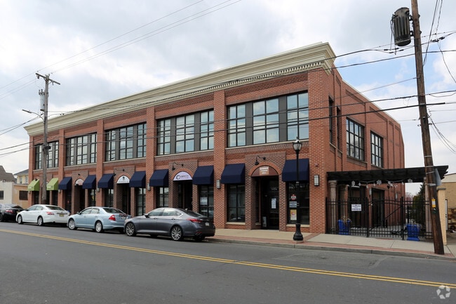
Property Record
60 E Bridge St, Morrisville, PA 19067

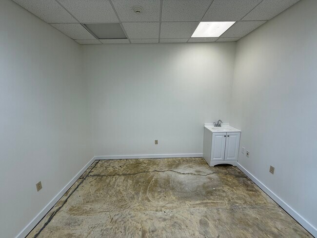

Current Lease Availabilities
Property Detail
60 E Bridge St
24-009-184
LOT N S BRIDGE ST W 55 FT OF MCCLEES AVE 126X225 30,644 SF
Storesoffices
Bucks
C1
Pennsylvania
B and X Area of moderate flood hazard, usually the area between the limits of the 100-year and 500-year floods.
n
2024
0.65 AC
2025
Lower Bucks County
105702
Philadelphia
21,064 SF
Philadelphia-Camden-Wilmington, PA-NJ-DE-MD
NEARBY LISTINGS FOR SALE OR LEASE
DEMOGRAPHICS near 60 E Bridge St
1 mile
3 mile
5 mile
2025 Total Population
15,879
149,068
263,215
2030 Population
16,179
153,011
269,393
Pop Growth 2025-2030
+ 1.89%
+ 2.65%
+ 2.35%
Average Age
40
38
40
2025 Total Households
6,025
52,349
96,785
HH Growth 2025-2030
+ 2.01%
+ 2.86%
+ 2.61%
Median Household Inc
$57,515
$62,174
$77,589
Avg Household Size
2.30
2.70
2.60
2025 Avg HH Vehicles
1.00
1.00
2.00
Median Home Value
$281,551
$240,146
$314,131
Median Year Built
1949
1949
1956
Nearby Places
Map Layers
Map Styles
 Street
 Aerial
Transit
 Traffic
 Biking
Places
Listings with unknown addresses are not visible on the map
- Restaurants
- Banks
- Shops
- Fitness
- Groceries
PUBLIC TRANSPORTATION
COMMUTER RAIL
Trenton Transit Center (Trenton Line - SEPTA)
Drive
Walk
Distance
Trenton Transit Center (Trenton Line - SEPTA)
4 min
1.7 mi
Trenton Transit Center (Njt) (Northeast Corridor Line - NJ Transit Commuter Rail (NJ Transit), R7 - NJ Transit Commuter Rail (NJ Transit), River LINE - NJ Transit Commuter Rail (NJ Transit))
Drive
Walk
Distance
Trenton Transit Center (Njt) (Northeast Corridor Line - NJ Transit Commuter Rail (NJ Transit), R7 - NJ Transit Commuter Rail (NJ Transit), River LINE - NJ Transit Commuter Rail (NJ Transit))
6 min
2.2 mi
AIRPORT
Trenton Mercer
Drive
Walk
Distance
Trenton Mercer
13 min
6.4 mi
Freight Ports
Port of Philadelphia
Drive
Walk
Distance
Port of Philadelphia
41 min
28.0 mi
Nearby Properties
Address
Land Use
TOTAL SIZE
Lot Size
Zoning
Address
Land Use
TOTAL SIZE
Lot Size
Zoning
8.23 AC
BA
Address
Land Use
TOTAL SIZE
Lot Size
Zoning
26 AC
HIST
Address
Land Use
TOTAL SIZE
Lot Size
Zoning
6.69 AC
BA
Address
Land Use
TOTAL SIZE
Lot Size
Zoning
13.73 AC
Address
Land Use
TOTAL SIZE
Lot Size
Zoning
Address
Land Use
TOTAL SIZE
Lot Size
Zoning
1,996 SF
125 AC
RA
Address
Land Use
TOTAL SIZE
Lot Size
Zoning
879,376 SF
2.54 AC
BA
Address
Land Use
TOTAL SIZE
Lot Size
Zoning
43,715 SF
49.95 AC
Address
Land Use
TOTAL SIZE
Lot Size
Zoning
125,000 SF
3.68 AC
MU
Address
Land Use
TOTAL SIZE
Lot Size
Zoning
104,448 SF
8.49 AC
IA
Address
Land Use
TOTAL SIZE
Lot Size
Zoning
5.38 AC
MU
Address
Land Use
TOTAL SIZE
Lot Size
Zoning
288,000 SF
1.23 AC
BA
Address
Land Use
TOTAL SIZE
Lot Size
Zoning
35.83 AC
RB
Address
Land Use
TOTAL SIZE
Lot Size
Zoning
0.24 AC
BA
Address
Land Use
TOTAL SIZE
Lot Size
Zoning
186,960 SF
2.37 AC
BA
Address
Land Use
TOTAL SIZE
Lot Size
Zoning
212,074 SF
0.82 AC
BA
Address
Land Use
TOTAL SIZE
Lot Size
Zoning
13.85 AC
MU
Address
Land Use
TOTAL SIZE
Lot Size
Zoning
58,620 SF
1.95 AC
PM
Address
Land Use
TOTAL SIZE
Lot Size
Zoning
161,080 SF
2.21 AC
BA
Address
Land Use
TOTAL SIZE
Lot Size
Zoning
27,776 SF
21.19 AC
B-H
Address
Land Use
TOTAL SIZE
Lot Size
Zoning
64.33 AC
R-2
Address
Land Use
TOTAL SIZE
Lot Size
Zoning
10.29 AC
RB
Address
Land Use
TOTAL SIZE
Lot Size
Zoning
41,000 SF
0.91 AC
HIST
Address
Land Use
TOTAL SIZE
Lot Size
Zoning
8.46 AC
RA
Address
Land Use
TOTAL SIZE
Lot Size
Zoning
7,724 SF
2.06 AC
BA
Address
Land Use
TOTAL SIZE
Lot Size
Zoning
4.07 AC
MU
Address
Land Use
TOTAL SIZE
Lot Size
Zoning
357 SF
0.96 AC
HIST
Address
Land Use
TOTAL SIZE
Lot Size
Zoning
260,160 SF
0.84 AC
BA
Address
Land Use
TOTAL SIZE
Lot Size
Zoning
57,500 SF
0.77 AC
BA
Address
Land Use
TOTAL SIZE
Lot Size
Zoning
112,840 SF
The World's #1 Commercial Real Estate Marketplace
Connect with us
© 2026 CoStar Group
The information above has been obtained from sources believed reliable. While we do not doubt its accuracy we have not verified it and make no guarantee, warranty or representation about it. It is your responsibility to independently confirm its accuracy and completeness. Any projections, opinions, assumptions, or estimates used are for example only and do not represent the current or future performance of the property. The value of this transaction to you depends on tax and other factors which should be evaluated by your tax, financial, and legal advisors. You and your advisors should conduct a careful, independent investigation of the property to determine to your satisfaction the suitability of the property for your needs.