Property Record
60 Gray Rd, Falmouth, ME 04105


NEARBY LISTINGS FOR SALE OR LEASE
Property Detail
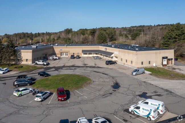
60 Gray Rd
FMTH-000005R-000045-B000000
Cumberland
Commercialbuilding
Maine
X
b
23005C0681F
4.77 AC
2024
NE Cumberland County
2024
Portland/South Portland
002503
Portland-South Portland, ME
27,938 SF
DEMOGRAPHICS near 60 Gray Rd
1 Mile
3 Mile
5 Mile
2024 Total Population
1,860
24,083
68,735
2029 Population
1,938
24,763
70,712
Pop Growth 2024-2029
+ 4.19%
+ 2.82%
+ 2.88%
Average Age
42
42
42
2024 Total Households
726
9,745
29,258
HH Growth 2024-2029
+ 4.27%
+ 2.85%
+ 2.88%
Median Household Inc
$135,632
$92,954
$84,455
Avg Household Size
2.50
2.40
2.30
2024 Avg HH Vehicles
2.00
2.00
2.00
Median Home Value
$596,419
$416,806
$407,916
Median Year Built
1978
1978
1965
Nearby Places
Map Layers
Map Styles
 Street
 Aerial
- Restaurants
- Banks
- Shops
- Fitness
- Groceries
PUBLIC TRANSPORTATION
COMMUTER RAIL
Portland (Downeaster - Amtrak)
DRIVE
WALK
Distance
Portland (Downeaster - Amtrak)
13 min
6.1 mi
AIRPORT
Portland International Jetport
DRIVE
WALK
Distance
Portland International Jetport
16 min
8.6 mi
Freight Ports
Portland, ME
DRIVE
WALK
Distance
Portland, ME
15 min
7.1 mi
SALE & LEASE HISTORY
LISTING DATE
SALE/LEASE

Sep 25, 2016
For Lease
Sep 22, 2017
For Lease
Mar 26, 2020
For Lease
Feb 01, 2023
For Lease
Apr 09, 2018
For Lease
Apr 02, 2021
For Sale
Nearby Properties
Address
Land Use
TOTAL SIZE
Lot Size
Zoning
Address
Land Use
TOTAL SIZE
Lot Size
Zoning
41 AC
FF
Address
Land Use
TOTAL SIZE
Lot Size
Zoning
141,420 SF
11.27 AC
TIF
Address
Land Use
TOTAL SIZE
Lot Size
Zoning
25.12 AC
Address
Land Use
TOTAL SIZE
Lot Size
Zoning
173,617 SF
15.28 AC
Address
Land Use
TOTAL SIZE
Lot Size
Zoning
19.08 AC
Address
Land Use
TOTAL SIZE
Lot Size
Zoning
137,037 SF
18.32 AC
Address
Land Use
TOTAL SIZE
Lot Size
Zoning
33.07 AC
Address
Land Use
TOTAL SIZE
Lot Size
Zoning
206,165 SF
25.75 AC
Address
Land Use
TOTAL SIZE
Lot Size
Zoning
12.10 AC
Address
Land Use
TOTAL SIZE
Lot Size
Zoning
19.86 AC
Address
Land Use
TOTAL SIZE
Lot Size
Zoning
136 SF
11.76 AC
Address
Land Use
TOTAL SIZE
Lot Size
Zoning
11.96 AC
Address
Land Use
TOTAL SIZE
Lot Size
Zoning
164 SF
12.48 AC
Address
Land Use
TOTAL SIZE
Lot Size
Zoning
Address
Land Use
TOTAL SIZE
Lot Size
Zoning
7.06 AC
Address
Land Use
TOTAL SIZE
Lot Size
Zoning
57,438 SF
8.28 AC
Address
Land Use
TOTAL SIZE
Lot Size
Zoning
66,721 SF
19.54 AC
Address
Land Use
TOTAL SIZE
Lot Size
Zoning
83,898 SF
19.96 AC
Address
Land Use
TOTAL SIZE
Lot Size
Zoning
272.87 AC
Address
Land Use
TOTAL SIZE
Lot Size
Zoning
56,155 SF
6.54 AC
TIF
Address
Land Use
TOTAL SIZE
Lot Size
Zoning
167,154 SF
6.79 AC
Address
Land Use
TOTAL SIZE
Lot Size
Zoning
100,000 SF
11.14 AC
Address
Land Use
TOTAL SIZE
Lot Size
Zoning
39,260 SF
3.50 AC
RB
Address
Land Use
TOTAL SIZE
Lot Size
Zoning
44,274 SF
17.70 AC
FF
Address
Land Use
TOTAL SIZE
Lot Size
Zoning
4.06 AC
Address
Land Use
TOTAL SIZE
Lot Size
Zoning
4.41 AC
Address
Land Use
TOTAL SIZE
Lot Size
Zoning
62,208 SF
5.41 AC
Address
Land Use
TOTAL SIZE
Lot Size
Zoning
27,600 SF
4.49 AC
Address
Land Use
TOTAL SIZE
Lot Size
Zoning
Address
Land Use
TOTAL SIZE
Lot Size
Zoning
46,944 SF
2.83 AC
The World's #1 Commercial Real Estate Marketplace
Connect with us
© 2025 CoStar Group
The information above has been obtained from sources believed reliable. While we do not doubt its accuracy we have not verified it and make no guarantee, warranty or representation about it. It is your responsibility to independently confirm its accuracy and completeness. Any projections, opinions, assumptions, or estimates used are for example only and do not represent the current or future performance of the property. The value of this transaction to you depends on tax and other factors which should be evaluated by your tax, financial, and legal advisors. You and your advisors should conduct a careful, independent investigation of the property to determine to your satisfaction the suitability of the property for your needs.