Property Record
60 Groton St, Pepperell, MA 01463
NEARBY LISTINGS FOR SALE OR LEASE
-
-
View all Pepperell listings for sale on LoopNet.com
Property Detail
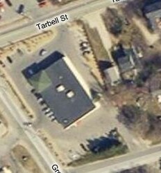
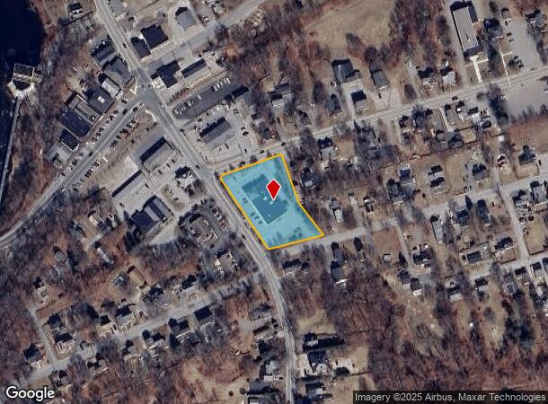
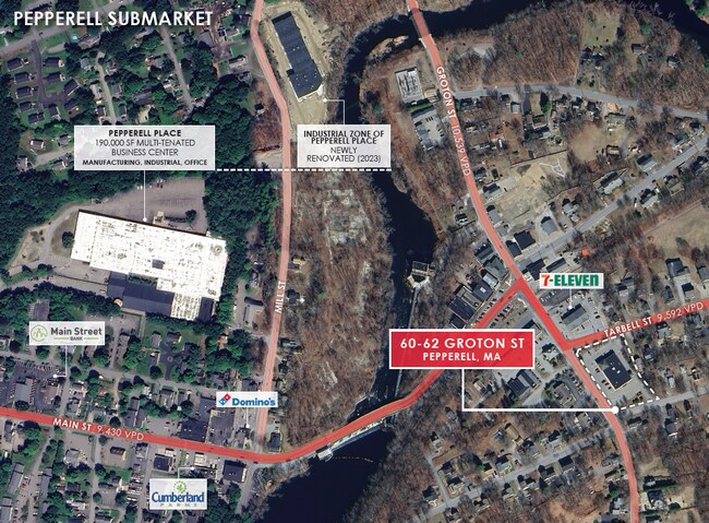
60 Groton St
Departmentstore
Middlesex
X
Massachusetts
25017C0087F
1.18 AC
2025
Groton/Townsend
2025
Boston
327102
Boston-Cambridge-Newton, MA-NH
9,920 SF
PEPP-000026-000170
DEMOGRAPHICS near 60 Groton St
1 Mile
3 Mile
5 Mile
2024 Total Population
4,072
12,000
29,219
2029 Population
4,007
11,829
28,959
Pop Growth 2024-2029
(1.60%)
(1.43%)
(0.89%)
Average Age
42
43
43
2024 Total Households
1,636
4,508
10,698
HH Growth 2024-2029
(1.83%)
(1.55%)
(0.98%)
Median Household Inc
$97,659
$122,939
$132,868
Avg Household Size
2.50
2.60
2.70
2024 Avg HH Vehicles
2.00
2.00
2.00
Median Home Value
$384,679
$457,134
$485,792
Median Year Built
1972
1979
1982
Nearby Places
Map Layers
Map Styles
 Street
 Aerial
- Restaurants
- Banks
- Shops
- Fitness
- Groceries
PUBLIC TRANSPORTATION
COMMUTER RAIL
Ayer (Fitchburg/South Acton Line - Massachusetts Bay Transportation Authority Commuter Rail (Purple Line))
DRIVE
WALK
Distance
Ayer (Fitchburg/South Acton Line - Massachusetts Bay Transportation Authority Commuter Rail (Purple Line))
19 min
8.7 mi
AIRPORT
Manchester Boston Regional
DRIVE
WALK
Distance
Manchester Boston Regional
39 min
23.2 mi
General Edward Lawrence Logan International
DRIVE
WALK
Distance
General Edward Lawrence Logan International
68 min
42.8 mi
Worcester Regional
DRIVE
WALK
Distance
Worcester Regional
69 min
44.7 mi
Freight Ports
Port of Boston
DRIVE
WALK
Distance
Port of Boston
68 min
42.6 mi
SALE & LEASE HISTORY
LISTING DATE
SALE/LEASE

Sep 18, 2025
For Sale
Nearby Properties
Address
Land Use
TOTAL SIZE
Lot Size
Zoning
Address
Land Use
TOTAL SIZE
Lot Size
Zoning
161,690 SF
186 AC
RA
Address
Land Use
TOTAL SIZE
Lot Size
Zoning
127,577 SF
77.91 AC
TNR
Address
Land Use
TOTAL SIZE
Lot Size
Zoning
129,435 SF
29.90 AC
TNR
Address
Land Use
TOTAL SIZE
Lot Size
Zoning
42.06 AC
IND
Address
Land Use
TOTAL SIZE
Lot Size
Zoning
5.02 AC
SUR
Address
Land Use
TOTAL SIZE
Lot Size
Zoning
80,953 SF
2.60 AC
TNR
Address
Land Use
TOTAL SIZE
Lot Size
Zoning
8.32 AC
URR
Address
Land Use
TOTAL SIZE
Lot Size
Zoning
9.16 AC
IND
Address
Land Use
TOTAL SIZE
Lot Size
Zoning
2.88 AC
COM
Address
Land Use
TOTAL SIZE
Lot Size
Zoning
518.99 AC
RA
Address
Land Use
TOTAL SIZE
Lot Size
Zoning
13.19 AC
SUR
Address
Land Use
TOTAL SIZE
Lot Size
Zoning
180,434 SF
10.94 AC
IND
Address
Land Use
TOTAL SIZE
Lot Size
Zoning
6.46 AC
COM
Address
Land Use
TOTAL SIZE
Lot Size
Zoning
2.73 AC
COM
Address
Land Use
TOTAL SIZE
Lot Size
Zoning
2,307 SF
1.50 AC
URR
Address
Land Use
TOTAL SIZE
Lot Size
Zoning
175.67 AC
RUR
Address
Land Use
TOTAL SIZE
Lot Size
Zoning
41,336 SF
3.90 AC
IND
Address
Land Use
TOTAL SIZE
Lot Size
Zoning
12,254 SF
1.60 AC
TNR
Address
Land Use
TOTAL SIZE
Lot Size
Zoning
16,939 SF
1 AC
URR
Address
Land Use
TOTAL SIZE
Lot Size
Zoning
25,400 SF
9.30 AC
IND
Address
Land Use
TOTAL SIZE
Lot Size
Zoning
12,678 SF
1.31 AC
TNR
Address
Land Use
TOTAL SIZE
Lot Size
Zoning
12,640 SF
2 AC
TNR
Address
Land Use
TOTAL SIZE
Lot Size
Zoning
14,391 SF
1 AC
COM
Address
Land Use
TOTAL SIZE
Lot Size
Zoning
11,098 SF
2.80 AC
COM
Address
Land Use
TOTAL SIZE
Lot Size
Zoning
26,000 SF
4.40 AC
IND
Address
Land Use
TOTAL SIZE
Lot Size
Zoning
5.47 AC
IND
Address
Land Use
TOTAL SIZE
Lot Size
Zoning
920 SF
3.20 AC
IND
Address
Land Use
TOTAL SIZE
Lot Size
Zoning
13,688 SF
0.48 AC
TNR
Address
Land Use
TOTAL SIZE
Lot Size
Zoning
15,400 SF
0.95 AC
COM
The World's #1 Commercial Real Estate Marketplace
Connect with us
© 2025 CoStar Group
The information above has been obtained from sources believed reliable. While we do not doubt its accuracy we have not verified it and make no guarantee, warranty or representation about it. It is your responsibility to independently confirm its accuracy and completeness. Any projections, opinions, assumptions, or estimates used are for example only and do not represent the current or future performance of the property. The value of this transaction to you depends on tax and other factors which should be evaluated by your tax, financial, and legal advisors. You and your advisors should conduct a careful, independent investigation of the property to determine to your satisfaction the suitability of the property for your needs.