Property Record
60 Harborside Blvd, Providence, RI 02905


NEARBY LISTINGS FOR SALE OR LEASE
Property Detail
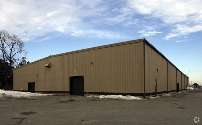
60 Harborside Blvd
CRAN-000002-000004-003935
Providence
Publicschool
Rhode Island
VE
3935
44007C0317J
5.99 AC
0
Cranston
2025
Providence
000102
Providence-Warwick, RI-MA
22,624 SF
DEMOGRAPHICS near 60 Harborside Blvd
1 Mile
3 Mile
5 Mile
2024 Total Population
12,032
135,128
329,653
2029 Population
11,823
133,948
327,087
Pop Growth 2024-2029
(1.74%)
(0.87%)
(0.78%)
Average Age
37
39
39
2024 Total Households
4,257
53,662
130,763
HH Growth 2024-2029
(1.83%)
(0.72%)
(0.69%)
Median Household Inc
$57,198
$59,212
$65,803
Avg Household Size
2.50
2.30
2.40
2024 Avg HH Vehicles
1.00
1.00
2.00
Median Home Value
$324,595
$283,520
$306,016
Median Year Built
1946
1949
1950
Nearby Places
Map Layers
Map Styles
 Street
 Aerial
- Restaurants
- Banks
- Shops
- Fitness
- Groceries
PUBLIC TRANSPORTATION
COMMUTER RAIL
Providence (Providence/Stoughton Line - Massachusetts Bay Transportation Authority Commuter Rail (Purple Line))
DRIVE
WALK
Distance
Providence (Providence/Stoughton Line - Massachusetts Bay Transportation Authority Commuter Rail (Purple Line))
8 min
3.5 mi
DRIVE
WALK
Distance
13 min
6.0 mi
AIRPORT
Rhode Island Tf Green International
DRIVE
WALK
Distance
Rhode Island Tf Green International
14 min
5.9 mi
Worcester Regional
DRIVE
WALK
Distance
Worcester Regional
65 min
47.2 mi
Freight Ports
Port of Davisville, RI
DRIVE
WALK
Distance
Port of Davisville, RI
35 min
20.7 mi
Nearby Properties
Address
Land Use
TOTAL SIZE
Lot Size
Zoning
Address
Land Use
TOTAL SIZE
Lot Size
Zoning
8.93 AC
OS
Address
Land Use
TOTAL SIZE
Lot Size
Zoning
233,468 SF
1.55 AC
I-1-20
Address
Land Use
TOTAL SIZE
Lot Size
Zoning
317,728 SF
28.20 AC
O1
Address
Land Use
TOTAL SIZE
Lot Size
Zoning
396,000 SF
0.12 AC
D-1-30
Address
Land Use
TOTAL SIZE
Lot Size
Zoning
244,872 SF
1.25 AC
D-1-12
Address
Land Use
TOTAL SIZE
Lot Size
Zoning
205,551 SF
1.38 AC
C-2
Address
Land Use
TOTAL SIZE
Lot Size
Zoning
2.01 AC
I-2
Address
Land Use
TOTAL SIZE
Lot Size
Zoning
4.21 AC
I-2
Address
Land Use
TOTAL SIZE
Lot Size
Zoning
174,352 SF
2.50 AC
I-1-20
Address
Land Use
TOTAL SIZE
Lot Size
Zoning
3.44 AC
D-1-20
Address
Land Use
TOTAL SIZE
Lot Size
Zoning
4.88 AC
I-2
Address
Land Use
TOTAL SIZE
Lot Size
Zoning
2.01 AC
I-2
Address
Land Use
TOTAL SIZE
Lot Size
Zoning
149,663 SF
1.90 AC
D-1-10
Address
Land Use
TOTAL SIZE
Lot Size
Zoning
95,064 SF
1.38 AC
I-2
Address
Land Use
TOTAL SIZE
Lot Size
Zoning
221,151 SF
2.13 AC
D-1-12
Address
Land Use
TOTAL SIZE
Lot Size
Zoning
218,167 SF
2.74 AC
D-1-20
Address
Land Use
TOTAL SIZE
Lot Size
Zoning
97,097 SF
0.99 AC
D-1-20
Address
Land Use
TOTAL SIZE
Lot Size
Zoning
Address
Land Use
TOTAL SIZE
Lot Size
Zoning
101,060 SF
0.66 AC
I-2
Address
Land Use
TOTAL SIZE
Lot Size
Zoning
394,538 SF
0.94 AC
D-1-30
Address
Land Use
TOTAL SIZE
Lot Size
Zoning
129,144 SF
3.60 AC
PS
Address
Land Use
TOTAL SIZE
Lot Size
Zoning
219,406 SF
1.03 AC
D-1-12
Address
Land Use
TOTAL SIZE
Lot Size
Zoning
215,664 SF
1.52 AC
D-1-12
Address
Land Use
TOTAL SIZE
Lot Size
Zoning
1.67 AC
I-2
Address
Land Use
TOTAL SIZE
Lot Size
Zoning
7.53 AC
I-2
Address
Land Use
TOTAL SIZE
Lot Size
Zoning
456,246 SF
1.49 AC
DWTN -
Address
Land Use
TOTAL SIZE
Lot Size
Zoning
6.80 AC
R-3
Address
Land Use
TOTAL SIZE
Lot Size
Zoning
136,072 SF
1.77 AC
Address
Land Use
TOTAL SIZE
Lot Size
Zoning
367,374 SF
0.55 AC
D-1-30
Address
Land Use
TOTAL SIZE
Lot Size
Zoning
131,216 SF
1.77 AC
The World's #1 Commercial Real Estate Marketplace
Connect with us
© 2025 CoStar Group
The information above has been obtained from sources believed reliable. While we do not doubt its accuracy we have not verified it and make no guarantee, warranty or representation about it. It is your responsibility to independently confirm its accuracy and completeness. Any projections, opinions, assumptions, or estimates used are for example only and do not represent the current or future performance of the property. The value of this transaction to you depends on tax and other factors which should be evaluated by your tax, financial, and legal advisors. You and your advisors should conduct a careful, independent investigation of the property to determine to your satisfaction the suitability of the property for your needs.